Kalgary Topo Map Texas
To zoom in, hover over the map of Kalgary
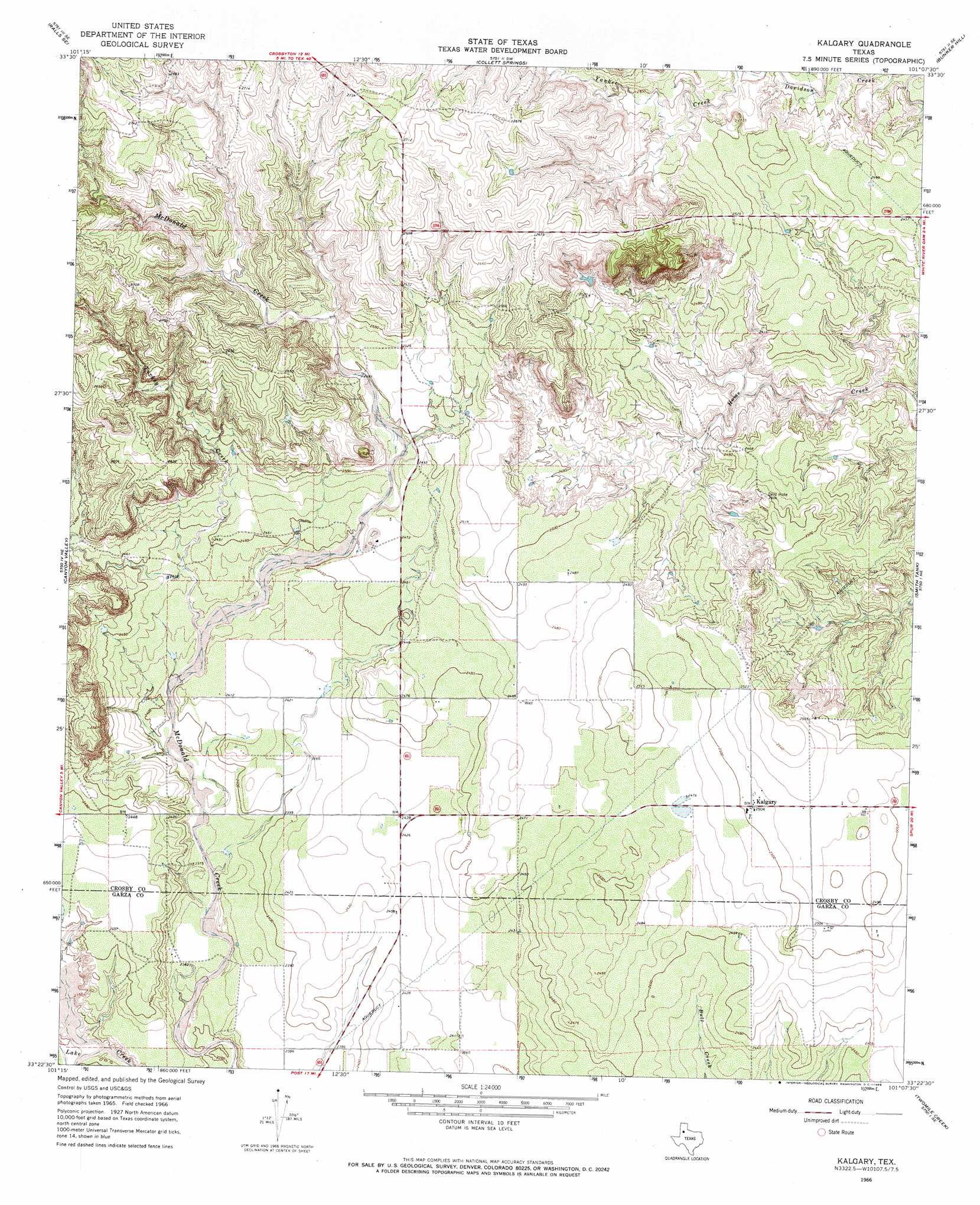
USGS Topo Quad 33101d2 - 1:24,000 scale
| Topo Map Name: | Kalgary |
| USGS Topo Quad ID: | 33101d2 |
| Print Size: | ca. 21 1/4" wide x 27" high |
| Southeast Coordinates: | 33.375° N latitude / 101.125° W longitude |
| Map Center Coordinates: | 33.4375° N latitude / 101.1875° W longitude |
| U.S. State: | TX |
| Filename: | o33101d2.jpg |
| Download Map JPG Image: | Kalgary topo map 1:24,000 scale |
| Map Type: | Topographic |
| Topo Series: | 7.5´ |
| Map Scale: | 1:24,000 |
| Source of Map Images: | United States Geological Survey (USGS) |
| Alternate Map Versions: |
Kalgary TX 1966, updated 1968 Download PDF Buy paper map Kalgary TX 2010 Download PDF Buy paper map Kalgary TX 2012 Download PDF Buy paper map Kalgary TX 2016 Download PDF Buy paper map |
1:24,000 Topo Quads surrounding Kalgary
Ralls |
Ralls Ne |
Crosbyton |
Mcadoo |
Haystack Mountain |
Savage |
Ralls Se |
Collett Springs |
Bunker Hill |
Foreman Chapel |
Cap Rock |
Canyon Valley |
Kalgary |
Smith Tank |
Spur Nw |
South Dokegood Creek |
Cap Rock Se |
Verbena |
Twomile Creek |
Spur Sw |
Post West |
Post East |
Justiceburg Nw |
Cottonwood Creek |
T-O Creek |
> Back to 33101a1 at 1:100,000 scale
> Back to 33100a1 at 1:250,000 scale
> Back to U.S. Topo Maps home
Kalgary topo map: Gazetteer
Kalgary: Populated Places
Kalgary elevation 763m 2503′Kalgary: Streams
Turkey Creek elevation 734m 2408′Yankee Creek elevation 749m 2457′
Kalgary digital topo map on disk
Buy this Kalgary topo map showing relief, roads, GPS coordinates and other geographical features, as a high-resolution digital map file on DVD: