Slaton Topo Map Texas
To zoom in, hover over the map of Slaton
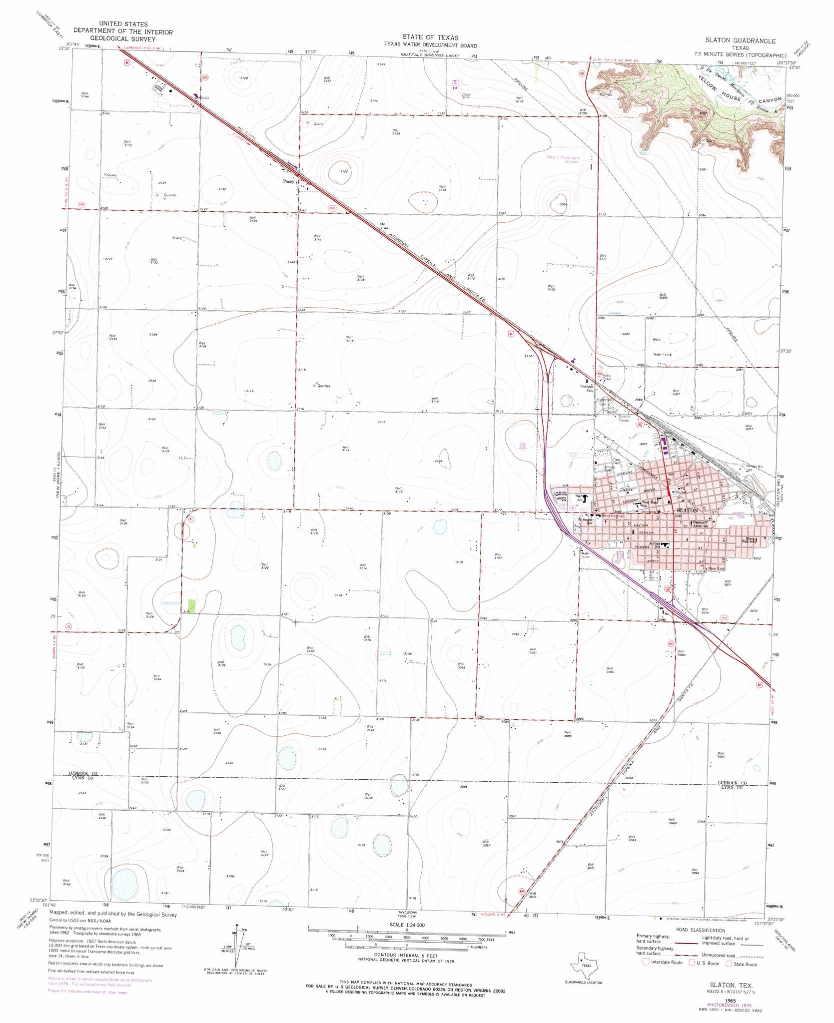
USGS Topo Quad 33101d6 - 1:24,000 scale
| Topo Map Name: | Slaton |
| USGS Topo Quad ID: | 33101d6 |
| Print Size: | ca. 21 1/4" wide x 27" high |
| Southeast Coordinates: | 33.375° N latitude / 101.625° W longitude |
| Map Center Coordinates: | 33.4375° N latitude / 101.6875° W longitude |
| U.S. State: | TX |
| Filename: | o33101d6.jpg |
| Download Map JPG Image: | Slaton topo map 1:24,000 scale |
| Map Type: | Topographic |
| Topo Series: | 7.5´ |
| Map Scale: | 1:24,000 |
| Source of Map Images: | United States Geological Survey (USGS) |
| Alternate Map Versions: |
Slaton TX 1965, updated 1966 Download PDF Buy paper map Slaton TX 1965, updated 1977 Download PDF Buy paper map Slaton TX 2010 Download PDF Buy paper map Slaton TX 2012 Download PDF Buy paper map Slaton TX 2016 Download PDF Buy paper map |
1:24,000 Topo Quads surrounding Slaton
Shallowater |
New Deal |
Idalou |
Lorenzo |
Ralls |
Lubbock West |
Lubbock East |
Buffalo Springs Lake |
Acuff |
Savage |
Slide |
Woodrow |
Slaton |
Slaton Ne |
Cap Rock |
New Home |
New Home Se |
Wilson |
Southland |
South Dokegood Creek |
Double Lakes |
Tahoka |
New Lynn |
Grassland |
Post West |
> Back to 33101a1 at 1:100,000 scale
> Back to 33100a1 at 1:250,000 scale
> Back to U.S. Topo Maps home
Slaton topo map: Gazetteer
Slaton: Airports
Slaton Municipal Airport elevation 952m 3123′Slaton: Parks
Tiger Field elevation 939m 3080′Slaton: Populated Places
Posey elevation 959m 3146′Slaton elevation 940m 3083′
Slaton digital topo map on disk
Buy this Slaton topo map showing relief, roads, GPS coordinates and other geographical features, as a high-resolution digital map file on DVD: