Ralls Topo Map Texas
To zoom in, hover over the map of Ralls
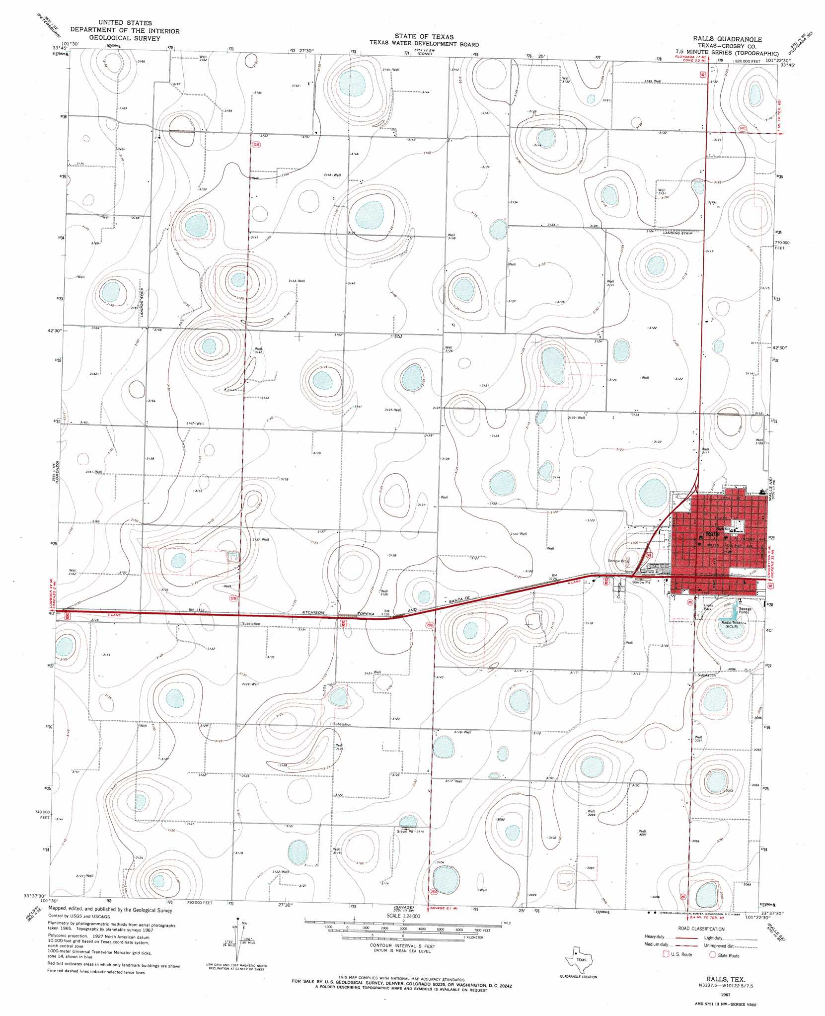
USGS Topo Quad 33101f4 - 1:24,000 scale
| Topo Map Name: | Ralls |
| USGS Topo Quad ID: | 33101f4 |
| Print Size: | ca. 21 1/4" wide x 27" high |
| Southeast Coordinates: | 33.625° N latitude / 101.375° W longitude |
| Map Center Coordinates: | 33.6875° N latitude / 101.4375° W longitude |
| U.S. State: | TX |
| Filename: | o33101f4.jpg |
| Download Map JPG Image: | Ralls topo map 1:24,000 scale |
| Map Type: | Topographic |
| Topo Series: | 7.5´ |
| Map Scale: | 1:24,000 |
| Source of Map Images: | United States Geological Survey (USGS) |
| Alternate Map Versions: |
Ralls TX 1967, updated 1968 Download PDF Buy paper map Ralls TX 2010 Download PDF Buy paper map Ralls TX 2012 Download PDF Buy paper map Ralls TX 2016 Download PDF Buy paper map |
1:24,000 Topo Quads surrounding Ralls
Julia Lake |
Barwise |
Sandhill |
Floydada |
Boothe |
Heckville |
Petersburg |
Cone |
Floydada Se |
Mount Blanco |
Idalou |
Lorenzo |
Ralls |
Ralls Ne |
Crosbyton |
Buffalo Springs Lake |
Acuff |
Savage |
Ralls Se |
Collett Springs |
Slaton |
Slaton Ne |
Cap Rock |
Canyon Valley |
Kalgary |
> Back to 33101e1 at 1:100,000 scale
> Back to 33100a1 at 1:250,000 scale
> Back to U.S. Topo Maps home
Ralls topo map: Gazetteer
Ralls: Parks
Lions Park elevation 946m 3103′Ralls: Populated Places
Ralls elevation 947m 3106′Ralls digital topo map on disk
Buy this Ralls topo map showing relief, roads, GPS coordinates and other geographical features, as a high-resolution digital map file on DVD: