Wake Topo Map Texas
To zoom in, hover over the map of Wake
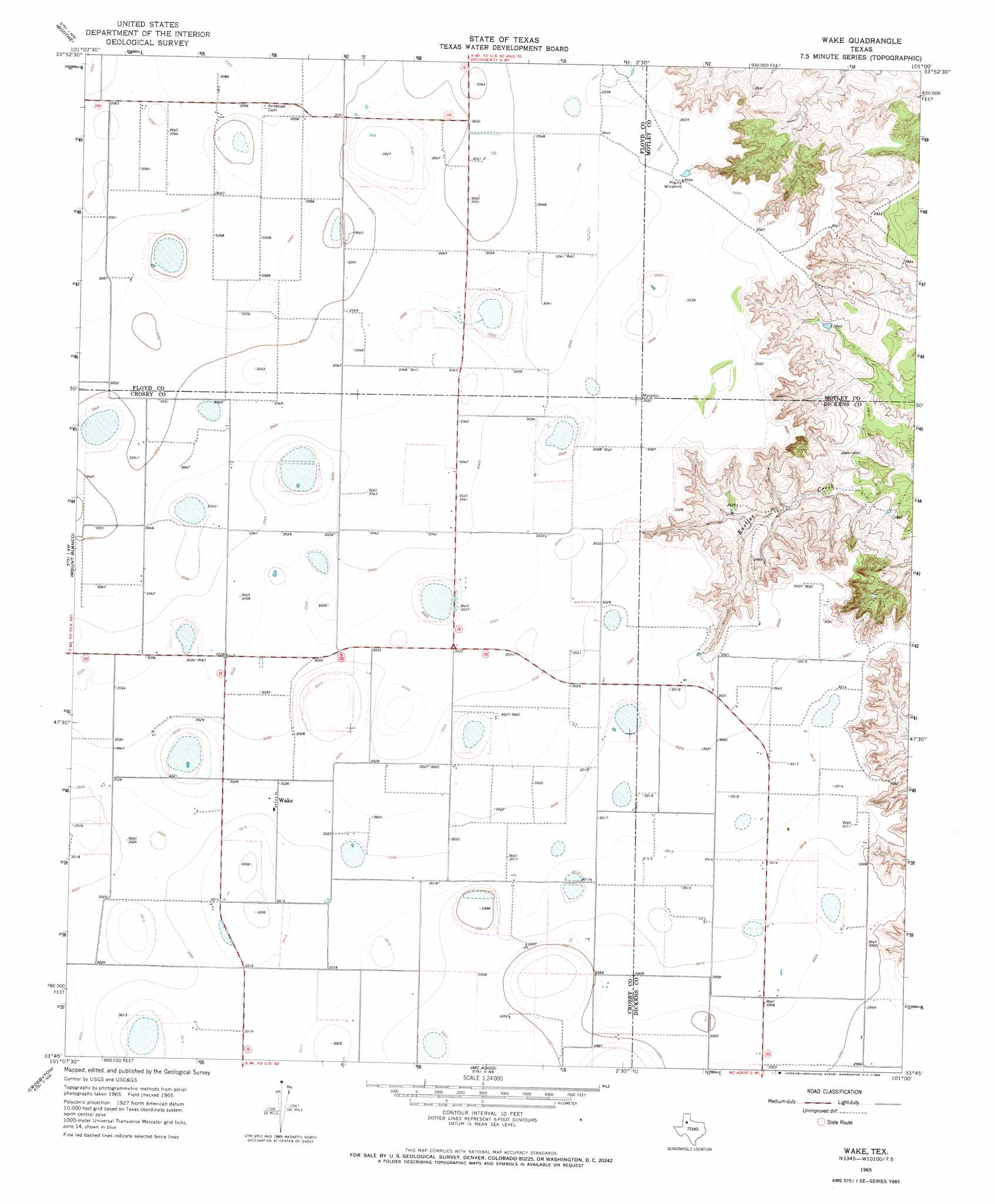
USGS Topo Quad 33101g1 - 1:24,000 scale
| Topo Map Name: | Wake |
| USGS Topo Quad ID: | 33101g1 |
| Print Size: | ca. 21 1/4" wide x 27" high |
| Southeast Coordinates: | 33.75° N latitude / 101° W longitude |
| Map Center Coordinates: | 33.8125° N latitude / 101.0625° W longitude |
| U.S. State: | TX |
| Filename: | o33101g1.jpg |
| Download Map JPG Image: | Wake topo map 1:24,000 scale |
| Map Type: | Topographic |
| Topo Series: | 7.5´ |
| Map Scale: | 1:24,000 |
| Source of Map Images: | United States Geological Survey (USGS) |
| Alternate Map Versions: |
Wake TX 1965, updated 1968 Download PDF Buy paper map Wake TX 2010 Download PDF Buy paper map Wake TX 2012 Download PDF Buy paper map Wake TX 2016 Download PDF Buy paper map |
1:24,000 Topo Quads surrounding Wake
Lockney Se |
Lockney 4 Sw |
Dick Moore Canyon |
Whiteflat |
Matador |
Floydada |
Boothe |
Doughtery |
Macbain |
Roaring Springs |
Floydada Se |
Mount Blanco |
Wake |
Rustler Camp |
Afton |
Ralls Ne |
Crosbyton |
Mcadoo |
Haystack Mountain |
Dickens North |
Ralls Se |
Collett Springs |
Bunker Hill |
Foreman Chapel |
Dickens South |
> Back to 33101e1 at 1:100,000 scale
> Back to 33100a1 at 1:250,000 scale
> Back to U.S. Topo Maps home
Wake topo map: Gazetteer
Wake: Airports
Gardner Farm Airport elevation 920m 3018′Wake: Populated Places
Wake elevation 922m 3024′Wake digital topo map on disk
Buy this Wake topo map showing relief, roads, GPS coordinates and other geographical features, as a high-resolution digital map file on DVD: