Plains Se Topo Map Texas
To zoom in, hover over the map of Plains Se
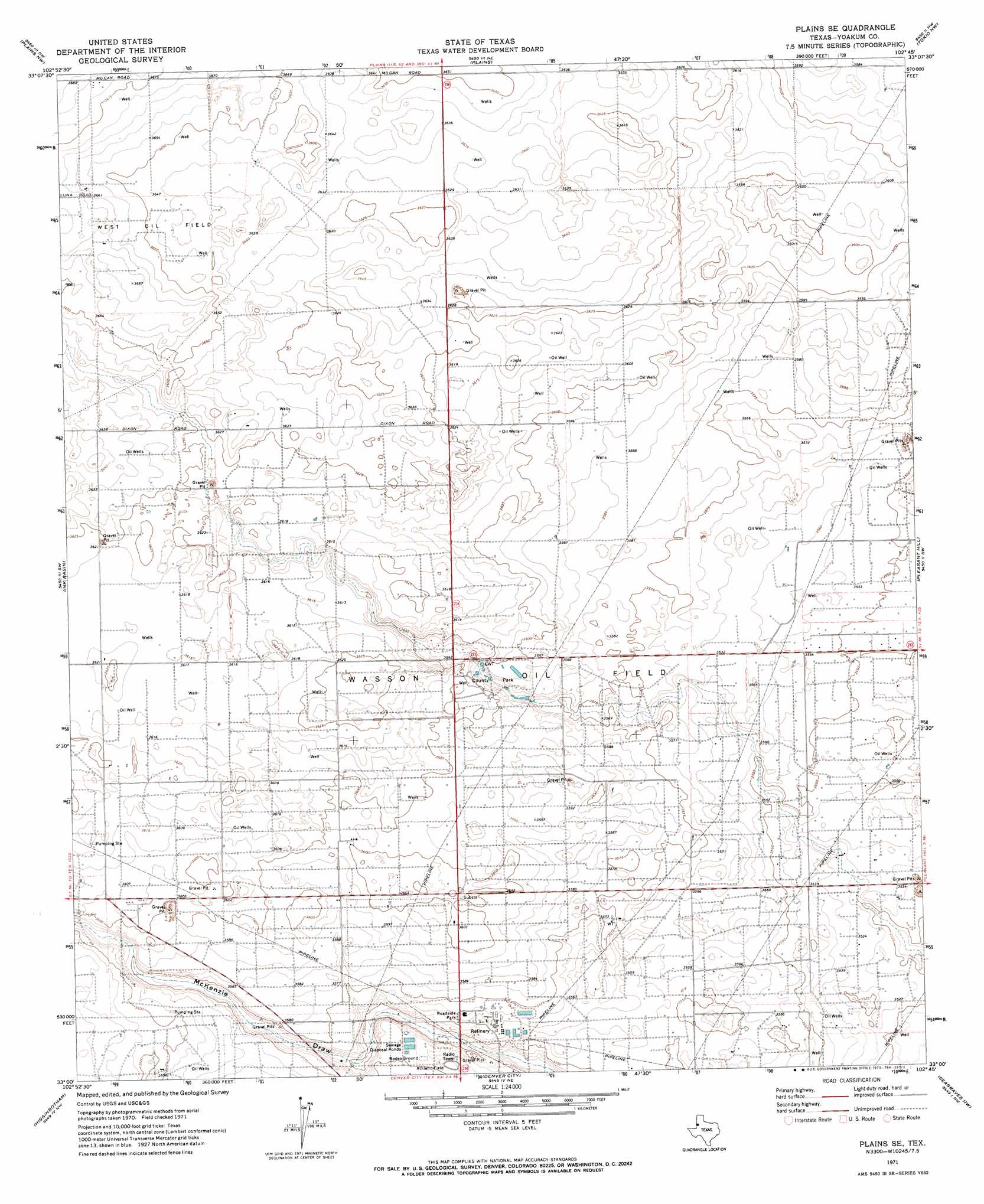
USGS Topo Quad 33102a7 - 1:24,000 scale
| Topo Map Name: | Plains Se |
| USGS Topo Quad ID: | 33102a7 |
| Print Size: | ca. 21 1/4" wide x 27" high |
| Southeast Coordinates: | 33° N latitude / 102.75° W longitude |
| Map Center Coordinates: | 33.0625° N latitude / 102.8125° W longitude |
| U.S. State: | TX |
| Filename: | o33102a7.jpg |
| Download Map JPG Image: | Plains Se topo map 1:24,000 scale |
| Map Type: | Topographic |
| Topo Series: | 7.5´ |
| Map Scale: | 1:24,000 |
| Source of Map Images: | United States Geological Survey (USGS) |
| Alternate Map Versions: |
Plains SE TX 1971, updated 1973 Download PDF Buy paper map Plains SE TX 2010 Download PDF Buy paper map Plains SE TX 2012 Download PDF Buy paper map Plains SE TX 2016 Download PDF Buy paper map |
1:24,000 Topo Quads surrounding Plains Se
Bronco |
Two B Ranch Sw |
Two B Ranch |
Plains 1 Sw |
Plains 1 Se |
Prairieview Ne |
Plains Nw |
Plains |
Tokio Nw |
Tokio |
Prairieview Se |
Ink Basin |
Plains Se |
Pleasant Hill |
Tokio Se |
Humble City Ne |
Higginbotham |
Denver City |
Seagraves Nw |
Seagraves |
Humble City Se |
Denver City Sw |
Denver City Se |
Seagraves Sw |
Seagraves Se |
> Back to 33102a1 at 1:100,000 scale
> Back to 33102a1 at 1:250,000 scale
> Back to U.S. Topo Maps home
Plains Se digital topo map on disk
Buy this Plains Se topo map showing relief, roads, GPS coordinates and other geographical features, as a high-resolution digital map file on DVD: