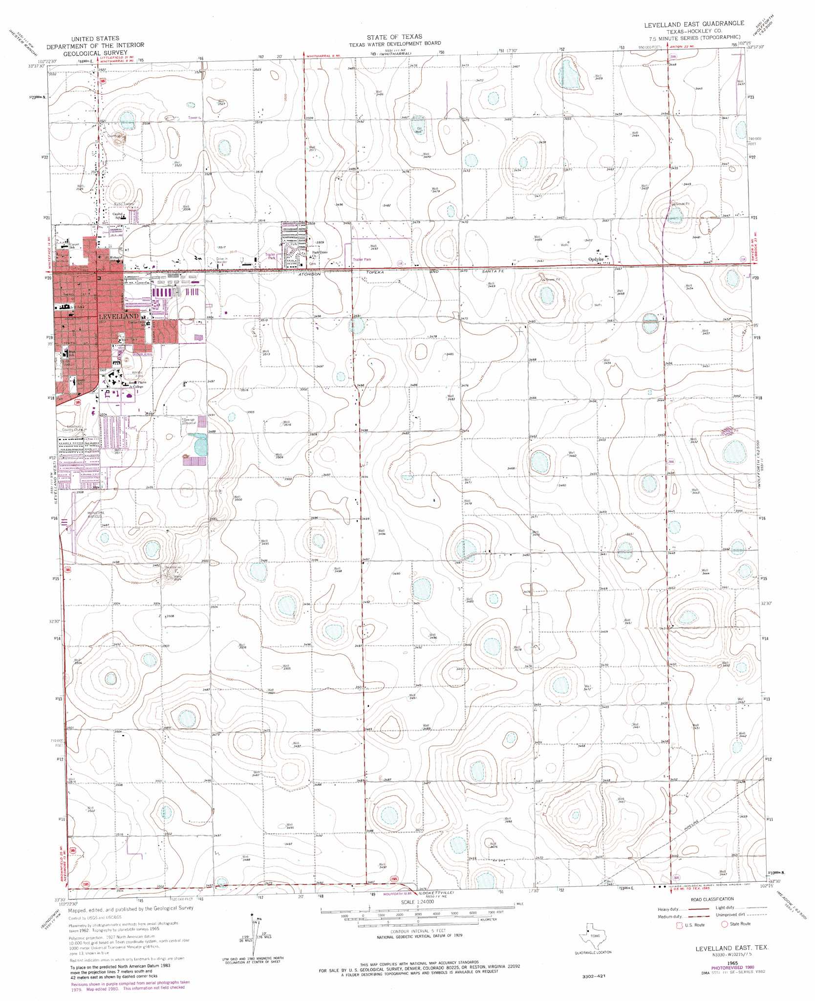
Levelland East Topo Map Texas
To zoom in, hover over the map of Levelland East
USGS Topo Quad 33102e3 - 1:24,000 scale
| Topo Map Name: | Levelland East |
| USGS Topo Quad ID: | 33102e3 |
| Print Size: | ca. 21 1/4" wide x 27" high |
| Southeast Coordinates: | 33.5° N latitude / 102.25° W longitude |
| Map Center Coordinates: | 33.5625° N latitude / 102.3125° W longitude |
| U.S. State: | TX |
| Filename: | o33102e3.jpg |
| Download Map JPG Image: | Levelland East topo map 1:24,000 scale |
| Map Type: | Topographic |
| Topo Series: | 7.5´ |
| Map Scale: | 1:24,000 |
| Source of Map Images: | United States Geological Survey (USGS) |
| Alternate Map Versions: |
Levelland East TX 1965, updated 1966 Download PDF Buy paper map Levelland East TX 1965, updated 1981 Download PDF Buy paper map Levelland East TX 2010 Download PDF Buy paper map Levelland East TX 2012 Download PDF Buy paper map Levelland East TX 2016 Download PDF Buy paper map |
1:24,000 Topo Quads surrounding Levelland East
Pep |
Oklahoma Flat |
Lums Chapel |
Anton |
Roundup |
Pettit |
Hester Ranch |
Whitharral |
Wolfforth Nw |
Wolfforth Ne |
Whiteface |
Levelland West |
Levelland East |
Smyer |
Wolfforth |
Plains 1 Ne |
Sundown |
Lockettville |
Ropesville |
Busterville |
Plains 1 Se |
Pool |
Sundown Se |
Meadow |
Meadow Se |
> Back to 33102e1 at 1:100,000 scale
> Back to 33102a1 at 1:250,000 scale
> Back to U.S. Topo Maps home
Levelland East topo map: Gazetteer
Levelland East: Airports
Levelland Municipal Airport elevation 1066m 3497′Levelland East: Parks
Country Club Park elevation 1069m 3507′Kauffman Park elevation 1071m 3513′
Lobb Stadium elevation 1068m 3503′
Lobo Stadium elevation 1072m 3517′
Sherman Park elevation 1069m 3507′
Levelland East: Populated Places
Opdyke elevation 1057m 3467′Opdyke West elevation 1058m 3471′
Levelland East digital topo map on disk
Buy this Levelland East topo map showing relief, roads, GPS coordinates and other geographical features, as a high-resolution digital map file on DVD: