Fort Ranch Topo Map New Mexico
To zoom in, hover over the map of Fort Ranch
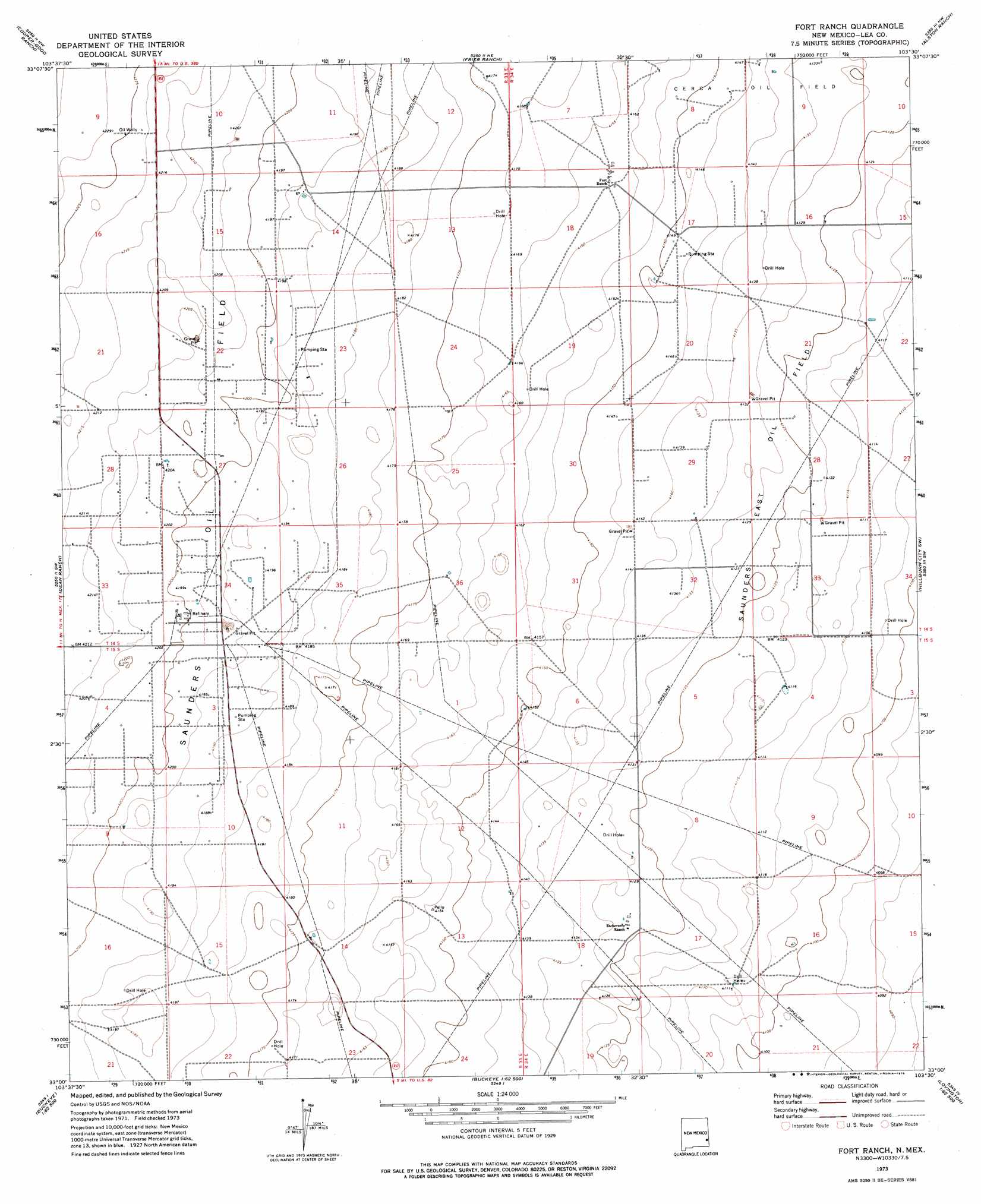
USGS Topo Quad 33103a5 - 1:24,000 scale
| Topo Map Name: | Fort Ranch |
| USGS Topo Quad ID: | 33103a5 |
| Print Size: | ca. 21 1/4" wide x 27" high |
| Southeast Coordinates: | 33° N latitude / 103.5° W longitude |
| Map Center Coordinates: | 33.0625° N latitude / 103.5625° W longitude |
| U.S. State: | NM |
| Filename: | o33103a5.jpg |
| Download Map JPG Image: | Fort Ranch topo map 1:24,000 scale |
| Map Type: | Topographic |
| Topo Series: | 7.5´ |
| Map Scale: | 1:24,000 |
| Source of Map Images: | United States Geological Survey (USGS) |
| Alternate Map Versions: |
Fort Ranch NM 1973, updated 1976 Download PDF Buy paper map Fort Ranch NM 2010 Download PDF Buy paper map Fort Ranch NM 2013 Download PDF Buy paper map Fort Ranch NM 2017 Download PDF Buy paper map |
1:24,000 Topo Quads surrounding Fort Ranch
Mescalero Point |
Soldier Hill |
Dallas Store |
Simanola Valley |
Tatum North |
Caudill Ranch |
Cooper-Good Ranch |
Frier Ranch |
Alston Ranch |
Tatum South |
Cedar Point Se |
Dean Ranch |
Fort Ranch |
Hillburn City Sw |
Hillburn City |
Maljamar Ne |
Buckeye Nw |
Buckeye Ne |
Lovington Nw |
Lovington |
Maljamar |
Dog Lake |
Buckeye |
Lovington Sw |
Lovington Se |
> Back to 33103a1 at 1:100,000 scale
> Back to 33102a1 at 1:250,000 scale
> Back to U.S. Topo Maps home
Fort Ranch topo map: Gazetteer
Fort Ranch: Mines
State Fort Pit elevation 1259m 4130′Fort Ranch: Oilfields
Saunders East Oil Field elevation 1259m 4130′Saunders Oil Field elevation 1280m 4199′
Fort Ranch digital topo map on disk
Buy this Fort Ranch topo map showing relief, roads, GPS coordinates and other geographical features, as a high-resolution digital map file on DVD: