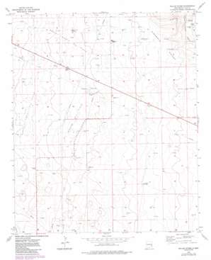
Dallas Store Topo Map New Mexico
To zoom in, hover over the map of Dallas Store
USGS Topo Quad 33103c5 - 1:24,000 scale
| Topo Map Name: | Dallas Store |
| USGS Topo Quad ID: | 33103c5 |
| Print Size: | ca. 21 1/4" wide x 27" high |
| Southeast Coordinates: | 33.25° N latitude / 103.5° W longitude |
| Map Center Coordinates: | 33.3125° N latitude / 103.5625° W longitude |
| U.S. State: | NM |
| Filename: | o33103c5.jpg |
| Download Map JPG Image: | Dallas Store topo map 1:24,000 scale |
| Map Type: | Topographic |
| Topo Series: | 7.5´ |
| Map Scale: | 1:24,000 |
| Source of Map Images: | United States Geological Survey (USGS) |
| Alternate Map Versions: |
Dallas Store NM 1973, updated 1977 Download PDF Buy paper map Dallas Store NW NM 1973, updated 1985 Download PDF Buy paper map Dallas Store NM 2010 Download PDF Buy paper map Dallas Store NM 2013 Download PDF Buy paper map Dallas Store NM 2017 Download PDF Buy paper map |
1:24,000 Topo Quads surrounding Dallas Store
> Back to 33103a1 at 1:100,000 scale
> Back to 33102a1 at 1:250,000 scale
> Back to U.S. Topo Maps home
Dallas Store topo map: Gazetteer
Dallas Store: Oilfields
Bagley North Oil Field elevation 1292m 4238′Bagley Oil Field elevation 1293m 4242′
Bagley West Oil Field elevation 1302m 4271′
Dallas Store: Wells
05004 Water Well elevation 1300m 4265′05005 Water Well elevation 1296m 4251′
05022 Water Well elevation 1302m 4271′
10002 Water Well elevation 1285m 4215′
10668 Water Well elevation 1303m 4274′
10671 Water Well elevation 1286m 4219′
10672 Water Well elevation 1296m 4251′
10675 Water Well elevation 1305m 4281′
10676 Water Well elevation 1287m 4222′
10677 Water Well elevation 1291m 4235′
10678 Water Well elevation 1287m 4222′
10679 Water Well elevation 1290m 4232′
10680 Water Well elevation 1305m 4281′
10684 Water Well elevation 1302m 4271′
10685 Water Well elevation 1298m 4258′
10688 Water Well elevation 1260m 4133′
10690 Water Well elevation 1277m 4189′
10697 Water Well elevation 1272m 4173′
10698 Water Well elevation 1279m 4196′
10699 Water Well elevation 1281m 4202′
10738 Water Well elevation 1293m 4242′
10739 Water Well elevation 1301m 4268′
10740 Water Well elevation 1292m 4238′
10741 Water Well elevation 1288m 4225′
10755 Water Well elevation 1278m 4192′
11267 Water Well elevation 1288m 4225′
12647 Water Well elevation 1296m 4251′
13054 Water Well elevation 1284m 4212′
13230 Water Well elevation 1274m 4179′
13387 Water Well elevation 1280m 4199′
13407 Water Well elevation 1274m 4179′
13531 Water Well elevation 1286m 4219′
Dallas Store digital topo map on disk
Buy this Dallas Store topo map showing relief, roads, GPS coordinates and other geographical features, as a high-resolution digital map file on DVD:


