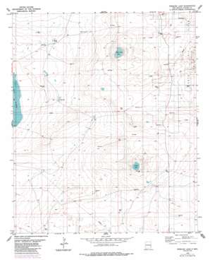
Presler Lake Topo Map New Mexico
To zoom in, hover over the map of Presler Lake
USGS Topo Quad 33103e8 - 1:24,000 scale
| Topo Map Name: | Presler Lake |
| USGS Topo Quad ID: | 33103e8 |
| Print Size: | ca. 21 1/4" wide x 27" high |
| Southeast Coordinates: | 33.5° N latitude / 103.875° W longitude |
| Map Center Coordinates: | 33.5625° N latitude / 103.9375° W longitude |
| U.S. State: | NM |
| Filename: | o33103e8.jpg |
| Download Map JPG Image: | Presler Lake topo map 1:24,000 scale |
| Map Type: | Topographic |
| Topo Series: | 7.5´ |
| Map Scale: | 1:24,000 |
| Source of Map Images: | United States Geological Survey (USGS) |
| Alternate Map Versions: |
Presler Lake NM 1978, updated 1979 Download PDF Buy paper map Presler Lake NM 1978, updated 1985 Download PDF Buy paper map Presler Lake NM 2010 Download PDF Buy paper map Presler Lake NM 2013 Download PDF Buy paper map Presler Lake NM 2017 Download PDF Buy paper map |
1:24,000 Topo Quads surrounding Presler Lake
> Back to 33103e1 at 1:100,000 scale
> Back to 33102a1 at 1:250,000 scale
> Back to U.S. Topo Maps home
Presler Lake topo map: Gazetteer
Presler Lake: Lakes
Broke Tank Lake elevation 1221m 4005′Lost Lake elevation 1214m 3982′
Presler Lake elevation 1209m 3966′
Presler Lake: Reservoirs
Broke Tank elevation 1211m 3973′Cooper Tank elevation 1223m 4012′
Presler Lake digital topo map on disk
Buy this Presler Lake topo map showing relief, roads, GPS coordinates and other geographical features, as a high-resolution digital map file on DVD:


