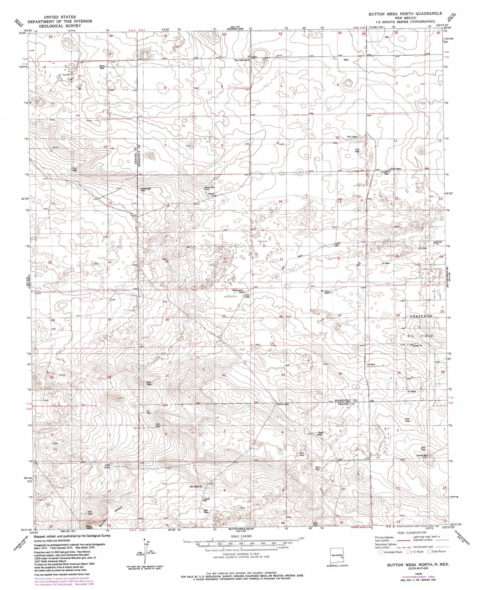
Button Mesa North Topo Map New Mexico
To zoom in, hover over the map of Button Mesa North
USGS Topo Quad 33103f6 - 1:24,000 scale
| Topo Map Name: | Button Mesa North |
| USGS Topo Quad ID: | 33103f6 |
| Print Size: | ca. 21 1/4" wide x 27" high |
| Southeast Coordinates: | 33.625° N latitude / 103.625° W longitude |
| Map Center Coordinates: | 33.6875° N latitude / 103.6875° W longitude |
| U.S. State: | NM |
| Filename: | o33103f6.jpg |
| Download Map JPG Image: | Button Mesa North topo map 1:24,000 scale |
| Map Type: | Topographic |
| Topo Series: | 7.5´ |
| Map Scale: | 1:24,000 |
| Source of Map Images: | United States Geological Survey (USGS) |
| Alternate Map Versions: |
Button Mesa North NM 1978, updated 1986 Download PDF Buy paper map Button Mesa North NM 2010 Download PDF Buy paper map Button Mesa North NM 2013 Download PDF Buy paper map Button Mesa North NM 2017 Download PDF Buy paper map |
1:24,000 Topo Quads surrounding Button Mesa North
San Juan Mesa West |
San Juan Mesa East |
Elida |
Badger Lake |
Dora Nw |
Kenna Sw |
Kenna |
Schram Lake |
Elida Se |
Dora Sw |
Curlew Lake |
Lone Wolf |
Button Mesa North |
Button Mesa Ne |
Milnesand Nw |
Presler Lake |
Curlew Lake Se |
Button Mesa South |
Flying M Ranch |
Milnesand Sw |
Oasis |
Mescalero Point Ne |
Caprock |
Lane Salt Lake |
Johnson Ranch |
> Back to 33103e1 at 1:100,000 scale
> Back to 33102a1 at 1:250,000 scale
> Back to U.S. Topo Maps home
Button Mesa North topo map: Gazetteer
Button Mesa North: Lakes
Vest Lake elevation 1346m 4416′Button Mesa North: Populated Places
Corner Well elevation 1355m 4445′Vest Wells elevation 1357m 4452′
Button Mesa North: Summits
Button Mesa elevation 1362m 4468′Button Mesa North: Wells
06175 Water Well elevation 1356m 4448′06176 Water Well elevation 1353m 4438′
06205 Water Well elevation 1359m 4458′
06206 Water Well elevation 1364m 4475′
06209 Water Well elevation 1360m 4461′
06210 Water Well elevation 1360m 4461′
06212 Water Well elevation 1363m 4471′
06213 Water Well elevation 1379m 4524′
Forseyth Well elevation 1360m 4461′
Button Mesa North digital topo map on disk
Buy this Button Mesa North topo map showing relief, roads, GPS coordinates and other geographical features, as a high-resolution digital map file on DVD: