Dexter West Topo Map New Mexico
To zoom in, hover over the map of Dexter West
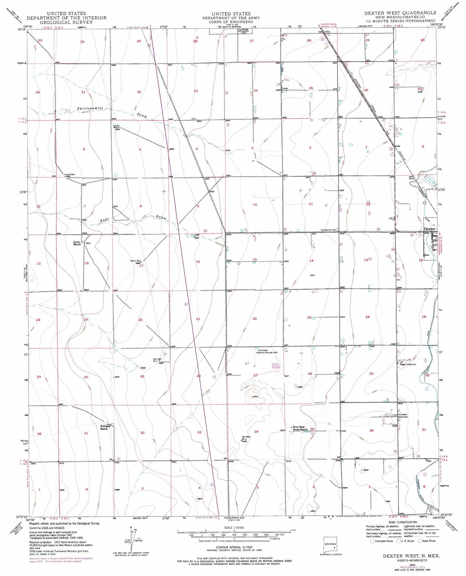
USGS Topo Quad 33104b4 - 1:24,000 scale
| Topo Map Name: | Dexter West |
| USGS Topo Quad ID: | 33104b4 |
| Print Size: | ca. 21 1/4" wide x 27" high |
| Southeast Coordinates: | 33.125° N latitude / 104.375° W longitude |
| Map Center Coordinates: | 33.1875° N latitude / 104.4375° W longitude |
| U.S. State: | NM |
| Filename: | o33104b4.jpg |
| Download Map JPG Image: | Dexter West topo map 1:24,000 scale |
| Map Type: | Topographic |
| Topo Series: | 7.5´ |
| Map Scale: | 1:24,000 |
| Source of Map Images: | United States Geological Survey (USGS) |
| Alternate Map Versions: |
Dexter West NM 1950 Download PDF Buy paper map Dexter West NM 1950, updated 1969 Download PDF Buy paper map Dexter West NM 1950, updated 1972 Download PDF Buy paper map Dexter West NM 1950, updated 1977 Download PDF Buy paper map Dexter West NM 2010 Download PDF Buy paper map Dexter West NM 2013 Download PDF Buy paper map Dexter West NM 2017 Download PDF Buy paper map |
1:24,000 Topo Quads surrounding Dexter West
Corn Ranch |
Roswell North |
Bitter Lake |
Comanche Spring |
L E Ranch |
Hondo Reservoir |
Roswell South |
South Spring |
Bottomless Lakes |
Wade Ranch |
Juan Lake |
Peters Lake |
Dexter West |
Dexter East |
Bar C Bar Ranch |
Kincaid Ranch |
Hackberry Ranch |
Hagerman Sw |
Hagerman |
Derrick Draw |
Hope Nw |
Hope Ne |
Espuela |
Artesia Ne |
Diamond Mound |
> Back to 33104a1 at 1:100,000 scale
> Back to 33104a1 at 1:250,000 scale
> Back to U.S. Topo Maps home
Dexter West topo map: Gazetteer
Dexter West: Valleys
Thirteenmile Draw elevation 1077m 3533′Zubi Draw elevation 1082m 3549′
Dexter West: Wells
Goodin Well elevation 1095m 3592′Greenfield Artesian Recorder Well elevation 1075m 3526′
Moore Well elevation 1094m 3589′
Ra-1423-S Water Well elevation 1082m 3549′
Vinyard Well elevation 1103m 3618′
Dexter West digital topo map on disk
Buy this Dexter West topo map showing relief, roads, GPS coordinates and other geographical features, as a high-resolution digital map file on DVD: