Panther Hill Topo Map New Mexico
To zoom in, hover over the map of Panther Hill
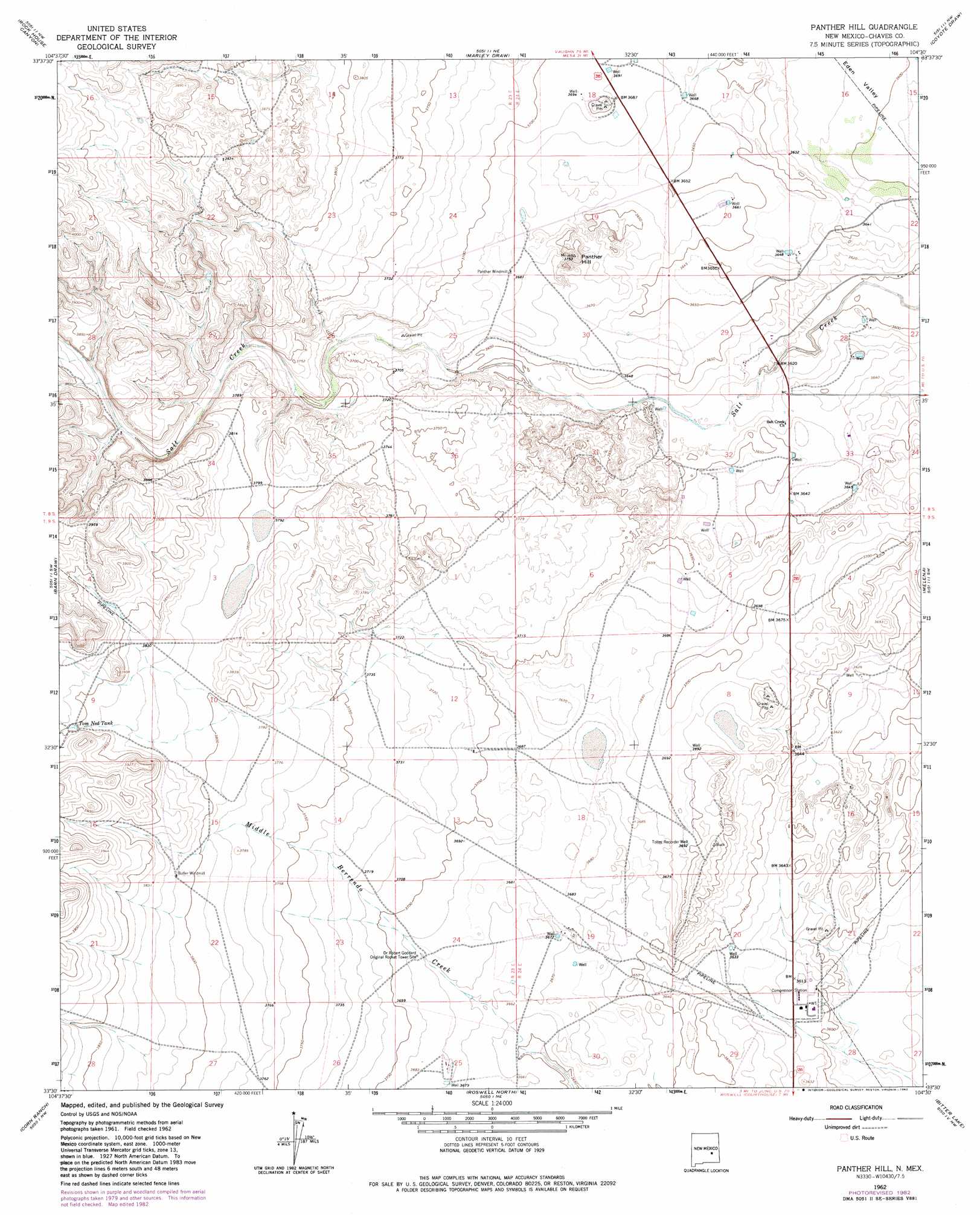
USGS Topo Quad 33104e5 - 1:24,000 scale
| Topo Map Name: | Panther Hill |
| USGS Topo Quad ID: | 33104e5 |
| Print Size: | ca. 21 1/4" wide x 27" high |
| Southeast Coordinates: | 33.5° N latitude / 104.5° W longitude |
| Map Center Coordinates: | 33.5625° N latitude / 104.5625° W longitude |
| U.S. State: | NM |
| Filename: | o33104e5.jpg |
| Download Map JPG Image: | Panther Hill topo map 1:24,000 scale |
| Map Type: | Topographic |
| Topo Series: | 7.5´ |
| Map Scale: | 1:24,000 |
| Source of Map Images: | United States Geological Survey (USGS) |
| Alternate Map Versions: |
Panther Hill NM 1962, updated 1965 Download PDF Buy paper map Panther Hill NM 1962, updated 1982 Download PDF Buy paper map Panther Hill NM 2010 Download PDF Buy paper map Panther Hill NM 2013 Download PDF Buy paper map Panther Hill NM 2017 Download PDF Buy paper map |
1:24,000 Topo Quads surrounding Panther Hill
Round Mountain Se |
Mesa Sw |
Mesa Se |
Shannon Draw |
Cottonwood Draw |
Deep Well |
Rock House Canyon |
Marley Draw |
Coyote Draw |
Eightmile Draw |
White Flat Se |
Barn Draw |
Panther Hill |
Melena |
Acme |
Blackwater Hill |
Corn Ranch |
Roswell North |
Bitter Lake |
Comanche Spring |
Diamond A Ranch |
Hondo Reservoir |
Roswell South |
South Spring |
Bottomless Lakes |
> Back to 33104e1 at 1:100,000 scale
> Back to 33104a1 at 1:250,000 scale
> Back to U.S. Topo Maps home
Panther Hill topo map: Gazetteer
Panther Hill: Reservoirs
Tom Ned Tank elevation 1173m 3848′Panther Hill: Summits
Panther Hill elevation 1143m 3750′Panther Hill: Valleys
Barn Draw elevation 1164m 3818′Eden Valley elevation 1094m 3589′
Panther Hill: Wells
Toltec Record Well elevation 1128m 3700′Panther Hill digital topo map on disk
Buy this Panther Hill topo map showing relief, roads, GPS coordinates and other geographical features, as a high-resolution digital map file on DVD: