White Flat Topo Map New Mexico
To zoom in, hover over the map of White Flat
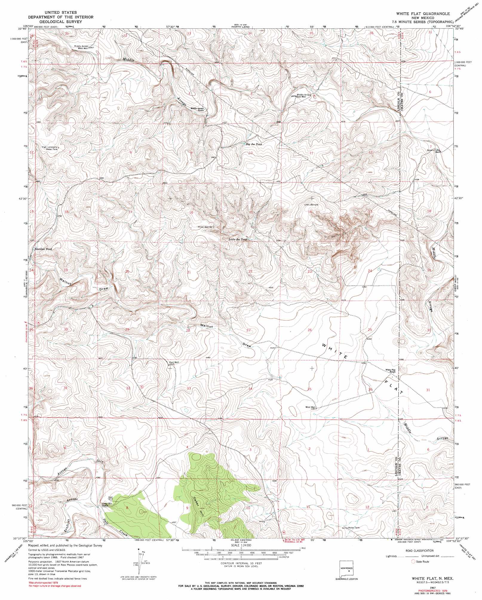
USGS Topo Quad 33104f8 - 1:24,000 scale
| Topo Map Name: | White Flat |
| USGS Topo Quad ID: | 33104f8 |
| Print Size: | ca. 21 1/4" wide x 27" high |
| Southeast Coordinates: | 33.625° N latitude / 104.875° W longitude |
| Map Center Coordinates: | 33.6875° N latitude / 104.9375° W longitude |
| U.S. State: | NM |
| Filename: | o33104f8.jpg |
| Download Map JPG Image: | White Flat topo map 1:24,000 scale |
| Map Type: | Topographic |
| Topo Series: | 7.5´ |
| Map Scale: | 1:24,000 |
| Source of Map Images: | United States Geological Survey (USGS) |
| Alternate Map Versions: |
White Flat NM 1967, updated 1971 Download PDF Buy paper map White Flat NM 1967, updated 1990 Download PDF Buy paper map White Flat NM 2010 Download PDF Buy paper map White Flat NM 2013 Download PDF Buy paper map White Flat NM 2017 Download PDF Buy paper map |
1:24,000 Topo Quads surrounding White Flat
Juan Largo Canyon West |
Juan Largo Canyon East |
Chivita Canyon |
Round Mountain |
Mesa |
Huff Hill |
Cistern Draw |
North Lake |
Round Mountain Se |
Mesa Sw |
Arroyo Serrano West |
Arroyo Serrano East |
White Flat |
Deep Well |
Rock House Canyon |
Arabela |
Granville Canyon |
Elsie Canyon |
White Flat Se |
Barn Draw |
Nelson Canyon West |
Nelson Canyon East |
Horseshoe Bend Nw |
Blackwater Hill |
Corn Ranch |
> Back to 33104e1 at 1:100,000 scale
> Back to 33104a1 at 1:250,000 scale
> Back to U.S. Topo Maps home
White Flat topo map: Gazetteer
White Flat: Arroyos
Arroyo Seco elevation 1391m 4563′Zeufeldt Arroyo elevation 1391m 4563′
White Flat: Flats
White Flat elevation 1328m 4356′White Flat: Reservoirs
Big Joe Tank elevation 1435m 4708′Gavilan Tank elevation 1437m 4714′
High Lonesome Water Tank elevation 1512m 4960′
Little Joe Tank elevation 1400m 4593′
White Flat: Summits
Cedar Hill elevation 1407m 4616′White Flat: Valleys
Walnut Draw elevation 1346m 4416′White Flat: Wells
Browns Lake Well elevation 1373m 4504′East Well elevation 1385m 4543′
Middle Arroyo West Well elevation 1465m 4806′
Miller Well Number 1 elevation 1451m 4760′
West Well elevation 1336m 4383′
White Flat digital topo map on disk
Buy this White Flat topo map showing relief, roads, GPS coordinates and other geographical features, as a high-resolution digital map file on DVD: