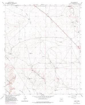
Mesa Topo Map New Mexico
To zoom in, hover over the map of Mesa
USGS Topo Quad 33104h6 - 1:24,000 scale
| Topo Map Name: | Mesa |
| USGS Topo Quad ID: | 33104h6 |
| Print Size: | ca. 21 1/4" wide x 27" high |
| Southeast Coordinates: | 33.875° N latitude / 104.625° W longitude |
| Map Center Coordinates: | 33.9375° N latitude / 104.6875° W longitude |
| U.S. State: | NM |
| Filename: | o33104h6.jpg |
| Download Map JPG Image: | Mesa topo map 1:24,000 scale |
| Map Type: | Topographic |
| Topo Series: | 7.5´ |
| Map Scale: | 1:24,000 |
| Source of Map Images: | United States Geological Survey (USGS) |
| Alternate Map Versions: |
Mesa NM 1967, updated 1971 Download PDF Buy paper map Mesa NM 1967, updated 1982 Download PDF Buy paper map Mesa NM 2010 Download PDF Buy paper map Mesa NM 2013 Download PDF Buy paper map Mesa NM 2017 Download PDF Buy paper map |
1:24,000 Topo Quads surrounding Mesa
> Back to 33104e1 at 1:100,000 scale
> Back to 33104a1 at 1:250,000 scale
> Back to U.S. Topo Maps home
Mesa topo map: Gazetteer
Mesa: Parks
Mesa and Pecos Valley Historical Marker elevation 1376m 4514′Mesa: Populated Places
Mesa elevation 1376m 4514′Mesa: Reservoirs
Big Tank elevation 1349m 4425′Bomb Target Tank elevation 1372m 4501′
Brahman California Tank elevation 1338m 4389′
Buck Springs elevation 1302m 4271′
Buck Springs Tank elevation 1291m 4235′
E L Tank elevation 1395m 4576′
Grage Tank elevation 1320m 4330′
Hunt Tank elevation 1358m 4455′
Jugs Tank elevation 1334m 4376′
Mesa Tank elevation 1358m 4455′
Olas Tank elevation 1387m 4550′
Shortys Tank elevation 1365m 4478′
Mesa: Valleys
West Fork Fivemile Draw elevation 1287m 4222′Mesa: Wells
Haas Well elevation 1360m 4461′Mesa Well elevation 1357m 4452′
Mesa digital topo map on disk
Buy this Mesa topo map showing relief, roads, GPS coordinates and other geographical features, as a high-resolution digital map file on DVD:


