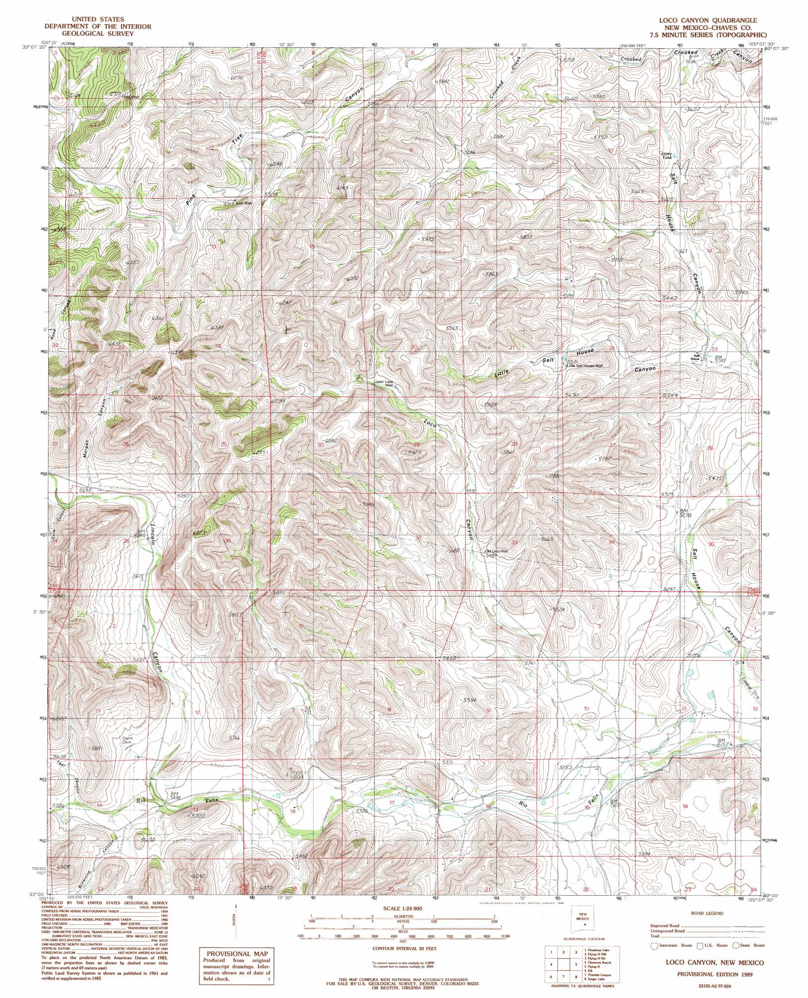
Loco Canyon Topo Map New Mexico
To zoom in, hover over the map of Loco Canyon
USGS Topo Quad 33105a2 - 1:24,000 scale
| Topo Map Name: | Loco Canyon |
| USGS Topo Quad ID: | 33105a2 |
| Print Size: | ca. 21 1/4" wide x 27" high |
| Southeast Coordinates: | 33° N latitude / 105.125° W longitude |
| Map Center Coordinates: | 33.0625° N latitude / 105.1875° W longitude |
| U.S. State: | NM |
| Filename: | o33105a2.jpg |
| Download Map JPG Image: | Loco Canyon topo map 1:24,000 scale |
| Map Type: | Topographic |
| Topo Series: | 7.5´ |
| Map Scale: | 1:24,000 |
| Source of Map Images: | United States Geological Survey (USGS) |
| Alternate Map Versions: |
Loco Canyon NM 1989, updated 1989 Download PDF Buy paper map Loco Canyon NM 2010 Download PDF Buy paper map Loco Canyon NM 2013 Download PDF Buy paper map |
1:24,000 Topo Quads surrounding Loco Canyon
Sheeppen Canyon |
Wahalee Canyon |
Tinnie |
Sunset |
Horseshoe Bend |
Pajarita Mountain |
Deadman Lake |
Flying H Nw |
Flying H Ne |
Skunk Canyon |
Turkey Peak |
Clements Ranch |
Loco Canyon |
Flying H |
Dark Canyon |
Mayhill |
Elk |
Thimble Canyon |
Singer Lake |
Sagebrush Valley W. |
Woodson Canyon |
Robertson Canyon |
Dunken |
Meadow Hill |
Sixteenmile Draw West |
> Back to 33105a1 at 1:100,000 scale
> Back to 33104a1 at 1:250,000 scale
> Back to U.S. Topo Maps home
Loco Canyon topo map: Gazetteer
Loco Canyon: Airports
Flying H Ranch Airport elevation 1571m 5154′Loco Canyon: Reservoirs
Janey Tank elevation 1684m 5524′Loco Canyon: Valleys
Browning Canyon elevation 1706m 5597′Cave Canyon elevation 1738m 5702′
Lincoln Canyon elevation 1677m 5501′
Little Salt House Canyon elevation 1653m 5423′
Loco Canyon elevation 1572m 5157′
Morgan Canyon elevation 1732m 5682′
Teal Canyon elevation 1694m 5557′
Loco Canyon: Wells
Alto Well elevation 1917m 6289′Little Salt House Well elevation 1700m 5577′
Luis Well elevation 1807m 5928′
Old Loco Well elevation 1667m 5469′
Upper Loco Well elevation 1729m 5672′
Loco Canyon digital topo map on disk
Buy this Loco Canyon topo map showing relief, roads, GPS coordinates and other geographical features, as a high-resolution digital map file on DVD: