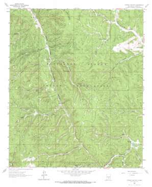
Firman Canyon Topo Map New Mexico
To zoom in, hover over the map of Firman Canyon
USGS Topo Quad 33105a6 - 1:24,000 scale
| Topo Map Name: | Firman Canyon |
| USGS Topo Quad ID: | 33105a6 |
| Print Size: | ca. 21 1/4" wide x 27" high |
| Southeast Coordinates: | 33° N latitude / 105.625° W longitude |
| Map Center Coordinates: | 33.0625° N latitude / 105.6875° W longitude |
| U.S. State: | NM |
| Filename: | o33105a6.jpg |
| Download Map JPG Image: | Firman Canyon topo map 1:24,000 scale |
| Map Type: | Topographic |
| Topo Series: | 7.5´ |
| Map Scale: | 1:24,000 |
| Source of Map Images: | United States Geological Survey (USGS) |
| Alternate Map Versions: |
Firman Canyon NM 1963, updated 1967 Download PDF Buy paper map Firman Canyon NM 2004, updated 2006 Download PDF Buy paper map Firman Canyon NM 2011 Download PDF Buy paper map Firman Canyon NM 2013 Download PDF Buy paper map |
| FStopo: | US Forest Service topo Firman Canyon is available: Download FStopo PDF Download FStopo TIF |
1:24,000 Topo Quads surrounding Firman Canyon
> Back to 33105a1 at 1:100,000 scale
> Back to 33104a1 at 1:250,000 scale
> Back to U.S. Topo Maps home
Firman Canyon topo map: Gazetteer
Firman Canyon: Dams
Shields Dam elevation 2245m 7365′Silver Springs Dam elevation 2350m 7709′
Firman Canyon: Lakes
Fireman Lake elevation 2493m 8179′Firman Canyon: Reservoirs
Burnt Canyon Tank elevation 2406m 7893′Morgan Tank elevation 2422m 7946′
Silver Lake elevation 2341m 7680′
Firman Canyon: Springs
Cienega Spring elevation 2389m 7837′Deer Flats Spring elevation 2363m 7752′
Firman Spring elevation 2365m 7759′
Five Spring elevation 2377m 7798′
Head Springs elevation 2146m 7040′
Horse Spring elevation 2447m 8028′
Peso Spring elevation 2327m 7634′
Turkey Pen Spring elevation 2558m 8392′
Firman Canyon: Valleys
Baird Canyon elevation 2340m 7677′Burnt Canyon elevation 2376m 7795′
Cienega Canyon elevation 2352m 7716′
East Five Canyon elevation 2222m 7290′
East Telephone Canyon elevation 2358m 7736′
Eight Canyon elevation 2293m 7522′
Firman Canyon elevation 2245m 7365′
Five Canyon elevation 2217m 7273′
George Canyon elevation 2375m 7791′
Peso Canyon elevation 2147m 7043′
Potato Patch Canyon elevation 2463m 8080′
Seven Canyon elevation 2256m 7401′
Water Canyon elevation 2365m 7759′
Zinker Canyon elevation 2440m 8005′
Firman Canyon digital topo map on disk
Buy this Firman Canyon topo map showing relief, roads, GPS coordinates and other geographical features, as a high-resolution digital map file on DVD:


