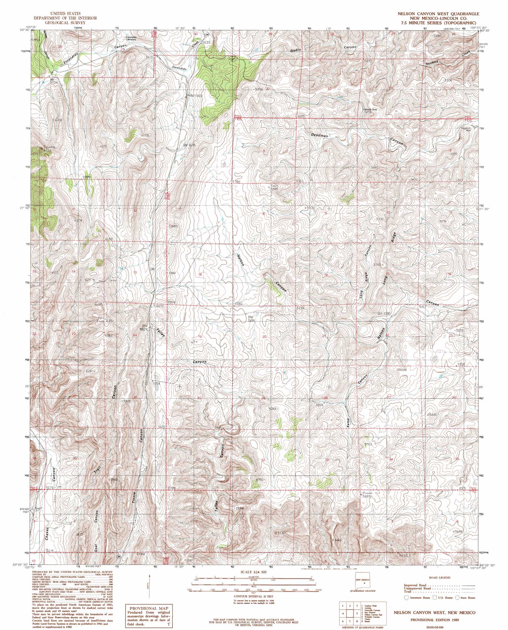
Nelson Canyon West Topo Map New Mexico
To zoom in, hover over the map of Nelson Canyon West
USGS Topo Quad 33105d2 - 1:24,000 scale
| Topo Map Name: | Nelson Canyon West |
| USGS Topo Quad ID: | 33105d2 |
| Print Size: | ca. 21 1/4" wide x 27" high |
| Southeast Coordinates: | 33.375° N latitude / 105.125° W longitude |
| Map Center Coordinates: | 33.4375° N latitude / 105.1875° W longitude |
| U.S. State: | NM |
| Filename: | o33105d2.jpg |
| Download Map JPG Image: | Nelson Canyon West topo map 1:24,000 scale |
| Map Type: | Topographic |
| Topo Series: | 7.5´ |
| Map Scale: | 1:24,000 |
| Source of Map Images: | United States Geological Survey (USGS) |
| Alternate Map Versions: |
Nelson Canyon West NM 1989, updated 1989 Download PDF Buy paper map Nelson Canyon West NM 2010 Download PDF Buy paper map Nelson Canyon West NM 2013 Download PDF Buy paper map |
| FStopo: | US Forest Service topo Nelson Canyon West is available: Download FStopo PDF Download FStopo TIF |
1:24,000 Topo Quads surrounding Nelson Canyon West
Encinoso |
Kyle Harrison Canyon |
Arroyo Serrano West |
Arroyo Serrano East |
White Flat |
Capitan Pass |
Capitan Peak |
Arabela |
Granville Canyon |
Elsie Canyon |
Lincoln |
San Patricio |
Nelson Canyon West |
Nelson Canyon East |
Horseshoe Bend Nw |
Sheeppen Canyon |
Wahalee Canyon |
Tinnie |
Sunset |
Horseshoe Bend |
Pajarita Mountain |
Deadman Lake |
Flying H Nw |
Flying H Ne |
Skunk Canyon |
> Back to 33105a1 at 1:100,000 scale
> Back to 33104a1 at 1:250,000 scale
> Back to U.S. Topo Maps home
Nelson Canyon West topo map: Gazetteer
Nelson Canyon West: Populated Places
Escondido (historical) elevation 1745m 5725′Nelson Canyon West: Ridges
Long Ridge elevation 1722m 5649′Nelson Canyon West: Valleys
Escondido Canyon elevation 1694m 5557′Kemp Canyon elevation 1647m 5403′
Long Ridge Canyon elevation 1639m 5377′
Sawset Canyon elevation 1741m 5711′
Talley Canyon elevation 1562m 5124′
Trail Canyon elevation 1604m 5262′
Nelson Canyon West: Wells
Deadman Well elevation 1600m 5249′Middle Well elevation 1682m 5518′
Nelson Canyon West digital topo map on disk
Buy this Nelson Canyon West topo map showing relief, roads, GPS coordinates and other geographical features, as a high-resolution digital map file on DVD: