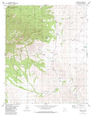
Arabela Topo Map New Mexico
To zoom in, hover over the map of Arabela
USGS Topo Quad 33105e2 - 1:24,000 scale
| Topo Map Name: | Arabela |
| USGS Topo Quad ID: | 33105e2 |
| Print Size: | ca. 21 1/4" wide x 27" high |
| Southeast Coordinates: | 33.5° N latitude / 105.125° W longitude |
| Map Center Coordinates: | 33.5625° N latitude / 105.1875° W longitude |
| U.S. State: | NM |
| Filename: | o33105e2.jpg |
| Download Map JPG Image: | Arabela topo map 1:24,000 scale |
| Map Type: | Topographic |
| Topo Series: | 7.5´ |
| Map Scale: | 1:24,000 |
| Source of Map Images: | United States Geological Survey (USGS) |
| Alternate Map Versions: |
Arabela NM 1981, updated 1981 Download PDF Buy paper map Arabela NM 2004, updated 2006 Download PDF Buy paper map Arabela NM 2011 Download PDF Buy paper map Arabela NM 2013 Download PDF Buy paper map |
| FStopo: | US Forest Service topo Arabela is available: Download FStopo PDF Download FStopo TIF |
1:24,000 Topo Quads surrounding Arabela
> Back to 33105e1 at 1:100,000 scale
> Back to 33104a1 at 1:250,000 scale
> Back to U.S. Topo Maps home
Arabela topo map: Gazetteer
Arabela: Lakes
Pacheco Lake elevation 1644m 5393′Arabela: Mines
Arabela Mines Incorporated Prospect elevation 1891m 6204′Arabela: Populated Places
Arabela elevation 1670m 5479′Bluewater elevation 1679m 5508′
Pine Lodge elevation 1954m 6410′
Arabela: Post Offices
Arabela Post Office (historical) elevation 1670m 5479′Pine Lodge Post Office (historical) elevation 1954m 6410′
Arabela: Springs
Bluewater Spring elevation 1705m 5593′Las Palas Spring elevation 1723m 5652′
Matney Spring elevation 2003m 6571′
Pino Real Spring elevation 1936m 6351′
Arabela: Streams
Escondido Creek elevation 1614m 5295′Arabela: Summits
Boy Scout Mountain elevation 2039m 6689′Chimney Rock elevation 2246m 7368′
Ramerez elevation 1867m 6125′
South Arabela elevation 1758m 5767′
Sunset Peak elevation 2817m 9242′
Arabela: Valleys
Diablo Canyon elevation 1550m 5085′Duran Canyon elevation 1587m 5206′
Encinoso Canyon elevation 1587m 5206′
Hale Canyon elevation 1659m 5442′
Pancho Canyon elevation 1664m 5459′
Arabela: Wells
10133 Water Well elevation 1699m 5574′Arabela digital topo map on disk
Buy this Arabela topo map showing relief, roads, GPS coordinates and other geographical features, as a high-resolution digital map file on DVD:


