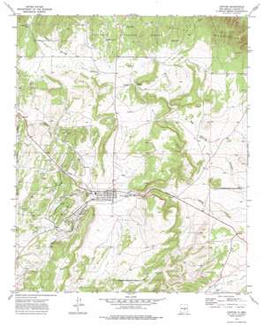
Capitan Topo Map New Mexico
To zoom in, hover over the map of Capitan
USGS Topo Quad 33105e5 - 1:24,000 scale
| Topo Map Name: | Capitan |
| USGS Topo Quad ID: | 33105e5 |
| Print Size: | ca. 21 1/4" wide x 27" high |
| Southeast Coordinates: | 33.5° N latitude / 105.5° W longitude |
| Map Center Coordinates: | 33.5625° N latitude / 105.5625° W longitude |
| U.S. State: | NM |
| Filename: | o33105e5.jpg |
| Download Map JPG Image: | Capitan topo map 1:24,000 scale |
| Map Type: | Topographic |
| Topo Series: | 7.5´ |
| Map Scale: | 1:24,000 |
| Source of Map Images: | United States Geological Survey (USGS) |
| Alternate Map Versions: |
Capitan NM 1973, updated 1978 Download PDF Buy paper map Capitan NM 2004, updated 2006 Download PDF Buy paper map Capitan NM 2011 Download PDF Buy paper map Capitan NM 2013 Download PDF Buy paper map |
| FStopo: | US Forest Service topo Capitan is available: Download FStopo PDF Download FStopo TIF |
1:24,000 Topo Quads surrounding Capitan
> Back to 33105e1 at 1:100,000 scale
> Back to 33104a1 at 1:250,000 scale
> Back to U.S. Topo Maps home
Capitan topo map: Gazetteer
Capitan: Mines
Capitan Mine elevation 2104m 6902′Capitan Number One elevation 2008m 6587′
Capitan Number Two elevation 1982m 6502′
Gray elevation 2012m 6601′
Linderman elevation 2043m 6702′
Smokey Mine elevation 2104m 6902′
Capitan: Parks
Capitan Historical Marker elevation 1935m 6348′Fort Stanton elevation 1879m 6164′
Capitan: Populated Places
Capitan elevation 1935m 6348′Coalora elevation 1999m 6558′
Capitan: Post Offices
Capitan Post Office elevation 1935m 6348′Coalora Post Office (historical) elevation 1999m 6558′
Capitan: Reservoirs
Hondo Tank elevation 2074m 6804′South Tank elevation 2054m 6738′
Southwest Tank elevation 2066m 6778′
Tie Chute Tank elevation 2143m 7030′
Capitan: Streams
Magado Creek elevation 1917m 6289′North Fork Salado Creek elevation 2012m 6601′
Oso Creek elevation 1944m 6377′
South Fork Salado Creek elevation 2037m 6683′
Capitan: Wells
10010 Water Well elevation 1934m 6345′Marfield Well elevation 2044m 6706′
Capitan digital topo map on disk
Buy this Capitan topo map showing relief, roads, GPS coordinates and other geographical features, as a high-resolution digital map file on DVD:


