Juan Largo Canyon East Topo Map New Mexico
To zoom in, hover over the map of Juan Largo Canyon East
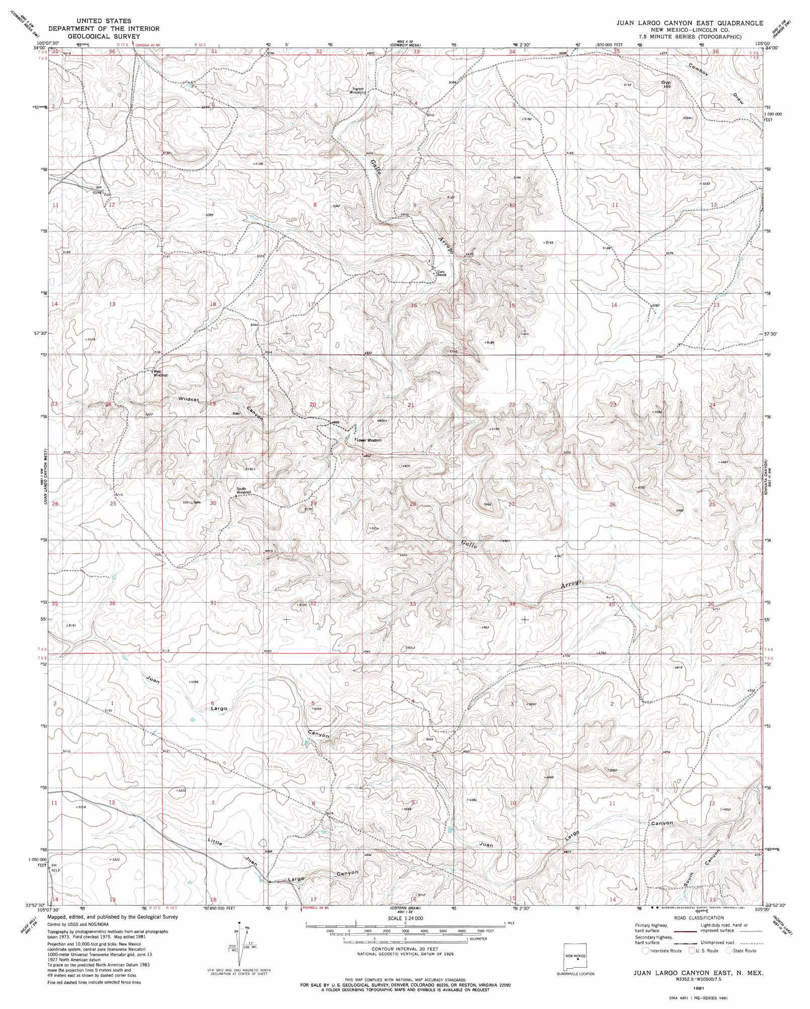
USGS Topo Quad 33105h1 - 1:24,000 scale
| Topo Map Name: | Juan Largo Canyon East |
| USGS Topo Quad ID: | 33105h1 |
| Print Size: | ca. 21 1/4" wide x 27" high |
| Southeast Coordinates: | 33.875° N latitude / 105° W longitude |
| Map Center Coordinates: | 33.9375° N latitude / 105.0625° W longitude |
| U.S. State: | NM |
| Filename: | o33105h1.jpg |
| Download Map JPG Image: | Juan Largo Canyon East topo map 1:24,000 scale |
| Map Type: | Topographic |
| Topo Series: | 7.5´ |
| Map Scale: | 1:24,000 |
| Source of Map Images: | United States Geological Survey (USGS) |
| Alternate Map Versions: |
Juan Largo Canyon East NM 1981, updated 1981 Download PDF Buy paper map Juan Largo Canyon East NM 2010 Download PDF Buy paper map Juan Largo Canyon East NM 2013 Download PDF Buy paper map |
1:24,000 Topo Quads surrounding Juan Largo Canyon East
Gallo Spring Canyon Ne |
Cowboy Mesa Nw |
Cowboy Mesa Ne |
Ramon |
Wright Ranch |
Red Bluff Draw East |
Cowboy Mesa Sw |
Cowboy Mesa |
Ramon Sw |
Wire Lake |
Golondrina Well |
Juan Largo Canyon West |
Juan Largo Canyon East |
Chivita Canyon |
Round Mountain |
Pedernal Arroyo |
Huff Hill |
Cistern Draw |
North Lake |
Round Mountain Se |
Kyle Harrison Canyon |
Arroyo Serrano West |
Arroyo Serrano East |
White Flat |
Deep Well |
> Back to 33105e1 at 1:100,000 scale
> Back to 33104a1 at 1:250,000 scale
> Back to U.S. Topo Maps home
Juan Largo Canyon East topo map: Gazetteer
Juan Largo Canyon East: Summits
Gyp Hill elevation 1519m 4983′Juan Largo Canyon East: Valleys
Little Juan Largo Canyon elevation 1469m 4819′South Canyon elevation 1430m 4691′
Wildcat Canyon elevation 1463m 4799′
Juan Largo Canyon East digital topo map on disk
Buy this Juan Largo Canyon East topo map showing relief, roads, GPS coordinates and other geographical features, as a high-resolution digital map file on DVD: