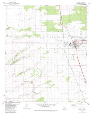
Tularosa Topo Map New Mexico
To zoom in, hover over the map of Tularosa
USGS Topo Quad 33106a1 - 1:24,000 scale
| Topo Map Name: | Tularosa |
| USGS Topo Quad ID: | 33106a1 |
| Print Size: | ca. 21 1/4" wide x 27" high |
| Southeast Coordinates: | 33° N latitude / 106° W longitude |
| Map Center Coordinates: | 33.0625° N latitude / 106.0625° W longitude |
| U.S. State: | NM |
| Filename: | o33106a1.jpg |
| Download Map JPG Image: | Tularosa topo map 1:24,000 scale |
| Map Type: | Topographic |
| Topo Series: | 7.5´ |
| Map Scale: | 1:24,000 |
| Source of Map Images: | United States Geological Survey (USGS) |
| Alternate Map Versions: |
Tularosa NM 1982, updated 1982 Download PDF Buy paper map Tularosa NM 2010 Download PDF Buy paper map Tularosa NM 2013 Download PDF Buy paper map Tularosa NM 2017 Download PDF Buy paper map |
1:24,000 Topo Quads surrounding Tularosa
> Back to 33106a1 at 1:100,000 scale
> Back to 33106a1 at 1:250,000 scale
> Back to U.S. Topo Maps home
Tularosa topo map: Gazetteer
Tularosa: Parks
Tularosa Historical Marker elevation 1374m 4507′Tularosa: Populated Places
Tularosa elevation 1374m 4507′Tularosa: Post Offices
Tularosa Post Office elevation 1374m 4507′Tularosa: Springs
Brazel Spring elevation 1280m 4199′French Spring elevation 1271m 4169′
Lomitas Spring elevation 1317m 4320′
Mesquite Spring elevation 1295m 4248′
Round Mountain Spring elevation 1276m 4186′
Scholler Spring elevation 1312m 4304′
Sheep Camp Springs elevation 1290m 4232′
South Spring elevation 1284m 4212′
Tularosa: Valleys
Tecolote Canyon elevation 1397m 4583′Tularosa: Wells
10016 Water Well elevation 1366m 4481′10017 Water Well elevation 1365m 4478′
10018 Water Well elevation 1352m 4435′
10021 Water Well elevation 1311m 4301′
10023 Water Well elevation 1384m 4540′
10025 Water Well elevation 1376m 4514′
10027 Water Well elevation 1377m 4517′
10029 Water Well elevation 1354m 4442′
10030 Water Well elevation 1332m 4370′
10033 Water Well elevation 1336m 4383′
10034 Water Well elevation 1342m 4402′
10106 Water Well elevation 1332m 4370′
10107 Water Well elevation 1322m 4337′
10111 Water Well elevation 1335m 4379′
10114 Water Well elevation 1354m 4442′
10119 Water Well elevation 1349m 4425′
10125 Water Well elevation 1341m 4399′
10129 Water Well elevation 1325m 4347′
10131 Water Well elevation 1320m 4330′
10133 Water Well elevation 1341m 4399′
10134 Water Well elevation 1383m 4537′
10138 Water Well elevation 1385m 4543′
10141 Water Well elevation 1375m 4511′
10143 Water Well elevation 1377m 4517′
10294 Water Well elevation 1348m 4422′
10301 Water Well elevation 1339m 4393′
10314 Water Well elevation 1346m 4416′
Aguilar Well elevation 1281m 4202′
Berral Well elevation 1322m 4337′
Clayton Well elevation 1336m 4383′
Kenny Well elevation 1322m 4337′
Sidwell Well elevation 1305m 4281′
Tularosa Water Well elevation 1319m 4327′
Tularosa digital topo map on disk
Buy this Tularosa topo map showing relief, roads, GPS coordinates and other geographical features, as a high-resolution digital map file on DVD:


