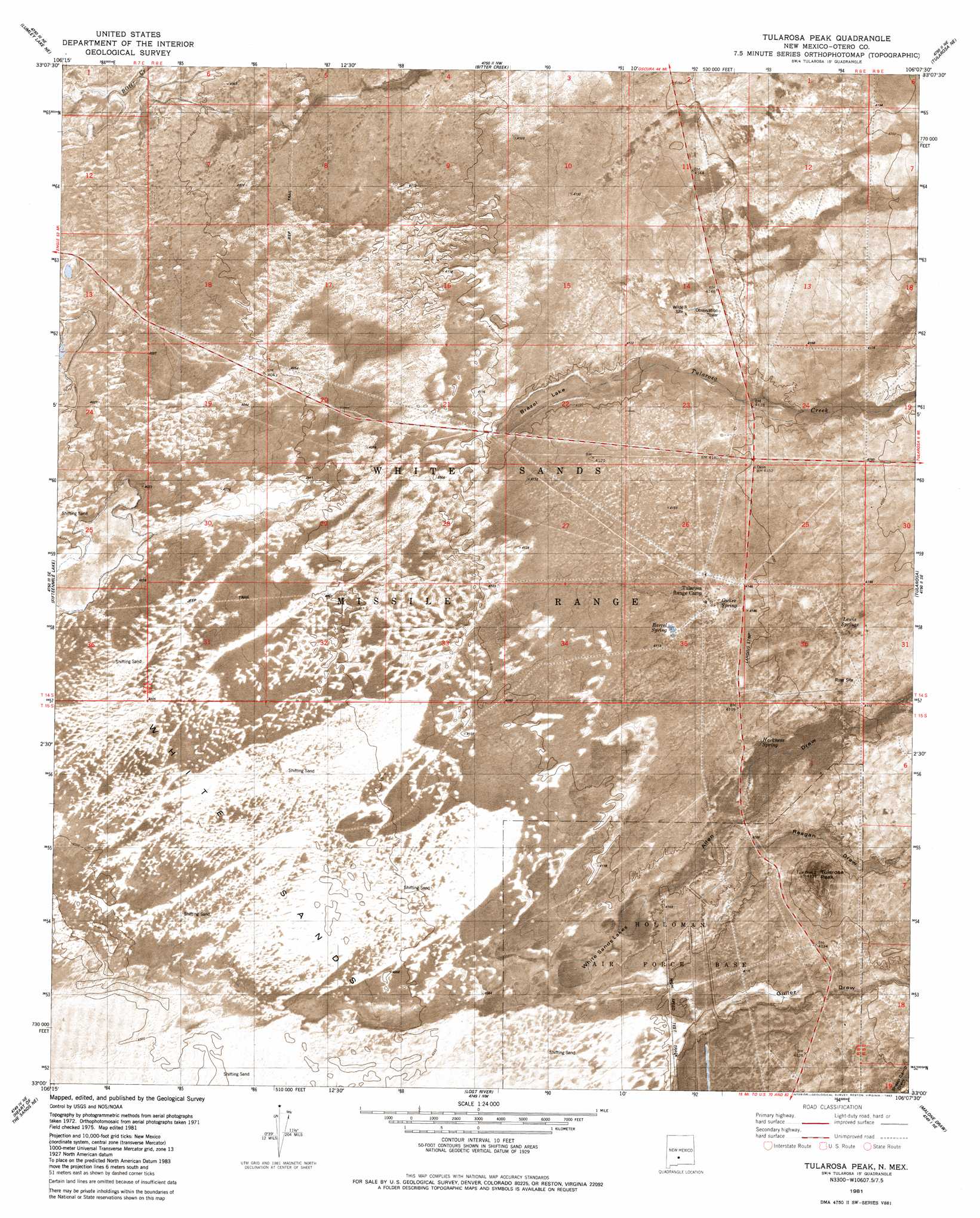
Tularosa Peak Topo Map New Mexico
To zoom in, hover over the map of Tularosa Peak
USGS Topo Quad 33106a2 - 1:24,000 scale
| Topo Map Name: | Tularosa Peak |
| USGS Topo Quad ID: | 33106a2 |
| Print Size: | ca. 21 1/4" wide x 27" high |
| Southeast Coordinates: | 33° N latitude / 106.125° W longitude |
| Map Center Coordinates: | 33.0625° N latitude / 106.1875° W longitude |
| U.S. State: | NM |
| Filename: | p33106a2.jpg |
| Download Map JPG Image: | Tularosa Peak topo map 1:24,000 scale |
| Map Type: | Orthophoto |
| Topo Series: | 7.5´ |
| Map Scale: | 1:24,000 |
| Source of Map Images: | United States Geological Survey (USGS) |
| Alternate Map Versions: |
Tularosa Peak NM 1981, updated 1982 Download PDF Buy paper map Tularosa Peak NM 2010 Download PDF Buy paper map Tularosa Peak NM 2013 Download PDF Buy paper map Tularosa Peak NM 2017 Download PDF Buy paper map |
1:24,000 Topo Quads surrounding Tularosa Peak
Sheep Mountain |
Capitol Peak Se |
Three Rivers Sw |
Three Rivers |
Golondrina Draw |
Lumley Lake Nw |
Lumley Lake Ne |
Bitter Creek |
Tularosa Ne |
Cat Mountain |
Lumley Lake |
Fifteenmile Lake |
Tularosa Peak |
Tularosa |
Sabinata Flat |
Heart Of The Sands Nw |
Heart Of The Sands Ne |
Lost River |
Malone Draw |
Alamogordo North |
Heart Of The Sands Sw |
Heart Of The Sands |
Garton Lake |
Holloman |
Alamogordo South |
> Back to 33106a1 at 1:100,000 scale
> Back to 33106a1 at 1:250,000 scale
> Back to U.S. Topo Maps home
Tularosa Peak topo map: Gazetteer
Tularosa Peak: Arroyos
Guilez Draw elevation 1248m 4094′Tularosa Peak: Flats
Brazel Lake elevation 1250m 4101′Tularosa Peak: Lakes
White Sands Lakes elevation 1243m 4078′Tularosa Peak: Springs
Barrel Spring elevation 1256m 4120′Guilez Spring elevation 1256m 4120′
Harkness Spring elevation 1256m 4120′
Lewis Spring elevation 1275m 4183′
South Springs elevation 1274m 4179′
Tularosa Peak: Streams
Tularosa Creek elevation 1250m 4101′Tularosa Peak: Summits
Tularosa Peak elevation 1330m 4363′Tularosa Peak: Valleys
Allen Draw elevation 1246m 4087′Reagan Draw elevation 1245m 4084′
Tularosa Peak digital topo map on disk
Buy this Tularosa Peak topo map showing relief, roads, GPS coordinates and other geographical features, as a high-resolution digital map file on DVD: