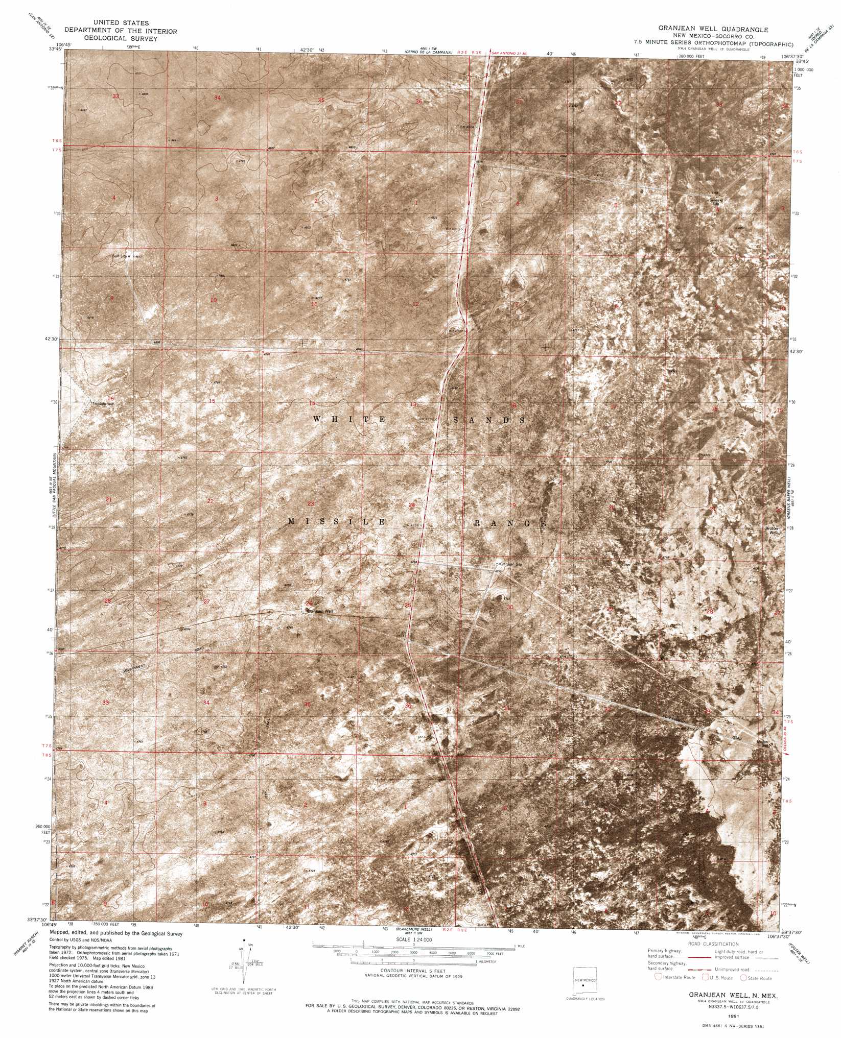
Granjean Well Topo Map New Mexico
To zoom in, hover over the map of Granjean Well
USGS Topo Quad 33106f6 - 1:24,000 scale
| Topo Map Name: | Granjean Well |
| USGS Topo Quad ID: | 33106f6 |
| Print Size: | ca. 21 1/4" wide x 27" high |
| Southeast Coordinates: | 33.625° N latitude / 106.625° W longitude |
| Map Center Coordinates: | 33.6875° N latitude / 106.6875° W longitude |
| U.S. State: | NM |
| Filename: | p33106f6.jpg |
| Download Map JPG Image: | Granjean Well topo map 1:24,000 scale |
| Map Type: | Orthophoto |
| Topo Series: | 7.5´ |
| Map Scale: | 1:24,000 |
| Source of Map Images: | United States Geological Survey (USGS) |
| Alternate Map Versions: |
Granjean Well NM 1981, updated 1981 Download PDF Buy paper map Granjean Well NM 2010 Download PDF Buy paper map Granjean Well NM 2013 Download PDF Buy paper map Granjean Well NM 2017 Download PDF Buy paper map |
1:24,000 Topo Quads surrounding Granjean Well
Luis Lopez |
San Antonio |
Canon Agua Buena |
Prairie Spring |
Wrye Peak Nw |
Indian Well Wilderness |
San Antonio Se |
Cerro De La Campana |
Cerro De La Campana Se |
Wrye Peak Sw |
San Marcial |
Little San Pasqual Mountain |
Granjean Well |
Greens Baber Well |
Trinity Site |
Pope |
Harriet Ranch |
Blakemore Well |
Foster Well |
Mockingbird Gap |
Tucson Spring |
Fuller Ranch |
Salinas Peak Nw |
Fairview Mountain |
Capitol Peak |
> Back to 33106e1 at 1:100,000 scale
> Back to 33106a1 at 1:250,000 scale
> Back to U.S. Topo Maps home
Granjean Well topo map: Gazetteer
Granjean Well: Reservoirs
Bruton Tank elevation 1441m 4727′Granjean Well: Wells
Bruton Well elevation 1439m 4721′Buntn Water Well elevation 1439m 4721′
Granjean Water Well elevation 1449m 4753′
Granjean Well elevation 1448m 4750′
Granjean Well digital topo map on disk
Buy this Granjean Well topo map showing relief, roads, GPS coordinates and other geographical features, as a high-resolution digital map file on DVD: