Little San Pasqual Mountain Topo Map New Mexico
To zoom in, hover over the map of Little San Pasqual Mountain
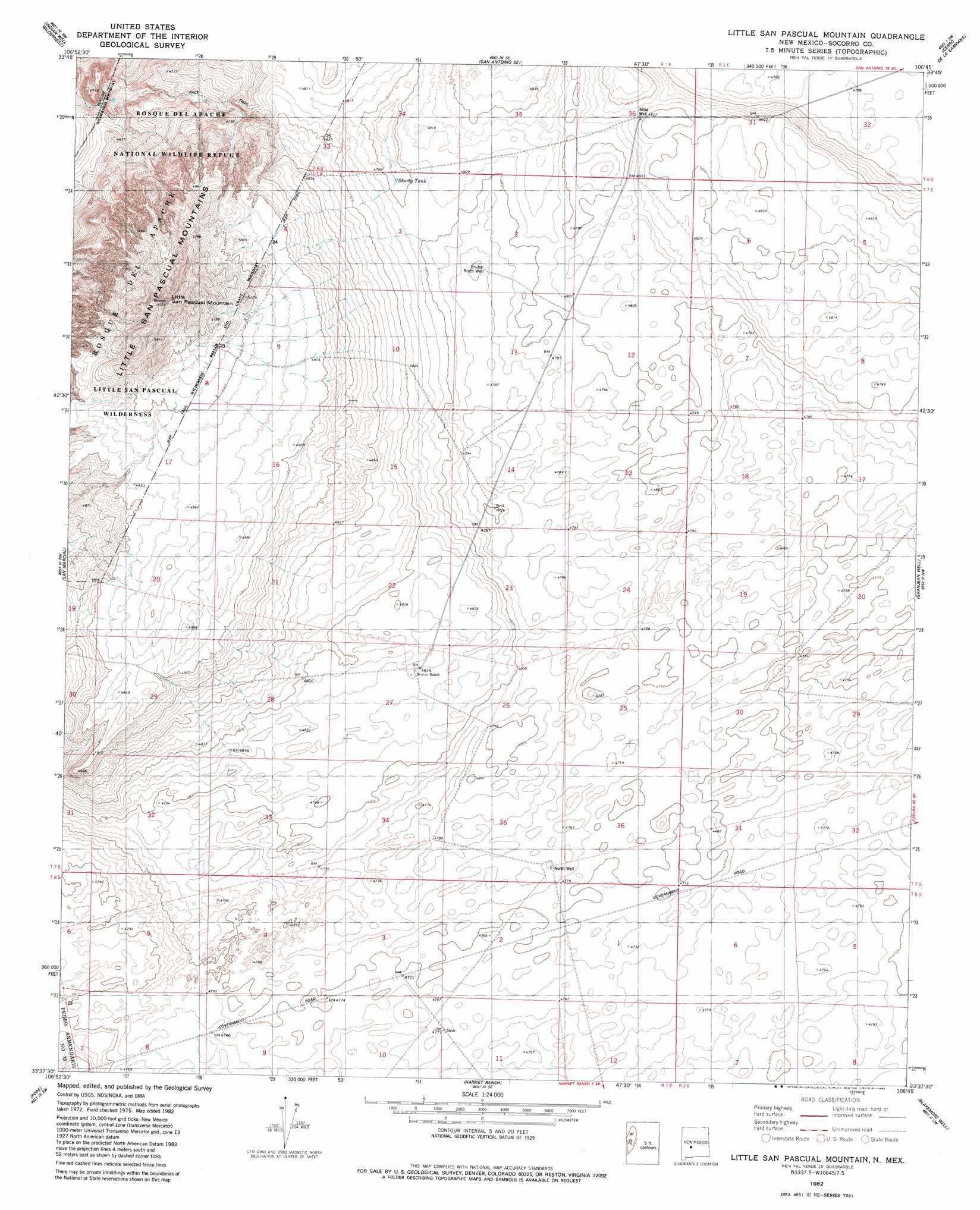
USGS Topo Quad 33106f7 - 1:24,000 scale
| Topo Map Name: | Little San Pasqual Mountain |
| USGS Topo Quad ID: | 33106f7 |
| Print Size: | ca. 21 1/4" wide x 27" high |
| Southeast Coordinates: | 33.625° N latitude / 106.75° W longitude |
| Map Center Coordinates: | 33.6875° N latitude / 106.8125° W longitude |
| U.S. State: | NM |
| Filename: | o33106f7.jpg |
| Download Map JPG Image: | Little San Pasqual Mountain topo map 1:24,000 scale |
| Map Type: | Topographic |
| Topo Series: | 7.5´ |
| Map Scale: | 1:24,000 |
| Source of Map Images: | United States Geological Survey (USGS) |
| Alternate Map Versions: |
Little San Pascual Mountain NM 1982, updated 1982 Download PDF Buy paper map Little San Pascual Mountain NM 2010 Download PDF Buy paper map Little San Pascual Mountain NM 2013 Download PDF Buy paper map Little San Pascual Mountain NM 2017 Download PDF Buy paper map |
1:24,000 Topo Quads surrounding Little San Pasqual Mountain
Molino Peak |
Luis Lopez |
San Antonio |
Canon Agua Buena |
Prairie Spring |
Cienega Ranch |
Indian Well Wilderness |
San Antonio Se |
Cerro De La Campana |
Cerro De La Campana Se |
Fort Craig |
San Marcial |
Little San Pasqual Mountain |
Granjean Well |
Greens Baber Well |
Paraje Well |
Pope |
Harriet Ranch |
Blakemore Well |
Foster Well |
Lava |
Tucson Spring |
Fuller Ranch |
Salinas Peak Nw |
Fairview Mountain |
> Back to 33106e1 at 1:100,000 scale
> Back to 33106a1 at 1:250,000 scale
> Back to U.S. Topo Maps home
Little San Pasqual Mountain topo map: Gazetteer
Little San Pasqual Mountain: Reservoirs
Shorty Tank elevation 1463m 4799′Little San Pasqual Mountain: Summits
Little San Pascual Mountain elevation 1672m 5485′Little San Pasqual Mountain: Wells
10054 Water Well elevation 1470m 4822′100600 Water Well elevation 1470m 4822′
Mike Well elevation 1470m 4822′
North Well elevation 1459m 4786′
Olguin Water Well elevation 1456m 4776′
Olquin Well elevation 1456m 4776′
Little San Pasqual Mountain digital topo map on disk
Buy this Little San Pasqual Mountain topo map showing relief, roads, GPS coordinates and other geographical features, as a high-resolution digital map file on DVD: