San Marcial Topo Map New Mexico
To zoom in, hover over the map of San Marcial
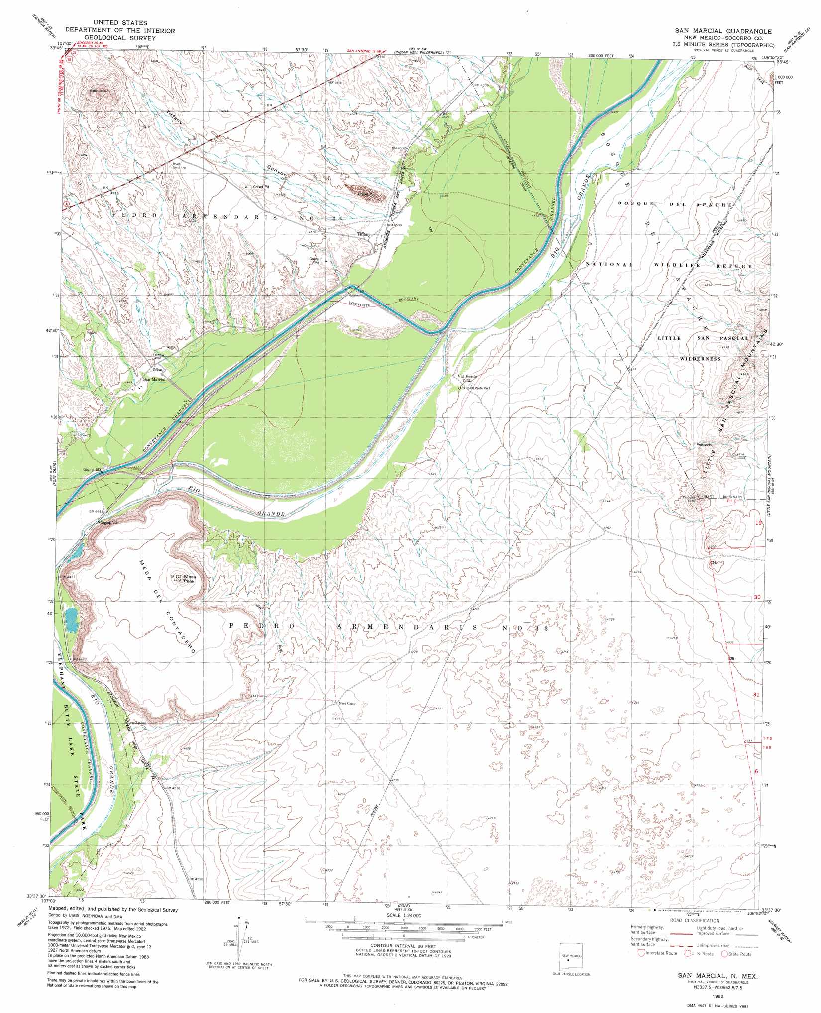
USGS Topo Quad 33106f8 - 1:24,000 scale
| Topo Map Name: | San Marcial |
| USGS Topo Quad ID: | 33106f8 |
| Print Size: | ca. 21 1/4" wide x 27" high |
| Southeast Coordinates: | 33.625° N latitude / 106.875° W longitude |
| Map Center Coordinates: | 33.6875° N latitude / 106.9375° W longitude |
| U.S. State: | NM |
| Filename: | o33106f8.jpg |
| Download Map JPG Image: | San Marcial topo map 1:24,000 scale |
| Map Type: | Topographic |
| Topo Series: | 7.5´ |
| Map Scale: | 1:24,000 |
| Source of Map Images: | United States Geological Survey (USGS) |
| Alternate Map Versions: |
San Marcial NM 1982, updated 1982 Download PDF Buy paper map San Marcial NM 2010 Download PDF Buy paper map San Marcial NM 2013 Download PDF Buy paper map San Marcial NM 2017 Download PDF Buy paper map |
1:24,000 Topo Quads surrounding San Marcial
South Baldy |
Molino Peak |
Luis Lopez |
San Antonio |
Canon Agua Buena |
Puertecito Gap |
Cienega Ranch |
Indian Well Wilderness |
San Antonio Se |
Cerro De La Campana |
Hickman Ranch |
Fort Craig |
San Marcial |
Little San Pasqual Mountain |
Granjean Well |
Black Hill |
Paraje Well |
Pope |
Harriet Ranch |
Blakemore Well |
Romero Canyon |
Lava |
Tucson Spring |
Fuller Ranch |
Salinas Peak Nw |
> Back to 33106e1 at 1:100,000 scale
> Back to 33106a1 at 1:250,000 scale
> Back to U.S. Topo Maps home
San Marcial topo map: Gazetteer
San Marcial: Lakes
San Marcial Lake elevation 1363m 4471′San Marcial: Populated Places
San Marcial elevation 1366m 4481′Tiffany elevation 1373m 4504′
Val Verde elevation 1366m 4481′
San Marcial: Post Offices
San Marcial Post Office (historical) elevation 1366m 4481′San Marcial: Summits
Mesa del Contadero elevation 1466m 4809′Mesa Peak elevation 1485m 4872′
San Marcial: Valleys
Tiffany Canyon elevation 1372m 4501′San Marcial: Wells
Val Verde Water Well elevation 1374m 4507′San Marcial digital topo map on disk
Buy this San Marcial topo map showing relief, roads, GPS coordinates and other geographical features, as a high-resolution digital map file on DVD: