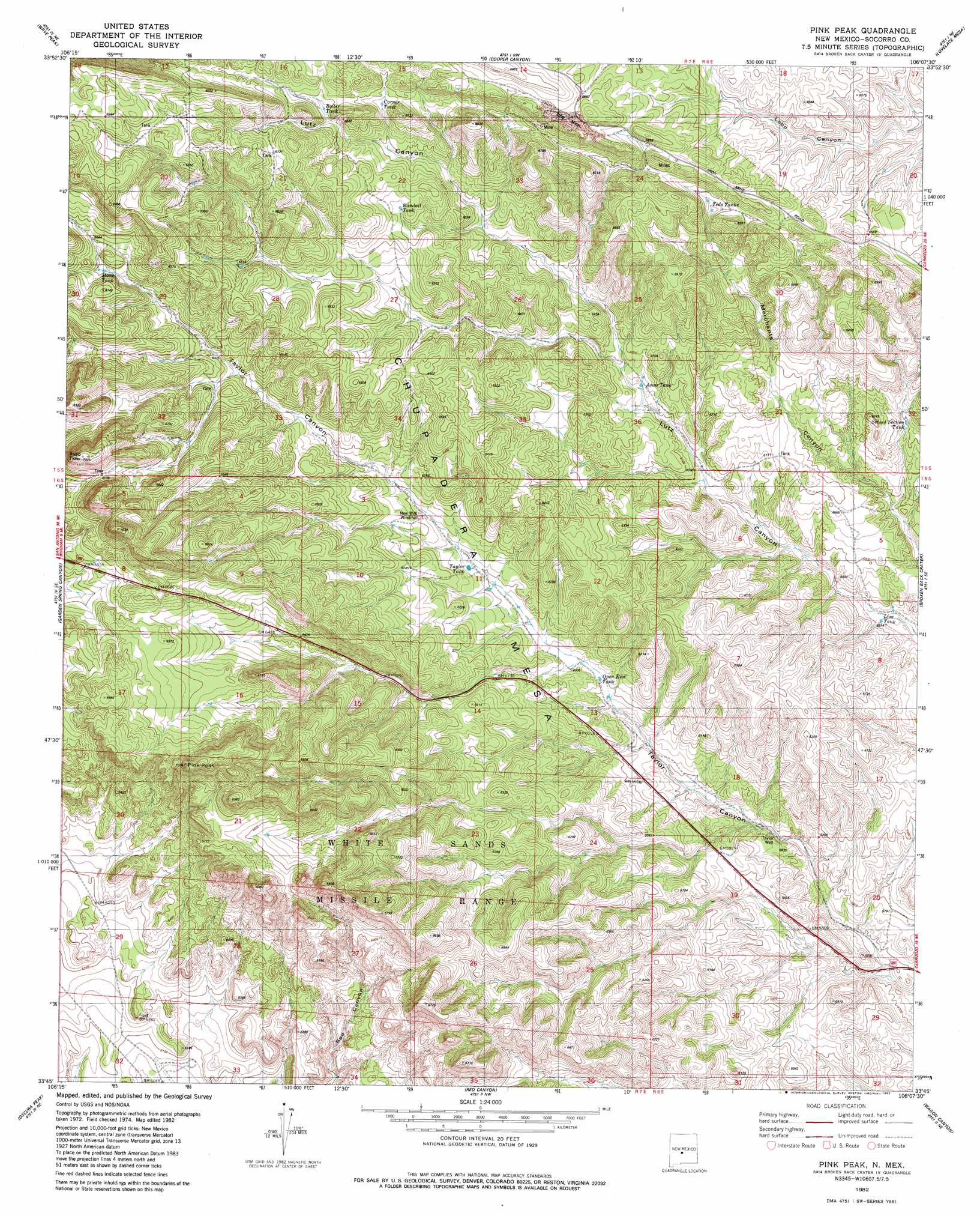
Pink Peak Topo Map New Mexico
To zoom in, hover over the map of Pink Peak
USGS Topo Quad 33106g2 - 1:24,000 scale
| Topo Map Name: | Pink Peak |
| USGS Topo Quad ID: | 33106g2 |
| Print Size: | ca. 21 1/4" wide x 27" high |
| Southeast Coordinates: | 33.75° N latitude / 106.125° W longitude |
| Map Center Coordinates: | 33.8125° N latitude / 106.1875° W longitude |
| U.S. State: | NM |
| Filename: | o33106g2.jpg |
| Download Map JPG Image: | Pink Peak topo map 1:24,000 scale |
| Map Type: | Topographic |
| Topo Series: | 7.5´ |
| Map Scale: | 1:24,000 |
| Source of Map Images: | United States Geological Survey (USGS) |
| Alternate Map Versions: |
Pink Peak NM 1982, updated 1982 Download PDF Buy paper map Pink Peak NM 2010 Download PDF Buy paper map Pink Peak NM 2013 Download PDF Buy paper map Pink Peak NM 2017 Download PDF Buy paper map |
1:24,000 Topo Quads surrounding Pink Peak
Orndorff Ranch |
Wilson Ranch |
Turkey Ridge Sw |
Cat Mesa |
Polecat Draw |
Wrye Peak Nw |
Wrye Peak |
Cooper Canyon |
Lovelace Mesa |
Dulce Draw |
Wrye Peak Sw |
Garden Spring Canyon |
Pink Peak |
Broken Back Crater |
Little Black Peak |
Trinity Site |
Oscura Peak |
Red Canyon |
Wagon Canyon |
Carrizoza West |
Mockingbird Gap |
Mockingbird Gap Se |
Bull Gap Sw |
Bull Gap |
Cub Mountain |
> Back to 33106e1 at 1:100,000 scale
> Back to 33106a1 at 1:250,000 scale
> Back to U.S. Topo Maps home
Pink Peak topo map: Gazetteer
Pink Peak: Mines
Jones Magnatite elevation 2021m 6630′Red Eagle elevation 1989m 6525′
Pink Peak: Reservoirs
Monk Tank elevation 2010m 6594′School Section Tank elevation 1866m 6122′
Taylor Tank elevation 1865m 6118′
Pink Peak: Wells
Red Tank Well elevation 1866m 6122′Taylor Well elevation 1775m 5823′
Pink Peak digital topo map on disk
Buy this Pink Peak topo map showing relief, roads, GPS coordinates and other geographical features, as a high-resolution digital map file on DVD: