Indian Well Wilderness Topo Map New Mexico
To zoom in, hover over the map of Indian Well Wilderness
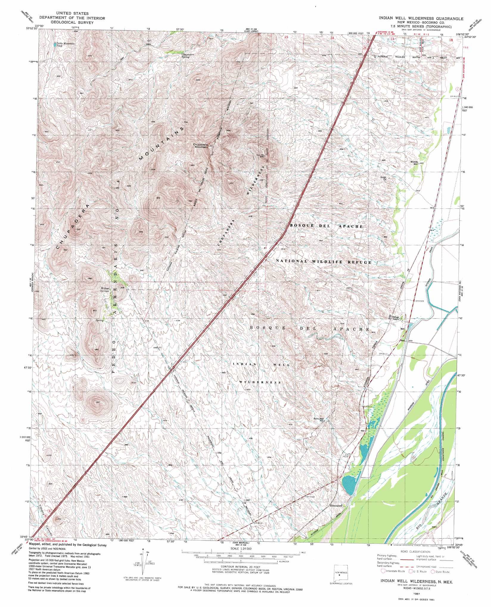
USGS Topo Quad 33106g8 - 1:24,000 scale
| Topo Map Name: | Indian Well Wilderness |
| USGS Topo Quad ID: | 33106g8 |
| Print Size: | ca. 21 1/4" wide x 27" high |
| Southeast Coordinates: | 33.75° N latitude / 106.875° W longitude |
| Map Center Coordinates: | 33.8125° N latitude / 106.9375° W longitude |
| U.S. State: | NM |
| Filename: | o33106g8.jpg |
| Download Map JPG Image: | Indian Well Wilderness topo map 1:24,000 scale |
| Map Type: | Topographic |
| Topo Series: | 7.5´ |
| Map Scale: | 1:24,000 |
| Source of Map Images: | United States Geological Survey (USGS) |
| Alternate Map Versions: |
Indian Well Wilderness NM 1981, updated 1982 Download PDF Buy paper map Indian Well Wilderness NM 2010 Download PDF Buy paper map Indian Well Wilderness NM 2013 Download PDF Buy paper map Indian Well Wilderness NM 2017 Download PDF Buy paper map |
1:24,000 Topo Quads surrounding Indian Well Wilderness
Magdalena |
Water Canyon |
Socorro |
Loma De Las Canas |
Bustos Well |
South Baldy |
Molino Peak |
Luis Lopez |
San Antonio |
Canon Agua Buena |
Puertecito Gap |
Cienega Ranch |
Indian Well Wilderness |
San Antonio Se |
Cerro De La Campana |
Hickman Ranch |
Fort Craig |
San Marcial |
Little San Pasqual Mountain |
Granjean Well |
Black Hill |
Paraje Well |
Pope |
Harriet Ranch |
Blakemore Well |
> Back to 33106e1 at 1:100,000 scale
> Back to 33106a1 at 1:250,000 scale
> Back to U.S. Topo Maps home
Indian Well Wilderness topo map: Gazetteer
Indian Well Wilderness: Post Offices
Elmendorf Post Office (historical) elevation 1385m 4543′Indian Well Wilderness: Trails
Canyon Trail elevation 1380m 4527′Marsh Overlook Trail elevation 1380m 4527′
Indian Well Wilderness: Wells
10045 Water Well elevation 1383m 4537′CCC Camp Water Well elevation 1389m 4557′
Indian Well Wilderness digital topo map on disk
Buy this Indian Well Wilderness topo map showing relief, roads, GPS coordinates and other geographical features, as a high-resolution digital map file on DVD: