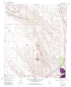
Cuchillo Topo Map New Mexico
To zoom in, hover over the map of Cuchillo
USGS Topo Quad 33107b3 - 1:24,000 scale
| Topo Map Name: | Cuchillo |
| USGS Topo Quad ID: | 33107b3 |
| Print Size: | ca. 21 1/4" wide x 27" high |
| Southeast Coordinates: | 33.125° N latitude / 107.25° W longitude |
| Map Center Coordinates: | 33.1875° N latitude / 107.3125° W longitude |
| U.S. State: | NM |
| Filename: | o33107b3.jpg |
| Download Map JPG Image: | Cuchillo topo map 1:24,000 scale |
| Map Type: | Topographic |
| Topo Series: | 7.5´ |
| Map Scale: | 1:24,000 |
| Source of Map Images: | United States Geological Survey (USGS) |
| Alternate Map Versions: |
Cuchillo NM 1961, updated 1964 Download PDF Buy paper map Cuchillo NM 2010 Download PDF Buy paper map Cuchillo NM 2013 Download PDF Buy paper map Cuchillo NM 2017 Download PDF Buy paper map |
1:24,000 Topo Quads surrounding Cuchillo
> Back to 33107a1 at 1:100,000 scale
> Back to 33106a1 at 1:250,000 scale
> Back to U.S. Topo Maps home
Cuchillo topo map: Gazetteer
Cuchillo: Airports
Truth or Consequences Municipal Airport elevation 1470m 4822′Cuchillo: Areas
Truth or Consequences Thermal Area elevation 1328m 4356′Cuchillo: Mines
Black Chief elevation 1373m 4504′Black Chief Claims elevation 1414m 4639′
Dredge Tailings Three elevation 1331m 4366′
Ellis elevation 1312m 4304′
Equator and Iron Reef Group elevation 1526m 5006′
Lucky Strike Mine elevation 1426m 4678′
Lucky Strike Mine elevation 1447m 4747′
Cuchillo: Parks
Caballo Mountains Historical Marker elevation 1294m 4245′Elephant Butte Dam Historical Marker elevation 1294m 4245′
Geronimos Spring Historical Marker elevation 1294m 4245′
Truth or Consequences Historical Marker elevation 1294m 4245′
Cuchillo: Populated Places
Cuchillo elevation 1457m 4780′Truth or Consequences elevation 1294m 4245′
Cuchillo: Post Offices
Cuchillo Post Office elevation 1457m 4780′Truth or Consequences Post Office (historical) elevation 1294m 4245′
Cuchillo: Reservoirs
Cantrell Tank Number 1 elevation 1438m 4717′Cuchillo Tank Number 2 elevation 1476m 4842′
Doolittle Tank Number 1 elevation 1475m 4839′
Mud Springs Tank Number 1 elevation 1494m 4901′
Pendergrass Tank elevation 1526m 5006′
Cuchillo: Ridges
Mud Springs Mountains elevation 1675m 5495′Cuchillo: Springs
Government Spring elevation 1298m 4258′Ponce de Leon Spring elevation 1294m 4245′
Sandia Spring elevation 1298m 4258′
State Spring elevation 1298m 4258′
Cuchillo: Summits
Mud Mountain elevation 1746m 5728′Cuchillo: Valleys
Cañon de la Plata elevation 1487m 4878′Willow Spring Draw elevation 1441m 4727′
Cuchillo: Wells
10A Water Well elevation 1296m 4251′11A Water Well elevation 1295m 4248′
19 Water Well elevation 1304m 4278′
Block 41 Water Well elevation 1291m 4235′
Hawk Water Well elevation 1325m 4347′
HS 107 Water Well elevation 1297m 4255′
HS 131 Water Well elevation 1323m 4340′
HS 294 Water Well elevation 1323m 4340′
HS 58 Water Well elevation 1296m 4251′
HS 73 Water Well elevation 1293m 4242′
HS-4 Water Well elevation 1293m 4242′
Lots 14 and 15 Water Well elevation 1312m 4304′
RG 14334 Water Well elevation 1463m 4799′
RG 19482 Water Well elevation 1329m 4360′
RG 20208 Water Well elevation 1462m 4796′
RG 24236 Water Well elevation 1477m 4845′
RG 25605 Water Well elevation 1347m 4419′
RG 26351 Water Well elevation 1418m 4652′
RG 26468 Water Well elevation 1460m 4790′
RG 26670 Water Well elevation 1352m 4435′
RG 27639 Water Well elevation 1446m 4744′
Rg 28236 Water Well elevation 1331m 4366′
RG 30025 Water Well elevation 1325m 4347′
Water Well 30 elevation 1298m 4258′
Cuchillo digital topo map on disk
Buy this Cuchillo topo map showing relief, roads, GPS coordinates and other geographical features, as a high-resolution digital map file on DVD:


