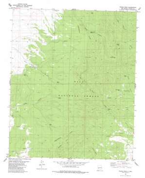
Wahoo Peak Topo Map New Mexico
To zoom in, hover over the map of Wahoo Peak
USGS Topo Quad 33107e7 - 1:24,000 scale
| Topo Map Name: | Wahoo Peak |
| USGS Topo Quad ID: | 33107e7 |
| Print Size: | ca. 21 1/4" wide x 27" high |
| Southeast Coordinates: | 33.5° N latitude / 107.75° W longitude |
| Map Center Coordinates: | 33.5625° N latitude / 107.8125° W longitude |
| U.S. State: | NM |
| Filename: | o33107e7.jpg |
| Download Map JPG Image: | Wahoo Peak topo map 1:24,000 scale |
| Map Type: | Topographic |
| Topo Series: | 7.5´ |
| Map Scale: | 1:24,000 |
| Source of Map Images: | United States Geological Survey (USGS) |
| Alternate Map Versions: |
Wahoo Peak NM 1965, updated 1967 Download PDF Buy paper map Wahoo Peak NM 1981, updated 1981 Download PDF Buy paper map Wahoo Peak NM 1999, updated 2002 Download PDF Buy paper map Wahoo Peak NM 2011 Download PDF Buy paper map Wahoo Peak NM 2013 Download PDF Buy paper map Wahoo Peak NM 2017 Download PDF Buy paper map |
| FStopo: | US Forest Service topo Wahoo Peak is available: Download FStopo PDF Download FStopo TIF |
1:24,000 Topo Quads surrounding Wahoo Peak
> Back to 33107e1 at 1:100,000 scale
> Back to 33106a1 at 1:250,000 scale
> Back to U.S. Topo Maps home
Wahoo Peak topo map: Gazetteer
Wahoo Peak: Mines
Bambi Claims elevation 2290m 7513′Black Box Mine elevation 2303m 7555′
Wahoo Peak: Reservoirs
Adobe Tank elevation 2378m 7801′Brush Tank elevation 2303m 7555′
Day Time Tank elevation 2448m 8031′
Doe Tank elevation 2329m 7641′
Dolan Tank elevation 2362m 7749′
Exit Tank elevation 2336m 7664′
Hog Tank elevation 2391m 7844′
Horse Tank elevation 2310m 7578′
House Tank elevation 2311m 7582′
Little Tank elevation 2323m 7621′
Northeast Tank elevation 2302m 7552′
Poison Tank elevation 2240m 7349′
Polecat Tank elevation 2423m 7949′
Quail Tank elevation 2291m 7516′
South Wahoo Tank elevation 2410m 7906′
Tyson Tank elevation 2343m 7687′
Wahoo Tank elevation 2361m 7746′
Woodcutter Tank elevation 2223m 7293′
Y Tank elevation 2219m 7280′
Wahoo Peak: Springs
Adobe Spring elevation 2379m 7805′Wahoo Peak: Summits
Wahoo Peak elevation 2675m 8776′Wahoo Peak: Wells
White Saddle Well elevation 2266m 7434′Wahoo Peak digital topo map on disk
Buy this Wahoo Peak topo map showing relief, roads, GPS coordinates and other geographical features, as a high-resolution digital map file on DVD:


