Cienega Ranch Topo Map New Mexico
To zoom in, hover over the map of Cienega Ranch
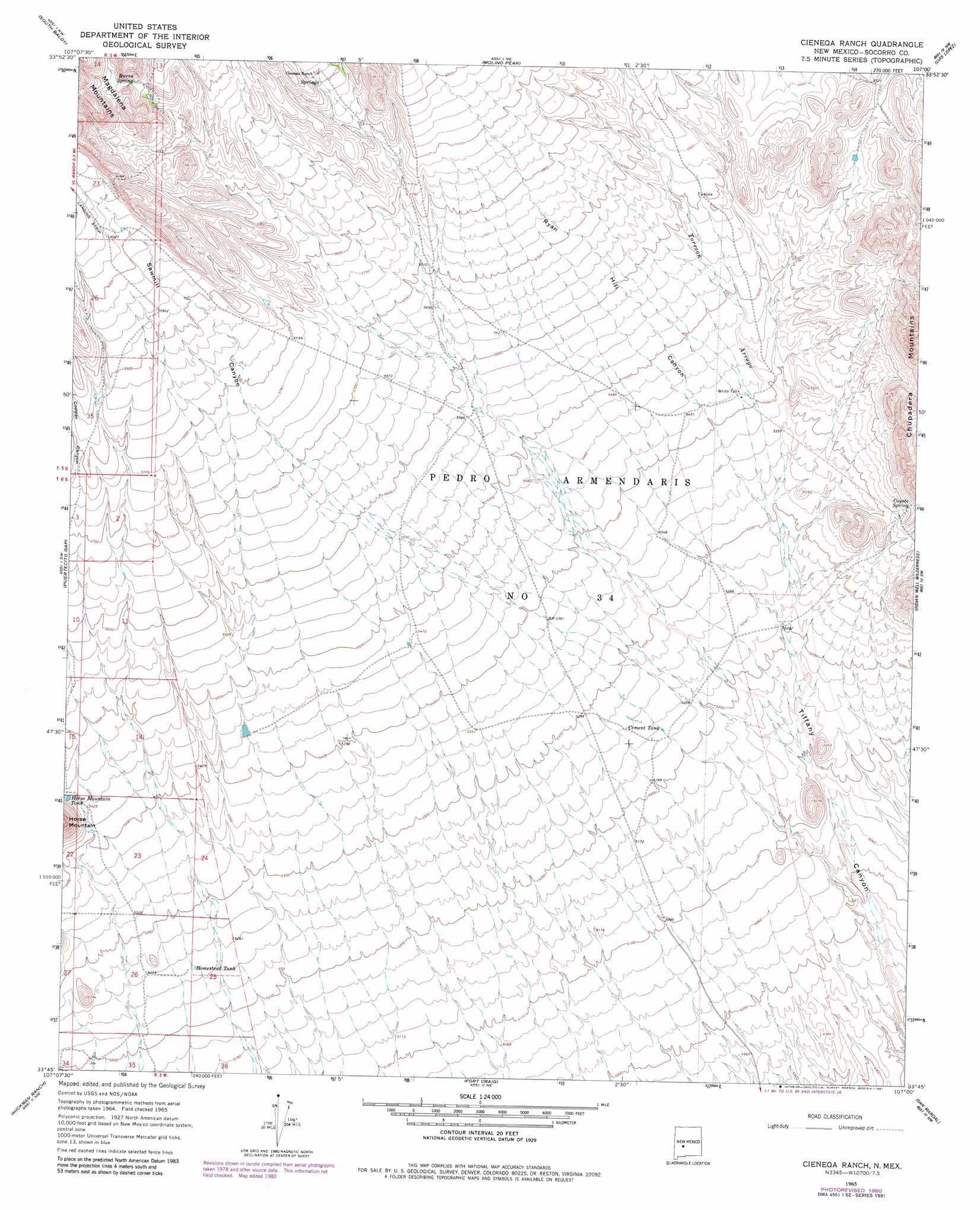
USGS Topo Quad 33107g1 - 1:24,000 scale
| Topo Map Name: | Cienega Ranch |
| USGS Topo Quad ID: | 33107g1 |
| Print Size: | ca. 21 1/4" wide x 27" high |
| Southeast Coordinates: | 33.75° N latitude / 107° W longitude |
| Map Center Coordinates: | 33.8125° N latitude / 107.0625° W longitude |
| U.S. State: | NM |
| Filename: | o33107g1.jpg |
| Download Map JPG Image: | Cienega Ranch topo map 1:24,000 scale |
| Map Type: | Topographic |
| Topo Series: | 7.5´ |
| Map Scale: | 1:24,000 |
| Source of Map Images: | United States Geological Survey (USGS) |
| Alternate Map Versions: |
Cienega Ranch NM 1965, updated 1968 Download PDF Buy paper map Cienega Ranch NM 1965, updated 1981 Download PDF Buy paper map Cienega Ranch NM 2010 Download PDF Buy paper map Cienega Ranch NM 2013 Download PDF Buy paper map Cienega Ranch NM 2017 Download PDF Buy paper map |
| FStopo: | US Forest Service topo Cienega Ranch is available: Download FStopo PDF Download FStopo TIF |
1:24,000 Topo Quads surrounding Cienega Ranch
Arroyo Landavaso |
Magdalena |
Water Canyon |
Socorro |
Loma De Las Canas |
Squaw Peak |
South Baldy |
Molino Peak |
Luis Lopez |
San Antonio |
Tenmile Hill |
Puertecito Gap |
Cienega Ranch |
Indian Well Wilderness |
San Antonio Se |
San Juan Peak |
Hickman Ranch |
Fort Craig |
San Marcial |
Little San Pasqual Mountain |
Steel Hill |
Black Hill |
Paraje Well |
Pope |
Harriet Ranch |
> Back to 33107e1 at 1:100,000 scale
> Back to 33106a1 at 1:250,000 scale
> Back to U.S. Topo Maps home
Cienega Ranch topo map: Gazetteer
Cienega Ranch: Arroyos
Torreon Arroyo elevation 1610m 5282′Cienega Ranch: Reservoirs
Cement Tank elevation 1595m 5232′Homestead Tank elevation 1602m 5255′
Horse Mountain Tank elevation 1662m 5452′
White Tank elevation 1650m 5413′
Cienega Ranch: Springs
Burro Spring elevation 1867m 6125′Coyote Spring elevation 1683m 5521′
Cienega Ranch: Valleys
Copper Canyon elevation 1634m 5360′Ryan Hill Canyon elevation 1609m 5278′
Sawmill Canyon elevation 1553m 5095′
Cienega Ranch digital topo map on disk
Buy this Cienega Ranch topo map showing relief, roads, GPS coordinates and other geographical features, as a high-resolution digital map file on DVD: