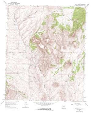
Squaw Peak Topo Map New Mexico
To zoom in, hover over the map of Squaw Peak
USGS Topo Quad 33107h3 - 1:24,000 scale
| Topo Map Name: | Squaw Peak |
| USGS Topo Quad ID: | 33107h3 |
| Print Size: | ca. 21 1/4" wide x 27" high |
| Southeast Coordinates: | 33.875° N latitude / 107.25° W longitude |
| Map Center Coordinates: | 33.9375° N latitude / 107.3125° W longitude |
| U.S. State: | NM |
| Filename: | o33107h3.jpg |
| Download Map JPG Image: | Squaw Peak topo map 1:24,000 scale |
| Map Type: | Topographic |
| Topo Series: | 7.5´ |
| Map Scale: | 1:24,000 |
| Source of Map Images: | United States Geological Survey (USGS) |
| Alternate Map Versions: |
Squaw Peak NM 1965, updated 1968 Download PDF Buy paper map Squaw Peak NM 1995, updated 1998 Download PDF Buy paper map Squaw Peak NM 2011 Download PDF Buy paper map Squaw Peak NM 2013 Download PDF Buy paper map Squaw Peak NM 2017 Download PDF Buy paper map |
| FStopo: | US Forest Service topo Squaw Peak is available: Download FStopo PDF Download FStopo TIF |
1:24,000 Topo Quads surrounding Squaw Peak
> Back to 33107e1 at 1:100,000 scale
> Back to 33106a1 at 1:250,000 scale
> Back to U.S. Topo Maps home
Squaw Peak topo map: Gazetteer
Squaw Peak: Reservoirs
Barnet Tank elevation 2128m 6981′McDaniel Tank elevation 2176m 7139′
Rock Header Tank elevation 2121m 6958′
Stallings Tank elevation 2102m 6896′
Squaw Peak: Springs
Alameda Spring elevation 1970m 6463′Squaw Peak: Summits
Squaw Peak elevation 2240m 7349′Squaw Peak: Valleys
Bear Canyon elevation 1882m 6174′Chavez Canyon elevation 1965m 6446′
Estaline Canyon elevation 1975m 6479′
Mill Canyon elevation 1946m 6384′
Rock Springs Canyon elevation 2004m 6574′
Squaw Peak: Wells
Gap Well elevation 1989m 6525′Squaw Peak digital topo map on disk
Buy this Squaw Peak topo map showing relief, roads, GPS coordinates and other geographical features, as a high-resolution digital map file on DVD:


