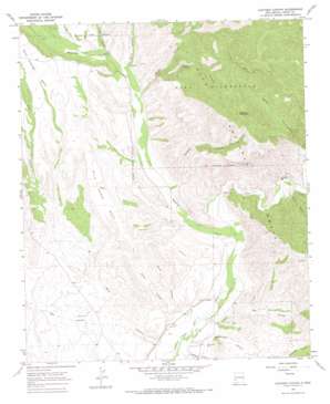
Canteen Canyon Topo Map New Mexico
To zoom in, hover over the map of Canteen Canyon
USGS Topo Quad 33108a5 - 1:24,000 scale
| Topo Map Name: | Canteen Canyon |
| USGS Topo Quad ID: | 33108a5 |
| Print Size: | ca. 21 1/4" wide x 27" high |
| Southeast Coordinates: | 33° N latitude / 108.5° W longitude |
| Map Center Coordinates: | 33.0625° N latitude / 108.5625° W longitude |
| U.S. State: | NM |
| Filename: | o33108a5.jpg |
| Download Map JPG Image: | Canteen Canyon topo map 1:24,000 scale |
| Map Type: | Topographic |
| Topo Series: | 7.5´ |
| Map Scale: | 1:24,000 |
| Source of Map Images: | United States Geological Survey (USGS) |
| Alternate Map Versions: |
Canteen Canyon NM 1965, updated 1969 Download PDF Buy paper map Canteen Canyon NM 1965, updated 1970 Download PDF Buy paper map Canteen Canyon NM 1999, updated 2002 Download PDF Buy paper map Canteen Canyon NM 2011 Download PDF Buy paper map Canteen Canyon NM 2013 Download PDF Buy paper map Canteen Canyon NM 2017 Download PDF Buy paper map |
| FStopo: | US Forest Service topo Canteen Canyon is available: Download FStopo PDF Download FStopo TIF |
1:24,000 Topo Quads surrounding Canteen Canyon
> Back to 33108a1 at 1:100,000 scale
> Back to 33108a1 at 1:250,000 scale
> Back to U.S. Topo Maps home
Canteen Canyon topo map: Gazetteer
Canteen Canyon: Benches
Wild Horse Mesa elevation 1585m 5200′Canteen Canyon: Dams
Clark Canyon Dam elevation 1466m 4809′Upper Gila Site Number 10 Dam elevation 1415m 4642′
Upper Gila Site Number 11 Dam elevation 1428m 4685′
Upper Gila Site Number Eight Dam elevation 1422m 4665′
Upper Gila Site Number Nine Dam elevation 1420m 4658′
Upper Gila Site Number Seven Dam elevation 1415m 4642′
Upper Gila Site Number Six Dam elevation 1449m 4753′
Canteen Canyon: Mines
Cedar Hill Prospect elevation 1465m 4806′Victoria Mine elevation 1488m 4881′
Canteen Canyon: Springs
Cherry Spring elevation 1955m 6414′Juniper Spring elevation 1970m 6463′
Canteen Canyon: Streams
Mogollon Creek elevation 1412m 4632′Canteen Canyon: Summits
Watson Mountain elevation 2265m 7431′Canteen Canyon: Valleys
Brock Canyon elevation 1447m 4747′Brushy Canyon elevation 1448m 4750′
Canteen Canyon elevation 1456m 4776′
Davis Canyon elevation 1508m 4947′
Doyle Canyon elevation 1408m 4619′
Fall Canyon elevation 1524m 5000′
Guerrero Canyon elevation 1395m 4576′
Indian Canyon elevation 1584m 5196′
Maldonado Canyon elevation 1396m 4580′
Miller Canyon elevation 1395m 4576′
Rough Canyon elevation 1499m 4917′
Spar Canyon elevation 1414m 4639′
Canteen Canyon digital topo map on disk
Buy this Canteen Canyon topo map showing relief, roads, GPS coordinates and other geographical features, as a high-resolution digital map file on DVD:


