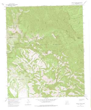
Shelley Peak Topo Map New Mexico
To zoom in, hover over the map of Shelley Peak
USGS Topo Quad 33108b5 - 1:24,000 scale
| Topo Map Name: | Shelley Peak |
| USGS Topo Quad ID: | 33108b5 |
| Print Size: | ca. 21 1/4" wide x 27" high |
| Southeast Coordinates: | 33.125° N latitude / 108.5° W longitude |
| Map Center Coordinates: | 33.1875° N latitude / 108.5625° W longitude |
| U.S. State: | NM |
| Filename: | o33108b5.jpg |
| Download Map JPG Image: | Shelley Peak topo map 1:24,000 scale |
| Map Type: | Topographic |
| Topo Series: | 7.5´ |
| Map Scale: | 1:24,000 |
| Source of Map Images: | United States Geological Survey (USGS) |
| Alternate Map Versions: |
Shelley Peak NM 1965, updated 1969 Download PDF Buy paper map Shelley Peak NM 1965, updated 1975 Download PDF Buy paper map Shelley Peak NM 1999, updated 2002 Download PDF Buy paper map Shelley Peak NM 2011 Download PDF Buy paper map Shelley Peak NM 2013 Download PDF Buy paper map Shelley Peak NM 2017 Download PDF Buy paper map |
| FStopo: | US Forest Service topo Shelley Peak is available: Download FStopo PDF Download FStopo TIF |
1:24,000 Topo Quads surrounding Shelley Peak
> Back to 33108a1 at 1:100,000 scale
> Back to 33108a1 at 1:250,000 scale
> Back to U.S. Topo Maps home
Shelley Peak topo map: Gazetteer
Shelley Peak: Basins
Buds Hole elevation 1828m 5997′Shelley Peak: Mines
Seventy Four Mountain Prospect elevation 2169m 7116′Shelley Peak: Ranges
Mogollon Mountains elevation 2589m 8494′Shelley Peak: Reservoirs
Deadman Tank elevation 1917m 6289′Seventyfour Mountain Tank elevation 2093m 6866′
Shelley Peak: Streams
South Fork Mogollow Creek elevation 1991m 6532′West Fork Mogollon Creek elevation 1793m 5882′
Shelley Peak: Summits
Lookout Mountain elevation 2561m 8402′Shelley Peak elevation 2649m 8690′
Shelley Peak: Trails
Lookout Canyon Trail elevation 2654m 8707′Mogollon Creek Trail elevation 1902m 6240′
West Fork Trail elevation 1937m 6354′
Shelley Peak: Valleys
Corral Canyon elevation 2094m 6870′Deadman Canyon elevation 1658m 5439′
Gobbler Canyon elevation 1926m 6318′
Judy Canyon elevation 1976m 6482′
Lookout Canyon elevation 1839m 6033′
Tepee Canyon elevation 1888m 6194′
Trail Canyon elevation 2047m 6715′
Turnbo Canyon elevation 2158m 7080′
Woodrow Canyon elevation 2155m 7070′
Shelley Peak digital topo map on disk
Buy this Shelley Peak topo map showing relief, roads, GPS coordinates and other geographical features, as a high-resolution digital map file on DVD:


