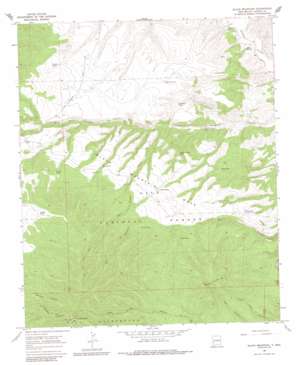
Black Mountain Topo Map New Mexico
To zoom in, hover over the map of Black Mountain
USGS Topo Quad 33108d2 - 1:24,000 scale
| Topo Map Name: | Black Mountain |
| USGS Topo Quad ID: | 33108d2 |
| Print Size: | ca. 21 1/4" wide x 27" high |
| Southeast Coordinates: | 33.375° N latitude / 108.125° W longitude |
| Map Center Coordinates: | 33.4375° N latitude / 108.1875° W longitude |
| U.S. State: | NM |
| Filename: | o33108d2.jpg |
| Download Map JPG Image: | Black Mountain topo map 1:24,000 scale |
| Map Type: | Topographic |
| Topo Series: | 7.5´ |
| Map Scale: | 1:24,000 |
| Source of Map Images: | United States Geological Survey (USGS) |
| Alternate Map Versions: |
Black Mountain NM 1967, updated 1986 Download PDF Buy paper map Black Mountain NM 2011 Download PDF Buy paper map Black Mountain NM 2013 Download PDF Buy paper map Black Mountain NM 2017 Download PDF Buy paper map |
| FStopo: | US Forest Service topo Black Mountain is available: Download FStopo PDF Download FStopo TIF |
1:24,000 Topo Quads surrounding Black Mountain
> Back to 33108a1 at 1:100,000 scale
> Back to 33108a1 at 1:250,000 scale
> Back to U.S. Topo Maps home
Black Mountain topo map: Gazetteer
Black Mountain: Airports
Beaverhead Airstrip elevation 2231m 7319′Black Mountain: Benches
Black Mountain Mesa elevation 2337m 7667′Black Mountain: Reservoirs
Armijo Tank elevation 2379m 7805′Buckhorn Tank elevation 2224m 7296′
Double Header Tank elevation 2209m 7247′
Elmo Tank elevation 2196m 7204′
Gap Tank elevation 2325m 7627′
Jordan Tank elevation 2396m 7860′
Lucero Tank elevation 2263m 7424′
Mesa Tank elevation 2322m 7618′
Perdido Tank elevation 2320m 7611′
Ranger Tank elevation 2457m 8061′
Reeds Tank elevation 2312m 7585′
Trail Tank elevation 2310m 7578′
Trap Corral Tank elevation 2406m 7893′
White Tank elevation 2187m 7175′
Black Mountain: Springs
Black Spring elevation 2116m 6942′Black Mountain: Summits
Beaver Points elevation 2425m 7956′Black Mountain elevation 2830m 9284′
Black Mountain: Valleys
Cooney Canyon elevation 2233m 7326′Wolf Hollow Canyon elevation 2166m 7106′
Black Mountain: Wells
Houghton Water Well elevation 2133m 6998′Black Mountain digital topo map on disk
Buy this Black Mountain topo map showing relief, roads, GPS coordinates and other geographical features, as a high-resolution digital map file on DVD:


