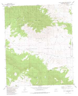
O Bar O Canyon West Topo Map New Mexico
To zoom in, hover over the map of O Bar O Canyon West
USGS Topo Quad 33108e3 - 1:24,000 scale
| Topo Map Name: | O Bar O Canyon West |
| USGS Topo Quad ID: | 33108e3 |
| Print Size: | ca. 21 1/4" wide x 27" high |
| Southeast Coordinates: | 33.5° N latitude / 108.25° W longitude |
| Map Center Coordinates: | 33.5625° N latitude / 108.3125° W longitude |
| U.S. State: | NM |
| Filename: | o33108e3.jpg |
| Download Map JPG Image: | O Bar O Canyon West topo map 1:24,000 scale |
| Map Type: | Topographic |
| Topo Series: | 7.5´ |
| Map Scale: | 1:24,000 |
| Source of Map Images: | United States Geological Survey (USGS) |
| Alternate Map Versions: |
O Bar O Canyon West NM 1981, updated 1981 Download PDF Buy paper map O Bar O Canyon West NM 1999, updated 2002 Download PDF Buy paper map O Bar O Canyon West NM 2011 Download PDF Buy paper map O Bar O Canyon West NM 2013 Download PDF Buy paper map O Bar O Canyon West NM 2017 Download PDF Buy paper map |
| FStopo: | US Forest Service topo O Bar O Canyon West is available: Download FStopo PDF Download FStopo TIF |
1:24,000 Topo Quads surrounding O Bar O Canyon West
> Back to 33108e1 at 1:100,000 scale
> Back to 33108a1 at 1:250,000 scale
> Back to U.S. Topo Maps home
O Bar O Canyon West topo map: Gazetteer
O Bar O Canyon West: Reservoirs
Brushy Tank elevation 2245m 7365′Burl Tank elevation 2560m 8398′
Deer Tank elevation 2315m 7595′
Divide Tank elevation 2449m 8034′
Government Tank elevation 2366m 7762′
Horse Camp Tank elevation 2284m 7493′
J J Pit Tank elevation 2560m 8398′
Jamie Tank elevation 2376m 7795′
Jiggs Tank elevation 2366m 7762′
Kimo Tank elevation 2452m 8044′
Mesa Redonda Tank elevation 2628m 8622′
Middle Elk Tank elevation 2610m 8562′
North Tank elevation 2534m 8313′
O Bar O Mountain Tank elevation 2493m 8179′
O Bar O Tank elevation 2318m 7604′
Reliable Tank elevation 2320m 7611′
Sheep Tank elevation 2268m 7440′
Water Well Tank elevation 2228m 7309′
O Bar O Canyon West: Springs
Mesa Redonda Spring elevation 2653m 8704′O Bar O Canyon West: Summits
O Bar O Mountain elevation 2846m 9337′O Bar O Canyon West: Trails
Continental Divide National Scenic Trail elevation 2526m 8287′O Bar O Canyon West: Valleys
Mesa Redonda Canyon elevation 2232m 7322′O Bar O Canyon West digital topo map on disk
Buy this O Bar O Canyon West topo map showing relief, roads, GPS coordinates and other geographical features, as a high-resolution digital map file on DVD:


