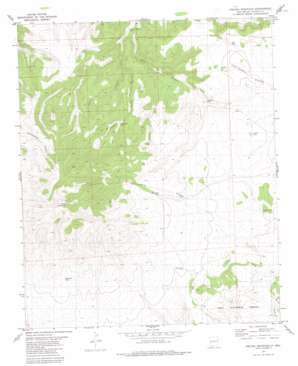
Pelona Mountain Topo Map New Mexico
To zoom in, hover over the map of Pelona Mountain
USGS Topo Quad 33108f1 - 1:24,000 scale
| Topo Map Name: | Pelona Mountain |
| USGS Topo Quad ID: | 33108f1 |
| Print Size: | ca. 21 1/4" wide x 27" high |
| Southeast Coordinates: | 33.625° N latitude / 108° W longitude |
| Map Center Coordinates: | 33.6875° N latitude / 108.0625° W longitude |
| U.S. State: | NM |
| Filename: | o33108f1.jpg |
| Download Map JPG Image: | Pelona Mountain topo map 1:24,000 scale |
| Map Type: | Topographic |
| Topo Series: | 7.5´ |
| Map Scale: | 1:24,000 |
| Source of Map Images: | United States Geological Survey (USGS) |
| Alternate Map Versions: |
Pelona Mountain NM 1981, updated 1981 Download PDF Buy paper map Pelona Mountain NM 1999, updated 2002 Download PDF Buy paper map Pelona Mountain NM 2011 Download PDF Buy paper map Pelona Mountain NM 2013 Download PDF Buy paper map Pelona Mountain NM 2017 Download PDF Buy paper map |
| FStopo: | US Forest Service topo Pelona Mountain is available: Download FStopo PDF Download FStopo TIF |
1:24,000 Topo Quads surrounding Pelona Mountain
> Back to 33108e1 at 1:100,000 scale
> Back to 33108a1 at 1:250,000 scale
> Back to U.S. Topo Maps home
Pelona Mountain topo map: Gazetteer
Pelona Mountain: Arroyos
Bear Track Canyon elevation 2405m 7890′Rock Corral Canyon elevation 2513m 8244′
Shaw Canyon elevation 2272m 7454′
Pelona Mountain: Lakes
Prairie Lake elevation 2328m 7637′Pelona Mountain: Parks
Continental Divide Wilderness Study Area elevation 2794m 9166′Pelona Mountain: Reservoirs
Bear Track Tank elevation 2389m 7837′Boulevard Tank elevation 2439m 8001′
Cornelius Tank elevation 2320m 7611′
Fullerton Spring Tank elevation 2205m 7234′
Mountain Tank elevation 2474m 8116′
Red Tank elevation 2367m 7765′
Stallings Tank elevation 2299m 7542′
Pelona Mountain: Springs
Bruja Spring elevation 2406m 7893′Pelona Mountain: Summits
Pelona Mountain elevation 2794m 9166′Pelona Mountain: Valleys
Juanita Canyon elevation 2267m 7437′Pelona Mountain: Wells
Chimney Water Well elevation 2231m 7319′Pelona Well elevation 2384m 7821′
Pelona Mountain digital topo map on disk
Buy this Pelona Mountain topo map showing relief, roads, GPS coordinates and other geographical features, as a high-resolution digital map file on DVD:


