Horse Mountain East Topo Map New Mexico
To zoom in, hover over the map of Horse Mountain East
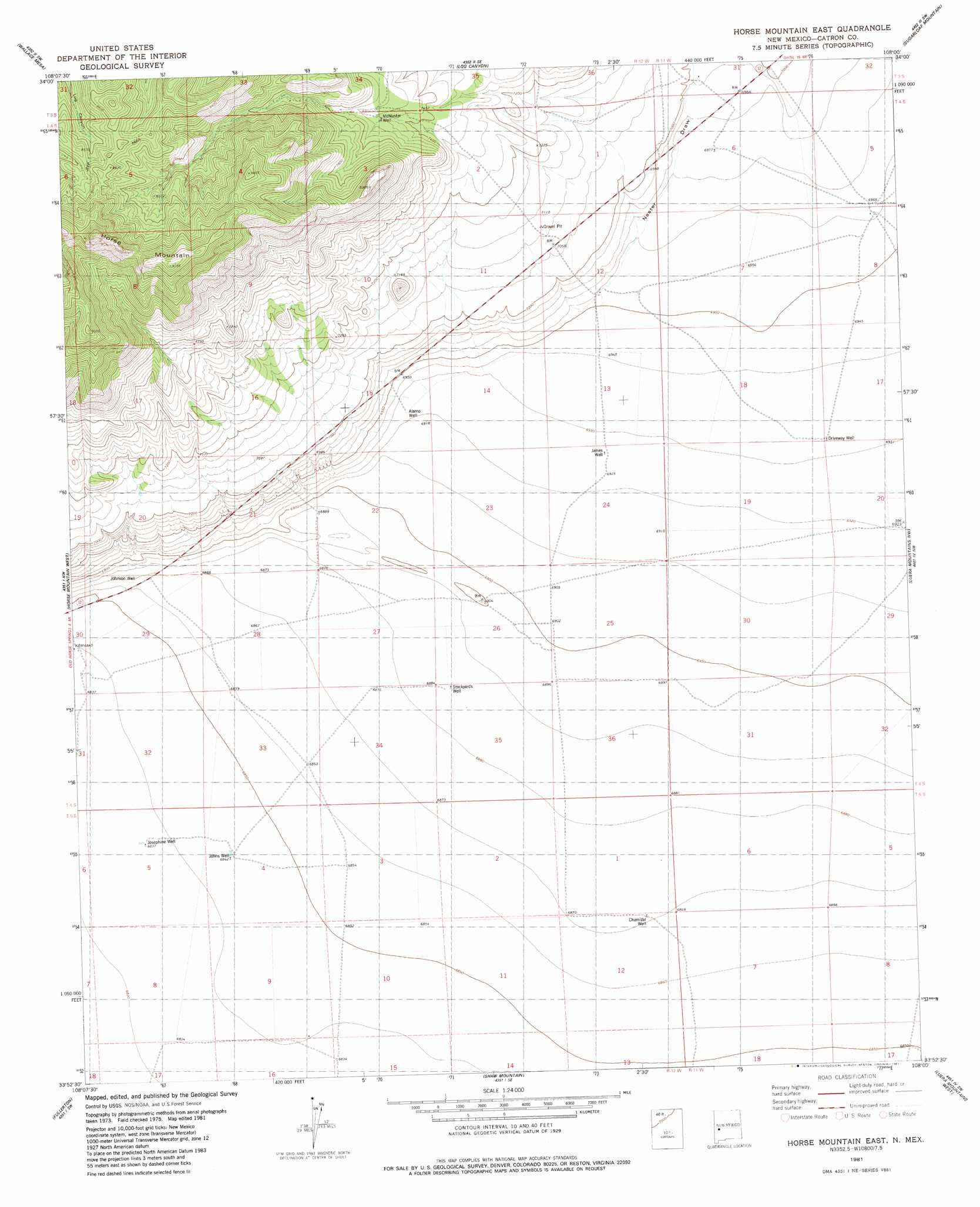
USGS Topo Quad 33108h1 - 1:24,000 scale
| Topo Map Name: | Horse Mountain East |
| USGS Topo Quad ID: | 33108h1 |
| Print Size: | ca. 21 1/4" wide x 27" high |
| Southeast Coordinates: | 33.875° N latitude / 108° W longitude |
| Map Center Coordinates: | 33.9375° N latitude / 108.0625° W longitude |
| U.S. State: | NM |
| Filename: | o33108h1.jpg |
| Download Map JPG Image: | Horse Mountain East topo map 1:24,000 scale |
| Map Type: | Topographic |
| Topo Series: | 7.5´ |
| Map Scale: | 1:24,000 |
| Source of Map Images: | United States Geological Survey (USGS) |
| Alternate Map Versions: |
Horse Mountain East NM 1981, updated 1981 Download PDF Buy paper map Horse Mountain East NM 2010 Download PDF Buy paper map Horse Mountain East NM 2013 Download PDF Buy paper map Horse Mountain East NM 2017 Download PDF Buy paper map |
1:24,000 Topo Quads surrounding Horse Mountain East
Mangas |
Alegres Mountain |
Cox Peak |
Crosby Springs |
Datil |
Mangas Mountain |
Wallace Mesa |
Log Canyon |
Sugarloaf Mountain |
Anderson Peak |
Bell Peak |
Horse Mountain West |
Horse Mountain East |
Luera Mountains Nw |
C-N Lake |
Rael Spring |
Fullerton |
Shaw Mountain |
Luera Mountains West |
Luera Mountains East |
Salvation Peak |
Rail Canyon |
Pelona Mountain |
Mojonera Canyon |
Paddys Hole |
> Back to 33108e1 at 1:100,000 scale
> Back to 33108a1 at 1:250,000 scale
> Back to U.S. Topo Maps home
Horse Mountain East topo map: Gazetteer
Horse Mountain East: Valleys
Nance Canyon elevation 2639m 8658′Nester Draw elevation 2122m 6961′
Horse Mountain East: Wells
Alamo Water Well elevation 2111m 6925′Chamizal Well elevation 2095m 6873′
Driveway Water Well elevation 2114m 6935′
James Water Well elevation 2112m 6929′
Johns Water Well elevation 2087m 6847′
Johnson Well elevation 2095m 6873′
Josephine Water Well elevation 2085m 6840′
McMaster Water Well elevation 2282m 7486′
Rock House Water Well elevation 2086m 6843′
Stockyards Water Well elevation 2099m 6886′
Windmill F Water Well elevation 2122m 6961′
Windmill G Water Well elevation 2120m 6955′
Horse Mountain East digital topo map on disk
Buy this Horse Mountain East topo map showing relief, roads, GPS coordinates and other geographical features, as a high-resolution digital map file on DVD: