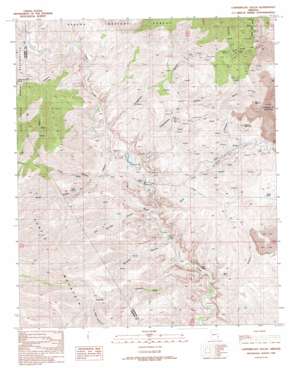
Copperplate Gulch Topo Map Arizona
To zoom in, hover over the map of Copperplate Gulch
USGS Topo Quad 33109a4 - 1:24,000 scale
| Topo Map Name: | Copperplate Gulch |
| USGS Topo Quad ID: | 33109a4 |
| Print Size: | ca. 21 1/4" wide x 27" high |
| Southeast Coordinates: | 33° N latitude / 109.375° W longitude |
| Map Center Coordinates: | 33.0625° N latitude / 109.4375° W longitude |
| U.S. State: | AZ |
| Filename: | o33109a4.jpg |
| Download Map JPG Image: | Copperplate Gulch topo map 1:24,000 scale |
| Map Type: | Topographic |
| Topo Series: | 7.5´ |
| Map Scale: | 1:24,000 |
| Source of Map Images: | United States Geological Survey (USGS) |
| Alternate Map Versions: |
Copperplate Gulch AZ 1989, updated 1990 Download PDF Buy paper map Copperplate Gulch AZ 1997, updated 2000 Download PDF Buy paper map Copperplate Gulch AZ 2011 Download PDF Buy paper map Copperplate Gulch AZ 2014 Download PDF Buy paper map |
| FStopo: | US Forest Service topo Copperplate Gulch is available: Download FStopo PDF Download FStopo TIF |
1:24,000 Topo Quads surrounding Copperplate Gulch
> Back to 33109a1 at 1:100,000 scale
> Back to 33108a1 at 1:250,000 scale
> Back to U.S. Topo Maps home
Copperplate Gulch topo map: Gazetteer
Copperplate Gulch: Basins
Silver Basin elevation 1409m 4622′Copperplate Gulch: Mines
Coronado Mine elevation 1737m 5698′Copperplate Gulch: Slopes
Coronado Incline elevation 1833m 6013′Copperplate Gulch: Springs
Garcia Spring elevation 1225m 4019′Hot Springs elevation 1154m 3786′
Poor Farm Spring elevation 1309m 4294′
Smith Spring elevation 1371m 4498′
Copperplate Gulch: Summits
Copper Mountain elevation 1600m 5249′Copperplate Gulch: Valleys
Bat Canyon elevation 1086m 3562′Bear Canyon elevation 1205m 3953′
Copperplate Gulch elevation 1131m 3710′
Coronado Gulch elevation 1539m 5049′
Gold Gulch elevation 1117m 3664′
Guswert Canyon elevation 1086m 3562′
Horseshoe Canyon elevation 1160m 3805′
Horseshoe Gulch elevation 1154m 3786′
Hot Springs Canyon elevation 1108m 3635′
La Jolla Canyon elevation 1412m 4632′
Pinkard Gulch elevation 1351m 4432′
Pinkhead Gulch elevation 1362m 4468′
Santa Rosa Gulch elevation 1556m 5104′
South Smith Canyon elevation 1129m 3704′
Stove Canyon elevation 1302m 4271′
Trujillo Canyon elevation 1090m 3576′
Copperplate Gulch digital topo map on disk
Buy this Copperplate Gulch topo map showing relief, roads, GPS coordinates and other geographical features, as a high-resolution digital map file on DVD:


