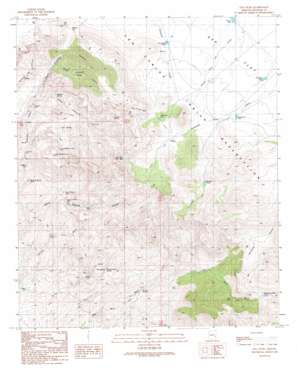
Gila Peak Topo Map Arizona
To zoom in, hover over the map of Gila Peak
USGS Topo Quad 33109b8 - 1:24,000 scale
| Topo Map Name: | Gila Peak |
| USGS Topo Quad ID: | 33109b8 |
| Print Size: | ca. 21 1/4" wide x 27" high |
| Southeast Coordinates: | 33.125° N latitude / 109.875° W longitude |
| Map Center Coordinates: | 33.1875° N latitude / 109.9375° W longitude |
| U.S. State: | AZ |
| Filename: | o33109b8.jpg |
| Download Map JPG Image: | Gila Peak topo map 1:24,000 scale |
| Map Type: | Topographic |
| Topo Series: | 7.5´ |
| Map Scale: | 1:24,000 |
| Source of Map Images: | United States Geological Survey (USGS) |
| Alternate Map Versions: |
Gila Peak AZ 1989, updated 1990 Download PDF Buy paper map Gila Peak AZ 2011 Download PDF Buy paper map Gila Peak AZ 2014 Download PDF Buy paper map |
1:24,000 Topo Quads surrounding Gila Peak
> Back to 33109a1 at 1:100,000 scale
> Back to 33108a1 at 1:250,000 scale
> Back to U.S. Topo Maps home
Gila Peak topo map: Gazetteer
Gila Peak: Dams
Burdette Dam elevation 1639m 5377′McKinney Dam elevation 1167m 3828′
Nine Mile Dam elevation 1573m 5160′
Seven Mile Dam elevation 1588m 5209′
Gila Peak: Gaps
Hooker Gap elevation 1605m 5265′Gila Peak: Reservoirs
Dutch Pasture Tank elevation 1246m 4087′Head-of-Day Mine Tanks elevation 1642m 5387′
Lower Fishhook Tank Number One elevation 1391m 4563′
Lower Fishhook Tank Number Two elevation 1488m 4881′
Mormon Spring Tank elevation 1219m 3999′
Ninemile Tank elevation 1573m 5160′
Pablano Tank elevation 1243m 4078′
Sevenmile Tank elevation 0m 0′
Gila Peak: Springs
Coyote Spring elevation 1592m 5223′Fishhook Springs elevation 1307m 4288′
Natural Corral Spring elevation 1218m 3996′
Tom Spring elevation 1230m 4035′
Gila Peak: Streams
Porter Wash elevation 1255m 4117′Gila Peak: Summits
Gila Peak elevation 2010m 6594′Gila Peak: Valleys
Hole in the Wall elevation 1681m 5515′Lower Fishhook Canyon elevation 1288m 4225′
Middle Fishhook Canyon elevation 1431m 4694′
Upper Fishhook Canyon elevation 1288m 4225′
Gila Peak: Wells
Dutch Pasture Well elevation 1264m 4146′Fishhook Well elevation 1252m 4107′
Gila Peak digital topo map on disk
Buy this Gila Peak topo map showing relief, roads, GPS coordinates and other geographical features, as a high-resolution digital map file on DVD:


