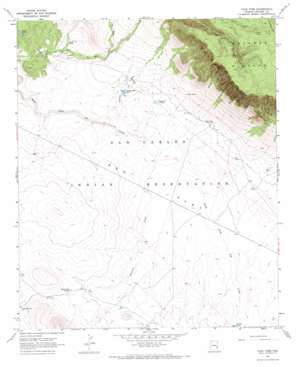
Tule Tubs Topo Map Arizona
To zoom in, hover over the map of Tule Tubs
USGS Topo Quad 33109c8 - 1:24,000 scale
| Topo Map Name: | Tule Tubs |
| USGS Topo Quad ID: | 33109c8 |
| Print Size: | ca. 21 1/4" wide x 27" high |
| Southeast Coordinates: | 33.25° N latitude / 109.875° W longitude |
| Map Center Coordinates: | 33.3125° N latitude / 109.9375° W longitude |
| U.S. State: | AZ |
| Filename: | o33109c8.jpg |
| Download Map JPG Image: | Tule Tubs topo map 1:24,000 scale |
| Map Type: | Topographic |
| Topo Series: | 7.5´ |
| Map Scale: | 1:24,000 |
| Source of Map Images: | United States Geological Survey (USGS) |
| Alternate Map Versions: |
Tule Tubs AZ 1967, updated 1971 Download PDF Buy paper map Tule Tubs AZ 2011 Download PDF Buy paper map Tule Tubs AZ 2014 Download PDF Buy paper map |
1:24,000 Topo Quads surrounding Tule Tubs
> Back to 33109a1 at 1:100,000 scale
> Back to 33108a1 at 1:250,000 scale
> Back to U.S. Topo Maps home
Tule Tubs topo map: Gazetteer
Tule Tubs: Dams
7-B Dam elevation 1523m 4996′Twin Tanks Dam elevation 1565m 5134′
Yellow Jacket Dam elevation 1586m 5203′
Tule Tubs: Flats
Ash Flat elevation 1540m 5052′Tule Tubs: Reservoirs
Arsenic Tank elevation 1550m 5085′Hooker Gap Charco elevation 1559m 5114′
Pasture Five Charco elevation 1550m 5085′
Rodeo Tank elevation 1492m 4895′
S and E Tank elevation 0m 0′
Soldier Hole Tank elevation 1544m 5065′
Tule Tank elevation 1580m 5183′
Tule Tubs: Springs
Tule Springs elevation 1788m 5866′Tule Tubs: Streams
Little Rocky Creek elevation 1550m 5085′Ninemile Creek elevation 1533m 5029′
Tule Tubs: Wells
Hooker Gap Well elevation 1589m 5213′Sunrise Well elevation 1510m 4954′
Tule Tubs digital topo map on disk
Buy this Tule Tubs topo map showing relief, roads, GPS coordinates and other geographical features, as a high-resolution digital map file on DVD:


