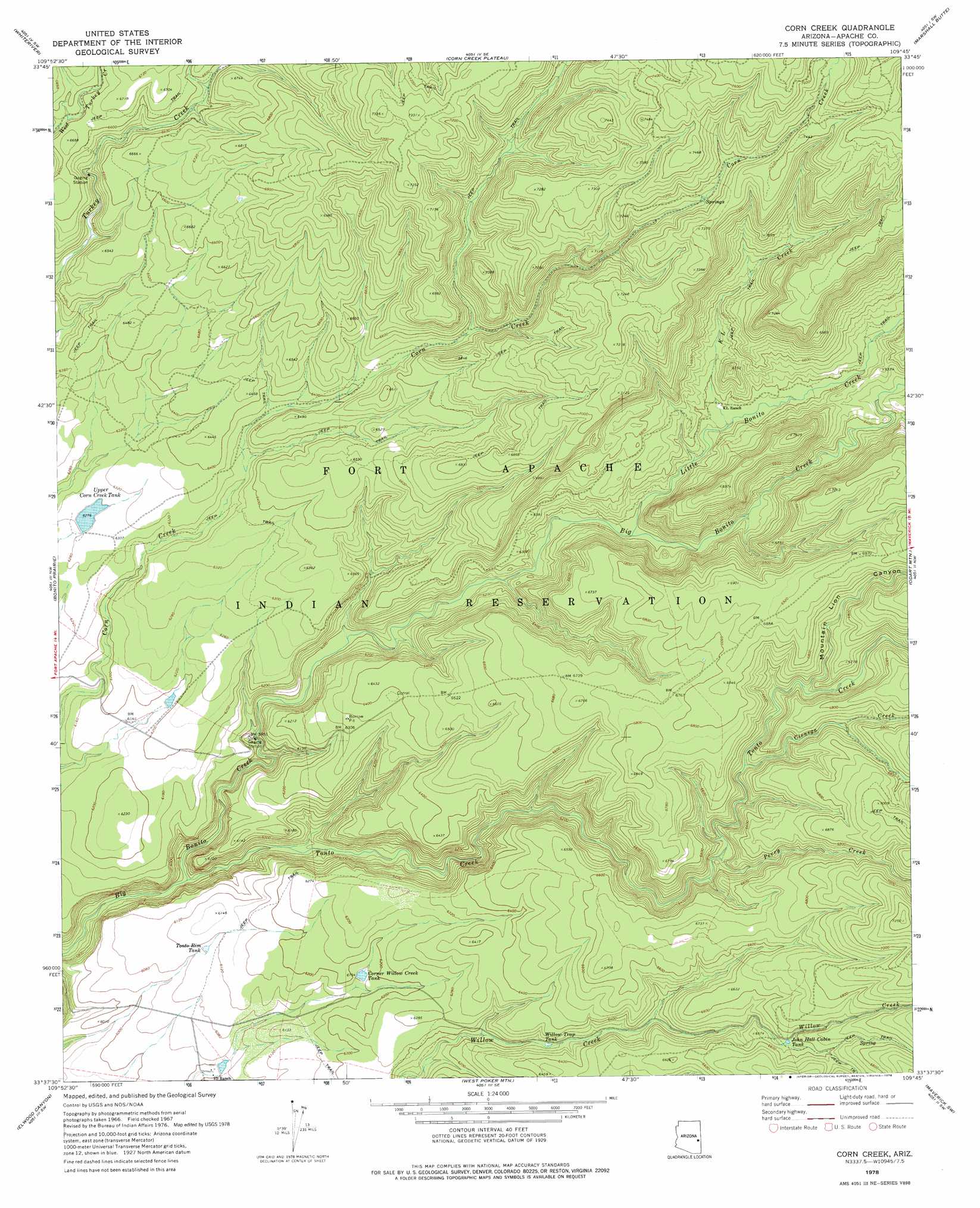
Corn Creek Topo Map Arizona
To zoom in, hover over the map of Corn Creek
USGS Topo Quad 33109f7 - 1:24,000 scale
| Topo Map Name: | Corn Creek |
| USGS Topo Quad ID: | 33109f7 |
| Print Size: | ca. 21 1/4" wide x 27" high |
| Southeast Coordinates: | 33.625° N latitude / 109.75° W longitude |
| Map Center Coordinates: | 33.6875° N latitude / 109.8125° W longitude |
| U.S. State: | AZ |
| Filename: | o33109f7.jpg |
| Download Map JPG Image: | Corn Creek topo map 1:24,000 scale |
| Map Type: | Topographic |
| Topo Series: | 7.5´ |
| Map Scale: | 1:24,000 |
| Source of Map Images: | United States Geological Survey (USGS) |
| Alternate Map Versions: |
Corn Creek AZ 1967, updated 1970 Download PDF Buy paper map Corn Creek AZ 1978, updated 1978 Download PDF Buy paper map Corn Creek AZ 2011 Download PDF Buy paper map Corn Creek AZ 2014 Download PDF Buy paper map |
1:24,000 Topo Quads surrounding Corn Creek
Round Top Mountain |
Alchesay Flat |
Hawley Lake West |
Hawley Lake East |
Mount Baldy |
Canyon Day |
Whiteriver |
Corn Creek Plateau |
Marshall Butte |
Bonito Rock |
Velasquez Butte |
Bonito Prairie |
Corn Creek |
Odart Mountain |
Maverick |
Georges Butte |
Elwood Canyon |
West Poker Mountain |
Maverick Sw |
Freezeout Mountain |
Ash Creek Ne |
Natanes Mountains Nw |
Natanes Mountains Ne |
Sawbuck Mountain |
Willow Mountain |
> Back to 33109e1 at 1:100,000 scale
> Back to 33108a1 at 1:250,000 scale
> Back to U.S. Topo Maps home
Corn Creek topo map: Gazetteer
Corn Creek: Reservoirs
Corner Willow Creek Tank elevation 1875m 6151′I D Tank elevation 1834m 6017′
John Hall Cabin Tank elevation 1998m 6555′
Tonto Rim Tank elevation 1864m 6115′
Upper Corn Creek Tank elevation 1914m 6279′
Willow Trap Tank elevation 1898m 6227′
Corn Creek: Streams
Cienega Creek elevation 1963m 6440′K L Creek elevation 1927m 6322′
Little Bonito Creek elevation 1890m 6200′
Perry Creek elevation 1925m 6315′
Tonto Creek elevation 1752m 5748′
Corn Creek: Valleys
Mountain Lion Canyon elevation 1983m 6505′Corn Creek digital topo map on disk
Buy this Corn Creek topo map showing relief, roads, GPS coordinates and other geographical features, as a high-resolution digital map file on DVD: