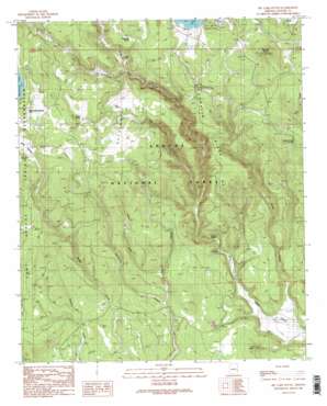
Big Lake South Topo Map Arizona
To zoom in, hover over the map of Big Lake South
USGS Topo Quad 33109g4 - 1:24,000 scale
| Topo Map Name: | Big Lake South |
| USGS Topo Quad ID: | 33109g4 |
| Print Size: | ca. 21 1/4" wide x 27" high |
| Southeast Coordinates: | 33.75° N latitude / 109.375° W longitude |
| Map Center Coordinates: | 33.8125° N latitude / 109.4375° W longitude |
| U.S. State: | AZ |
| Filename: | o33109g4.jpg |
| Download Map JPG Image: | Big Lake South topo map 1:24,000 scale |
| Map Type: | Topographic |
| Topo Series: | 7.5´ |
| Map Scale: | 1:24,000 |
| Source of Map Images: | United States Geological Survey (USGS) |
| Alternate Map Versions: |
Big Lake South AZ 1991, updated 1991 Download PDF Buy paper map Big Lake South AZ 1991, updated 1991 Download PDF Buy paper map Big Lake South AZ 1997, updated 2000 Download PDF Buy paper map Big Lake South AZ 2011 Download PDF Buy paper map Big Lake South AZ 2014 Download PDF Buy paper map |
| FStopo: | US Forest Service topo Big Lake South is available: Download FStopo PDF Download FStopo TIF |
1:24,000 Topo Quads surrounding Big Lake South
> Back to 33109e1 at 1:100,000 scale
> Back to 33108a1 at 1:250,000 scale
> Back to U.S. Topo Maps home
Big Lake South topo map: Gazetteer
Big Lake South: Flats
Haygrounds elevation 2695m 8841′Big Lake South: Reservoirs
285 Tank elevation 2669m 8756′Black Tank elevation 2681m 8795′
Boggy Pit Tank elevation 2665m 8743′
Boggy Tank elevation 2590m 8497′
Center Fire Tank elevation 2524m 8280′
Center Tank elevation 2714m 8904′
Center Tank elevation 2493m 8179′
Cienega Fourteen Tank elevation 2707m 8881′
Conklin Tank elevation 2566m 8418′
Deer Tank elevation 2597m 8520′
Dry Tank elevation 2425m 7956′
Duck Lake elevation 2760m 9055′
Duck Lake Tank elevation 2761m 9058′
East Draw Tank elevation 2528m 8293′
Fence Pit Tank elevation 2738m 8982′
Fork Tank elevation 2513m 8244′
Hall Tank elevation 2701m 8861′
Hay Creek Tank elevation 2668m 8753′
Hayground Tank elevation 2676m 8779′
Hayground Tank Number One elevation 2658m 8720′
Home Creek Tank elevation 2433m 7982′
House Tank elevation 2672m 8766′
Lagoon Tank elevation 2700m 8858′
Larry Flat Tank elevation 2646m 8681′
Lou Tank elevation 2628m 8622′
Lower Hayground Tank elevation 2614m 8576′
Merv Tank elevation 2695m 8841′
Neck Tank elevation 2717m 8914′
Railroad Loop Tank elevation 2696m 8845′
Redondo Tank elevation 2719m 8920′
Reservation Tank elevation 2714m 8904′
Reservoir Tank elevation 2754m 9035′
Resspass Tank elevation 2342m 7683′
Section 26 Tank elevation 2576m 8451′
Section 30 Tank elevation 2504m 8215′
Section Eleven Tank elevation 2724m 8937′
Section Fourteen Tank elevation 2726m 8943′
Section Sixteen Tank elevation 2694m 8838′
Section Ten Tank elevation 2762m 9061′
Section Thirteen Tank elevation 2688m 8818′
Section Twenty-Eight Tank elevation 2421m 7942′
Skin Spring Tank elevation 2682m 8799′
Slade Tank elevation 2755m 9038′
Slide Draw Tank elevation 2706m 8877′
South Tank elevation 2432m 7979′
Turkey Tank elevation 2622m 8602′
Upper Conklin Tank elevation 2573m 8441′
Upper Horse Tank Number One elevation 2657m 8717′
Upper Horse Tank Number Two elevation 2640m 8661′
Yes Tank elevation 2727m 8946′
Big Lake South: Ridges
Conklin Ridge elevation 2670m 8759′Big Lake South: Springs
Colonel Spring elevation 2368m 7769′Conklin Spring elevation 2683m 8802′
Deadman Spring elevation 2724m 8937′
Fir Spring elevation 2766m 9074′
Homestead Spring elevation 2749m 9019′
Indian Spring elevation 2649m 8690′
Lost Spring elevation 2586m 8484′
Middle Prong Spring elevation 2588m 8490′
Must Spring elevation 2760m 9055′
OK Spring elevation 2667m 8750′
Old Spring elevation 2544m 8346′
PN Spring elevation 2731m 8959′
Rail Spring elevation 2689m 8822′
Skin Spring Tank elevation 2686m 8812′
Slade Spring elevation 2717m 8914′
Spillman Spring elevation 2760m 9055′
Big Lake South: Streams
Hay Creek elevation 2399m 7870′Home Creek elevation 2310m 7578′
Big Lake South: Summits
Big Lake Knoll elevation 2862m 9389′P S Knoll elevation 2453m 8047′
Big Lake South: Valleys
Blow Draw elevation 2399m 7870′East Draw elevation 2368m 7769′
Big Lake South digital topo map on disk
Buy this Big Lake South topo map showing relief, roads, GPS coordinates and other geographical features, as a high-resolution digital map file on DVD:


