Bonito Rock Topo Map Arizona
To zoom in, hover over the map of Bonito Rock
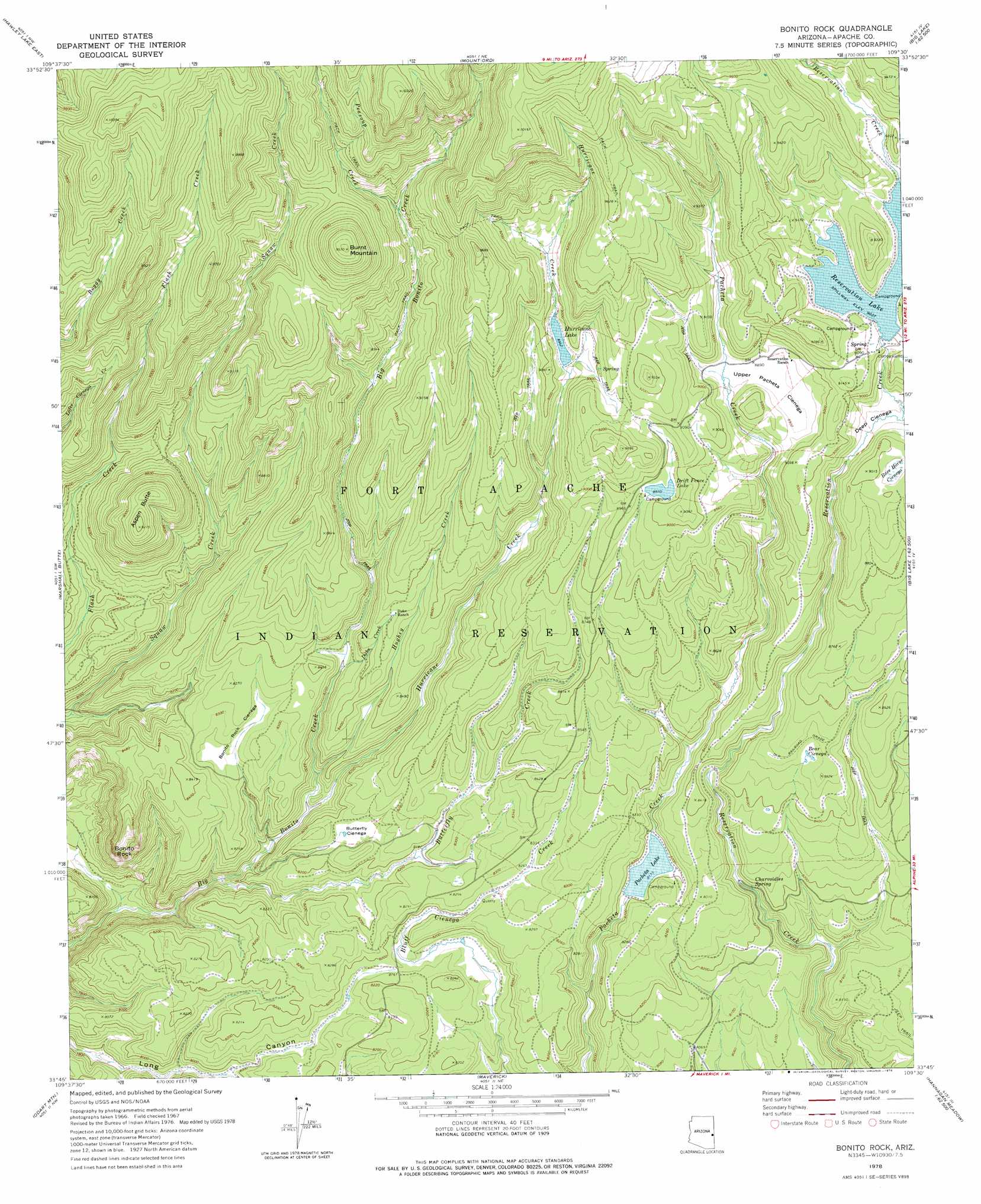
USGS Topo Quad 33109g5 - 1:24,000 scale
| Topo Map Name: | Bonito Rock |
| USGS Topo Quad ID: | 33109g5 |
| Print Size: | ca. 21 1/4" wide x 27" high |
| Southeast Coordinates: | 33.75° N latitude / 109.5° W longitude |
| Map Center Coordinates: | 33.8125° N latitude / 109.5625° W longitude |
| U.S. State: | AZ |
| Filename: | o33109g5.jpg |
| Download Map JPG Image: | Bonito Rock topo map 1:24,000 scale |
| Map Type: | Topographic |
| Topo Series: | 7.5´ |
| Map Scale: | 1:24,000 |
| Source of Map Images: | United States Geological Survey (USGS) |
| Alternate Map Versions: |
Bonito Rock AZ 1967, updated 1970 Download PDF Buy paper map Bonito Rock AZ 1978, updated 1978 Download PDF Buy paper map Bonito Rock AZ 2011 Download PDF Buy paper map Bonito Rock AZ 2014 Download PDF Buy paper map |
1:24,000 Topo Quads surrounding Bonito Rock
Mcnary |
Horseshoe Cienega |
Greens Peak |
Greer |
Eagar |
Hawley Lake West |
Hawley Lake East |
Mount Baldy |
Big Lake North |
Rudd Knoll |
Corn Creek Plateau |
Marshall Butte |
Bonito Rock |
Big Lake South |
Buffalo Crossing |
Corn Creek |
Odart Mountain |
Maverick |
Hoodoo Knob |
Hannagan Meadow |
West Poker Mountain |
Maverick Sw |
Freezeout Mountain |
Baldy Bill Point |
Strayhorse |
> Back to 33109e1 at 1:100,000 scale
> Back to 33108a1 at 1:250,000 scale
> Back to U.S. Topo Maps home
Bonito Rock topo map: Gazetteer
Bonito Rock: Dams
Drift Fence Dam elevation 2735m 8973′Hurricane Dam elevation 2727m 8946′
Pacheta Dam elevation 2521m 8270′
Reservation Dam elevation 2747m 9012′
Bonito Rock: Flats
Deep Cienega elevation 2695m 8841′Bonito Rock: Parks
Reservation Lake Campgrounds elevation 2758m 9048′Bonito Rock: Reservoirs
Drift Fence Lake elevation 2735m 8973′Hurricane Lake elevation 2722m 8930′
Pacheta Lake elevation 2492m 8175′
Reservation Lake elevation 2755m 9038′
Bonito Rock: Springs
Charvoidles Spring elevation 2485m 8152′Bonito Rock: Streams
Butterfly Creek elevation 2404m 7887′Duke Creek elevation 2501m 8205′
Hughey Creek elevation 2451m 8041′
Hurricane Creek elevation 2438m 7998′
Peasoup Creek elevation 2730m 8956′
Bonito Rock: Summits
Aspen Butte elevation 2809m 9215′Bonito Rock elevation 2668m 8753′
Burnt Mountain elevation 3033m 9950′
Bonito Rock: Swamps
Bear Cienega elevation 2589m 8494′Bonito Rock Cienega elevation 2522m 8274′
Butterfly Cienega elevation 2516m 8254′
Race Horse Cienega elevation 2730m 8956′
Upper Pacheta Cienega elevation 2713m 8900′
Bonito Rock digital topo map on disk
Buy this Bonito Rock topo map showing relief, roads, GPS coordinates and other geographical features, as a high-resolution digital map file on DVD: