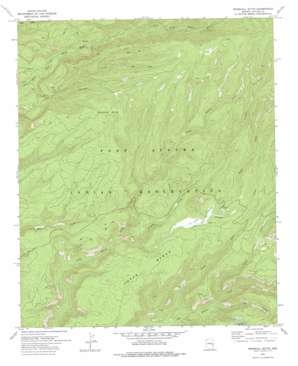
Marshall Butte Topo Map Arizona
To zoom in, hover over the map of Marshall Butte
USGS Topo Quad 33109g6 - 1:24,000 scale
| Topo Map Name: | Marshall Butte |
| USGS Topo Quad ID: | 33109g6 |
| Print Size: | ca. 21 1/4" wide x 27" high |
| Southeast Coordinates: | 33.75° N latitude / 109.625° W longitude |
| Map Center Coordinates: | 33.8125° N latitude / 109.6875° W longitude |
| U.S. State: | AZ |
| Filename: | o33109g6.jpg |
| Download Map JPG Image: | Marshall Butte topo map 1:24,000 scale |
| Map Type: | Topographic |
| Topo Series: | 7.5´ |
| Map Scale: | 1:24,000 |
| Source of Map Images: | United States Geological Survey (USGS) |
| Alternate Map Versions: |
Marshall Butte AZ 1967, updated 1970 Download PDF Buy paper map Marshall Butte AZ 1978, updated 1978 Download PDF Buy paper map Marshall Butte AZ 2011 Download PDF Buy paper map Marshall Butte AZ 2014 Download PDF Buy paper map |
1:24,000 Topo Quads surrounding Marshall Butte
> Back to 33109e1 at 1:100,000 scale
> Back to 33108a1 at 1:250,000 scale
> Back to U.S. Topo Maps home
Marshall Butte topo map: Gazetteer
Marshall Butte: Benches
Lofer Bench elevation 2379m 7805′Marshall Butte: Streams
Boggy Creek elevation 2391m 7844′Crooked Creek elevation 2215m 7267′
Flash Creek elevation 2106m 6909′
Lofer Cienega Creek elevation 2268m 7440′
Squaw Creek elevation 2171m 7122′
Marshall Butte: Summits
Marshall Butte elevation 2696m 8845′Marshall Butte: Swamps
Lofer Cienega elevation 2383m 7818′Marshall Butte: Valleys
Elk Canyon elevation 2196m 7204′Long Canyon elevation 2166m 7106′
Marshall Butte digital topo map on disk
Buy this Marshall Butte topo map showing relief, roads, GPS coordinates and other geographical features, as a high-resolution digital map file on DVD:


