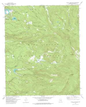
Hawley Lake East Topo Map Arizona
To zoom in, hover over the map of Hawley Lake East
USGS Topo Quad 33109h6 - 1:24,000 scale
| Topo Map Name: | Hawley Lake East |
| USGS Topo Quad ID: | 33109h6 |
| Print Size: | ca. 21 1/4" wide x 27" high |
| Southeast Coordinates: | 33.875° N latitude / 109.625° W longitude |
| Map Center Coordinates: | 33.9375° N latitude / 109.6875° W longitude |
| U.S. State: | AZ |
| Filename: | o33109h6.jpg |
| Download Map JPG Image: | Hawley Lake East topo map 1:24,000 scale |
| Map Type: | Topographic |
| Topo Series: | 7.5´ |
| Map Scale: | 1:24,000 |
| Source of Map Images: | United States Geological Survey (USGS) |
| Alternate Map Versions: |
Hawley Lake East AZ 1967, updated 1971 Download PDF Buy paper map Hawley Lake East AZ 1978, updated 1978 Download PDF Buy paper map Hawley Lake East AZ 2011 Download PDF Buy paper map Hawley Lake East AZ 2014 Download PDF Buy paper map |
1:24,000 Topo Quads surrounding Hawley Lake East
> Back to 33109e1 at 1:100,000 scale
> Back to 33108a1 at 1:250,000 scale
> Back to U.S. Topo Maps home
Hawley Lake East topo map: Gazetteer
Hawley Lake East: Dams
Earl Park Dam elevation 2522m 8274′Hawley Lake East: Flats
Upper Earl Park elevation 2557m 8389′Hawley Lake East: Parks
Diamond Creek Campsite Number Five elevation 2552m 8372′Diamond Creek Campsite Number Four elevation 2770m 9087′
Hawley Lake East: Populated Places
Hawley Lake elevation 2498m 8195′Hawley Lake East: Reservoirs
Christmas Tree Lake elevation 2506m 8221′Earl Park Lake elevation 2514m 8248′
Earl Park Tank elevation 2572m 8438′
Sand Tank elevation 0m 0′
Hawley Lake East: Ridges
Aspen Ridge elevation 2842m 9324′Hawley Lake East: Streams
Earl Creek elevation 2498m 8195′Moon Creek elevation 2500m 8202′
North Fork Diamond Creek elevation 2675m 8776′
Porcupine Creek elevation 2556m 8385′
Snow Stake Creek elevation 2643m 8671′
Snowshoe Creek elevation 2625m 8612′
Star Creek elevation 2668m 8753′
Sun Creek elevation 2487m 8159′
Hawley Lake East: Summits
Apache Butte elevation 2978m 9770′Diamond Butte elevation 3234m 10610′
Spruce Mountain elevation 3155m 10351′
Tiger Butte elevation 3100m 10170′
Hawley Lake East: Swamps
Bear Cienega elevation 2922m 9586′Beaver Dam elevation 2677m 8782′
Maverick Cienega elevation 2573m 8441′
Hawley Lake East: Valleys
Wohlenberg Draw elevation 2525m 8284′Hawley Lake East digital topo map on disk
Buy this Hawley Lake East topo map showing relief, roads, GPS coordinates and other geographical features, as a high-resolution digital map file on DVD:


