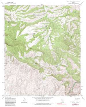
Mescal Warm Spring Topo Map Arizona
To zoom in, hover over the map of Mescal Warm Spring
USGS Topo Quad 33110b6 - 1:24,000 scale
| Topo Map Name: | Mescal Warm Spring |
| USGS Topo Quad ID: | 33110b6 |
| Print Size: | ca. 21 1/4" wide x 27" high |
| Southeast Coordinates: | 33.125° N latitude / 110.625° W longitude |
| Map Center Coordinates: | 33.1875° N latitude / 110.6875° W longitude |
| U.S. State: | AZ |
| Filename: | o33110b6.jpg |
| Download Map JPG Image: | Mescal Warm Spring topo map 1:24,000 scale |
| Map Type: | Topographic |
| Topo Series: | 7.5´ |
| Map Scale: | 1:24,000 |
| Source of Map Images: | United States Geological Survey (USGS) |
| Alternate Map Versions: |
Mescal Warm Spring AZ 1968, updated 1971 Download PDF Buy paper map Mescal Warm Spring AZ 1968, updated 1985 Download PDF Buy paper map Mescal Warm Spring AZ 2011 Download PDF Buy paper map Mescal Warm Spring AZ 2014 Download PDF Buy paper map |
1:24,000 Topo Quads surrounding Mescal Warm Spring
> Back to 33110a1 at 1:100,000 scale
> Back to 33110a1 at 1:250,000 scale
> Back to U.S. Topo Maps home
Mescal Warm Spring topo map: Gazetteer
Mescal Warm Spring: Dams
Bar F Bar Detention Dam elevation 1204m 3950′Mescal Dam elevation 1425m 4675′
Mescal Warm Spring: Reservoirs
Bar F Bar Detention elevation 1206m 3956′Big Rock Detention elevation 1261m 4137′
Elk Detention elevation 1281m 4202′
Hill Detention elevation 1223m 4012′
Mescal Tank elevation 1269m 4163′
Rock Gate Detention elevation 1208m 3963′
Wob Tank elevation 1208m 3963′
Mescal Warm Spring: Ridges
Mescal Mountains elevation 1640m 5380′Mescal Warm Spring: Springs
Big Rock Spring elevation 1440m 4724′Mescal Warm Spring elevation 878m 2880′
Mud Spring elevation 1363m 4471′
Red Whiskers Spring elevation 1361m 4465′
Wild Horse Spring elevation 1325m 4347′
Mescal Warm Spring: Streams
Mescal Creek elevation 655m 2148′Tulapai Creek elevation 1146m 3759′
Mescal Warm Spring: Wells
Naltazan Well elevation 1250m 4101′Wagon Wheel Well elevation 1199m 3933′
Mescal Warm Spring digital topo map on disk
Buy this Mescal Warm Spring topo map showing relief, roads, GPS coordinates and other geographical features, as a high-resolution digital map file on DVD:


