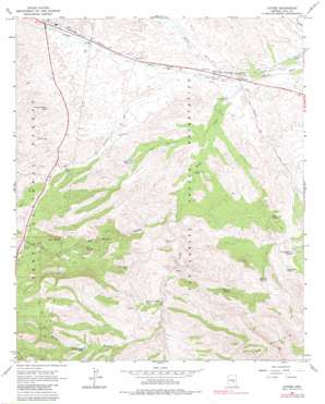
Cutter Topo Map Arizona
To zoom in, hover over the map of Cutter
USGS Topo Quad 33110c6 - 1:24,000 scale
| Topo Map Name: | Cutter |
| USGS Topo Quad ID: | 33110c6 |
| Print Size: | ca. 21 1/4" wide x 27" high |
| Southeast Coordinates: | 33.25° N latitude / 110.625° W longitude |
| Map Center Coordinates: | 33.3125° N latitude / 110.6875° W longitude |
| U.S. State: | AZ |
| Filename: | o33110c6.jpg |
| Download Map JPG Image: | Cutter topo map 1:24,000 scale |
| Map Type: | Topographic |
| Topo Series: | 7.5´ |
| Map Scale: | 1:24,000 |
| Source of Map Images: | United States Geological Survey (USGS) |
| Alternate Map Versions: |
Cutter AZ 1966, updated 1968 Download PDF Buy paper map Cutter AZ 2004, updated 2007 Download PDF Buy paper map Cutter AZ 2011 Download PDF Buy paper map Cutter AZ 2014 Download PDF Buy paper map |
| FStopo: | US Forest Service topo Cutter is available: Download FStopo PDF Download FStopo TIF |
1:24,000 Topo Quads surrounding Cutter
> Back to 33110a1 at 1:100,000 scale
> Back to 33110a1 at 1:250,000 scale
> Back to U.S. Topo Maps home
Cutter topo map: Gazetteer
Cutter: Airports
Globe-San Carlos Regional Air Facility elevation 976m 3202′Cutter: Dams
Branch Creek Dam elevation 1195m 3920′Coyote Hold Dam elevation 1210m 3969′
Naltazen Dam Number One elevation 1125m 3690′
Cutter: Populated Places
Cutter elevation 964m 3162′Cutter: Reservoirs
Branch Creek Tank elevation 1194m 3917′Capitan Hayes Tank elevation 1133m 3717′
Copper Hills Tank elevation 1164m 3818′
Coyote Hole Tank elevation 1214m 3982′
Cutter Tank elevation 1067m 3500′
Elk Trick Tank elevation 1304m 4278′
Hensen Tank elevation 1256m 4120′
Hole in the Rock Tank elevation 1122m 3681′
Twin Tanks elevation 935m 3067′
Cutter: Springs
Bull Spring elevation 1158m 3799′Coyote Hole Spring elevation 1267m 4156′
Elk Spring elevation 1131m 3710′
Haunted Spring elevation 1171m 3841′
Indian Spring elevation 1192m 3910′
Red Box Spring elevation 1270m 4166′
Rocky Spring elevation 1121m 3677′
Cutter: Streams
Ramboz Wash elevation 957m 3139′Ranch Creek elevation 957m 3139′
Spring Branch elevation 1098m 3602′
Cutter: Summits
Hog Mountain elevation 1733m 5685′Cutter: Valleys
Arrastra Canyon elevation 1185m 3887′Bull Canyon elevation 1017m 3336′
Cutter: Wells
Cactus Well elevation 1039m 3408′Globe City Well elevation 1060m 3477′
Grantham Well elevation 1142m 3746′
Martin Well elevation 1003m 3290′
Nig Well Number Two elevation 1062m 3484′
Cutter digital topo map on disk
Buy this Cutter topo map showing relief, roads, GPS coordinates and other geographical features, as a high-resolution digital map file on DVD:


