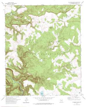
Velasquez Butte Topo Map Arizona
To zoom in, hover over the map of Velasquez Butte
USGS Topo Quad 33110f1 - 1:24,000 scale
| Topo Map Name: | Velasquez Butte |
| USGS Topo Quad ID: | 33110f1 |
| Print Size: | ca. 21 1/4" wide x 27" high |
| Southeast Coordinates: | 33.625° N latitude / 110° W longitude |
| Map Center Coordinates: | 33.6875° N latitude / 110.0625° W longitude |
| U.S. State: | AZ |
| Filename: | o33110f1.jpg |
| Download Map JPG Image: | Velasquez Butte topo map 1:24,000 scale |
| Map Type: | Topographic |
| Topo Series: | 7.5´ |
| Map Scale: | 1:24,000 |
| Source of Map Images: | United States Geological Survey (USGS) |
| Alternate Map Versions: |
Velasquez Butte AZ 1966, updated 1968 Download PDF Buy paper map Velasquez Butte AZ 1978, updated 1978 Download PDF Buy paper map Velasquez Butte AZ 2011 Download PDF Buy paper map Velasquez Butte AZ 2014 Download PDF Buy paper map |
1:24,000 Topo Quads surrounding Velasquez Butte
> Back to 33110e1 at 1:100,000 scale
> Back to 33110a1 at 1:250,000 scale
> Back to U.S. Topo Maps home
Velasquez Butte topo map: Gazetteer
Velasquez Butte: Dams
Georges Basin Dam elevation 1697m 5567′Velasquez Butte: Reservoirs
Basin Tank elevation 1685m 5528′Deer Creek Tank elevation 1736m 5695′
Georges Basin elevation 1694m 5557′
Halfway Tank elevation 1738m 5702′
Indian Creek Tank elevation 1739m 5705′
Lower Camp Tank elevation 1709m 5606′
Malapai Tank elevation 1822m 5977′
Moore Mountain Tank elevation 1635m 5364′
Mule Tank elevation 1747m 5731′
Pasture Tank Number One elevation 1755m 5757′
Pine Flat Tank elevation 1670m 5479′
Pit Hole Tank elevation 1790m 5872′
Priebe Creek Tank elevation 1724m 5656′
Squirrel Tank elevation 1755m 5757′
Tin Shack Tank Number One elevation 1711m 5613′
Velasquez Butte Tank Number Two elevation 1752m 5748′
Velasquez Tank elevation 1812m 5944′
V-two Tank elevation 1817m 5961′
Velasquez Butte: Springs
Benedict Spring elevation 1593m 5226′L-Eleven Spring elevation 1728m 5669′
Navajo Bill Spring elevation 1522m 4993′
Velasquez Butte: Streams
Georges Basin Creek elevation 1405m 4609′Indian Creek elevation 1458m 4783′
Nash Creek elevation 1397m 4583′
Priebe Creek elevation 1388m 4553′
Velasquez Butte: Summits
Velasquez Butte elevation 1869m 6131′Velasquez Butte: Valleys
White Cow Canyon elevation 1396m 4580′Velasquez Butte digital topo map on disk
Buy this Velasquez Butte topo map showing relief, roads, GPS coordinates and other geographical features, as a high-resolution digital map file on DVD:


