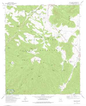
Cone Butte Topo Map Arizona
To zoom in, hover over the map of Cone Butte
USGS Topo Quad 33110g2 - 1:24,000 scale
| Topo Map Name: | Cone Butte |
| USGS Topo Quad ID: | 33110g2 |
| Print Size: | ca. 21 1/4" wide x 27" high |
| Southeast Coordinates: | 33.75° N latitude / 110.125° W longitude |
| Map Center Coordinates: | 33.8125° N latitude / 110.1875° W longitude |
| U.S. State: | AZ |
| Filename: | o33110g2.jpg |
| Download Map JPG Image: | Cone Butte topo map 1:24,000 scale |
| Map Type: | Topographic |
| Topo Series: | 7.5´ |
| Map Scale: | 1:24,000 |
| Source of Map Images: | United States Geological Survey (USGS) |
| Alternate Map Versions: |
Cone Butte AZ 1966, updated 1968 Download PDF Buy paper map Cone Butte AZ 1978, updated 1978 Download PDF Buy paper map Cone Butte AZ 2011 Download PDF Buy paper map Cone Butte AZ 2014 Download PDF Buy paper map |
1:24,000 Topo Quads surrounding Cone Butte
> Back to 33110e1 at 1:100,000 scale
> Back to 33110a1 at 1:250,000 scale
> Back to U.S. Topo Maps home
Cone Butte topo map: Gazetteer
Cone Butte: Dams
Apache Pond Dam Number One elevation 1638m 5374′Apache Pond Dam Number Two elevation 1642m 5387′
Cone Butte: Flats
Louse Flat elevation 1554m 5098′Cone Butte: Populated Places
Cedar Creek Crossing elevation 1453m 4767′Cone Butte: Reservoirs
Apache Pond Number One elevation 1643m 5390′Apache Pond Number Two elevation 1644m 5393′
Black Grama Tank elevation 1607m 5272′
Calf Creek Tank elevation 1604m 5262′
Cedar Drift Fence Tank elevation 1614m 5295′
Cemetery Tank elevation 1526m 5006′
Chipmunk Tank elevation 1485m 4872′
Cone Butte Tank elevation 1591m 5219′
Dead Cow Tank elevation 1612m 5288′
E B Tank elevation 1444m 4737′
Endfield Tank elevation 1508m 4947′
G Wash Tank elevation 1558m 5111′
Juniper Tank elevation 1609m 5278′
Kelly Butte Tank elevation 1538m 5045′
Lone Tank elevation 1551m 5088′
Louse Flat Tank elevation 1548m 5078′
New Cedar Drift Fence Tank elevation 1605m 5265′
Old Road Tank elevation 1585m 5200′
Pinyon Tank elevation 1570m 5150′
Plow Tank elevation 1615m 5298′
Red Hill Tank elevation 1523m 4996′
Rim Tank elevation 1625m 5331′
Sam Green Tank elevation 0m 0′
Upper Calf Creek Tank elevation 1690m 5544′
Cone Butte: Springs
Anderson Spring elevation 1478m 4849′Bad Luck Spring elevation 1485m 4872′
Deer Spring elevation 1548m 5078′
E B Spring elevation 1505m 4937′
Lone Pine Spring elevation 1529m 5016′
Mare Springs elevation 1512m 4960′
Seasonal Springs elevation 0m 0′
Shower Spring elevation 0m 0′
Trailer House Spring elevation 1487m 4878′
Wild Bull Spring elevation 1446m 4744′
Wild Ox Spring elevation 1487m 4878′
Cone Butte: Streams
Cave Creek elevation 1287m 4222′G Wash elevation 1409m 4622′
Cone Butte: Summits
Blue Rock Butte elevation 1737m 5698′Cone Butte elevation 1700m 5577′
Cone Butte digital topo map on disk
Buy this Cone Butte topo map showing relief, roads, GPS coordinates and other geographical features, as a high-resolution digital map file on DVD:


