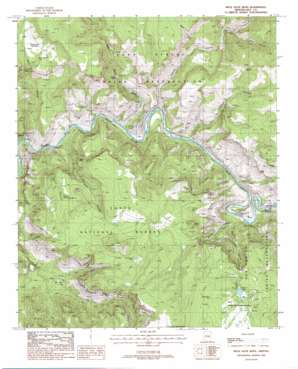
Mule Hoof Bend Topo Map Arizona
To zoom in, hover over the map of Mule Hoof Bend
USGS Topo Quad 33110g5 - 1:24,000 scale
| Topo Map Name: | Mule Hoof Bend |
| USGS Topo Quad ID: | 33110g5 |
| Print Size: | ca. 21 1/4" wide x 27" high |
| Southeast Coordinates: | 33.75° N latitude / 110.5° W longitude |
| Map Center Coordinates: | 33.8125° N latitude / 110.5625° W longitude |
| U.S. State: | AZ |
| Filename: | o33110g5.jpg |
| Download Map JPG Image: | Mule Hoof Bend topo map 1:24,000 scale |
| Map Type: | Topographic |
| Topo Series: | 7.5´ |
| Map Scale: | 1:24,000 |
| Source of Map Images: | United States Geological Survey (USGS) |
| Alternate Map Versions: |
Mule Hoof Bend AZ 1988, updated 1988 Download PDF Buy paper map Mule Hoof Bend AZ 2004, updated 2007 Download PDF Buy paper map Mule Hoof Bend AZ 2011 Download PDF Buy paper map Mule Hoof Bend AZ 2014 Download PDF Buy paper map |
| FStopo: | US Forest Service topo Mule Hoof Bend is available: Download FStopo PDF Download FStopo TIF |
1:24,000 Topo Quads surrounding Mule Hoof Bend
> Back to 33110e1 at 1:100,000 scale
> Back to 33110a1 at 1:250,000 scale
> Back to U.S. Topo Maps home
Mule Hoof Bend topo map: Gazetteer
Mule Hoof Bend: Bends
Mule Hoof Bend elevation 1002m 3287′Mule Hoof Bend: Dams
Seneca Lake Dam elevation 1469m 4819′Mule Hoof Bend: Lakes
Seneca Lake elevation 1518m 4980′Mule Hoof Bend: Mines
Apache Mine elevation 1147m 3763′Canadian Mines elevation 1469m 4819′
Emsco Mine elevation 1306m 4284′
Enders Mine elevation 1304m 4278′
Fiber King Mine elevation 1049m 3441′
Phillips Mine elevation 1509m 4950′
Regal Mine elevation 1294m 4245′
Mule Hoof Bend: Parks
Roadside Picnic Area Milepost Two Hundred Ninety elevation 1356m 4448′Seneca Lake Recreation Area elevation 1459m 4786′
Mule Hoof Bend: Populated Places
Seneca elevation 1463m 4799′Mule Hoof Bend: Reservoirs
Ash Spring Tank elevation 1501m 4924′Horse Camp Tank elevation 1446m 4744′
Horse Camp Trap Tank elevation 1486m 4875′
Reservation Tank elevation 1497m 4911′
Top of the Mountain Tank elevation 1745m 5725′
Mule Hoof Bend: Springs
Ash Spring elevation 1500m 4921′Cedar Spring elevation 1271m 4169′
Lower Fourth of July Spring elevation 1351m 4432′
Mormon Spring elevation 1393m 4570′
Rock Canyon Spring elevation 1267m 4156′
Slick Rock Spring elevation 1142m 3746′
Mule Hoof Bend: Streams
Cibecue Creek elevation 960m 3149′Cienega Creek elevation 1006m 3300′
Mule Hoof Bend: Summits
Ash Mountain elevation 1664m 5459′Coyote Butte elevation 1719m 5639′
Mule Hoof Bend: Valleys
Coyote Canyon elevation 973m 3192′Hole Canyon elevation 1064m 3490′
Mule Hoof Canyon elevation 1024m 3359′
Phillips Canyon elevation 1008m 3307′
Regal Canyon elevation 939m 3080′
Rock Canyon elevation 919m 3015′
Salt River Draw elevation 951m 3120′
Tank Canyon elevation 1159m 3802′
Walnut Canyon elevation 978m 3208′
Mule Hoof Bend digital topo map on disk
Buy this Mule Hoof Bend topo map showing relief, roads, GPS coordinates and other geographical features, as a high-resolution digital map file on DVD:


